
Peru itinerary: 2 weeks to Machu Picchu
In short
This Peru itinerary takes 14 days from Lima via Arequipa (about 2,400 m), the Colca Valley and Puno on Lake Titicaca (about 3,800 m) to Cusco and Machu Picchu (2,430 m). The order eases you into the altitude. The longest overland leg is Puno to Cusco, about 10.5 hours by train. Cusco is driest from May to September, with 8 to 35 mm of rain a month.
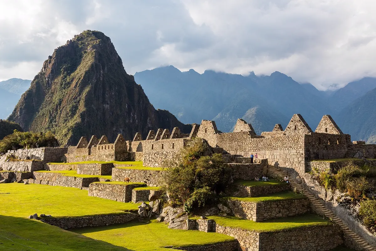
Fly from Lima straight to Cusco and you go from sea level to about 3,400 m in a morning. That is the quickest way to Machu Picchu, and the one most likely to bring headaches and sleepless first nights. This route takes a detour on purpose. Via Arequipa and the Colca Valley you gain height in steps, so Cusco and Machu Picchu come at the end of the trip, once your body has caught up. Machu Picchu itself, at 2,430 m, is actually lower than Cusco.
The route at a glance
| Day | Stop | Altitude | Getting there |
|---|---|---|---|
| 1–2 | Lima | coast | arrival |
| 3–4 | Arequipa | approx. 2,400 m | flight from Lima |
| 5–6 | Chivay, Colca Valley | approx. 3,600 m | road, 149 km, approx. 3:12 h |
| 7–8 | Puno, Lake Titicaca | approx. 3,800 m | road, 270 km, approx. 5:02 h |
| 9 | Puno → Cusco | approx. 3,400 m | train approx. 10.5 h, or bus |
| 10–11 | Cusco | approx. 3,400 m | – |
| 12 | Cusco → Ollantaytambo | approx. 2,800 m | road, 61 km, approx. 1:10 h |
| 13 | Machu Picchu | 2,430 m | train approx. 1.5 h from Ollantaytambo |
| 14 | Cusco → Lima | coast | flight |
Road times: route calculation based on OpenStreetMap, without breaks. Highland roads take far longer, so add at least a third. Train times from PeruRail.
- Lima
- Arequipa
- Chivay
- Puno
- Cusco
- Ollantaytambo
- Machu Picchu
Base map: Natural Earth
Safety and travel advice
The country as a whole is not under a warning. The FCDO advises against all but essential travel to two areas, the VRAEM valley and the strip along the Colombian border, both far from this route. Germany's Foreign Office reports a state of emergency in metropolitan Lima and Callao and high crime, especially in the evening in the centre, Miraflores and Barranco, and the FCDO mentions armed robberies of British tourists in Miraflores and Barranco. So use only licensed or app-based taxis in Lima, above all from the airport, and keep your stay short.
The FCDO lists Puno among regions that have seen recent protests, and protests sometimes suspend trains to Machu Picchu. Germany's Foreign Office says never to try to pass a roadblock; wait or find another way. If the road between Puno and Cusco closes, Juliaca airport is about an hour from Puno.
The dunes around Ica and Huacachina are left out deliberately. The FCDO reports deaths in unregulated sand buggy rides there, and warns that El Niño may bring flooding and landslides from late 2026 to April 2027, especially on the northern and central coast.
Why this order
Altitude sickness can start at around 2,500 m, according to the German Foreign Office, often only after 24 hours: headaches, dizziness, poor sleep, breathlessness. If symptoms persist, go below 2,000 m. The FCDO names Cusco, Puno and the Colca Canyon as places where it is a serious risk. Talk to your doctor beforehand, especially if you have heart or lung problems.
So the trip begins in Arequipa, just below that threshold. Two nights there and two in the Colca Valley, and only then Puno, the highest place on the route. Doing it in reverse, from Cusco to Arequipa, would put you at 3,400 m on day two. This order also makes the end easier, because after Puno it is downhill.
Days 1–4: Lima and Arequipa
Treat Lima as a short stop for its food and a look at the coast. In the middle of the year it is grey and cool, about 19 °C by day in July. A pre-booked transfer from Lima airport* is worthwhile, because fake taxi drivers operate there.
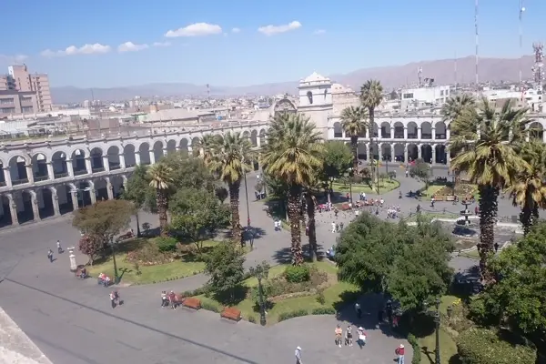
Arequipa is known as the White City for its pale volcanic stone, sillar. According to Peru's tourism board, the historic centre holds over 500 colonial mansions. Two days are enough. Germany's Foreign Office reports isolated night-time robberies of buses to and from Arequipa, another reason to travel only by day on this route.
Days 5–8: Colca Valley and Lake Titicaca
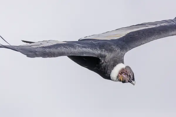
The Colca Canyon is up to 3,200 m deep, according to the tourism board, and is about three and a half hours from Arequipa by road. At the Cruz del Cóndor lookout you can watch Andean condors. Tours from Arequipa* will take you there; since many return to Arequipa, ask specifically for one that continues to Puno. Otherwise a bus* from Chivay is the alternative, with a large operator and in daylight.
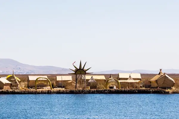
Puno sits on Lake Titicaca, at about 3,810 m the world's highest navigable lake. Boats go to the floating reed islands of the Uros and to Taquile, known for its weavers. Expect around 14 °C by day and 3 °C at night, so warm clothes are essential.
Day 9: the Puno to Cusco leg
This is the hard part of the trip, and you have two sensible options:
- Train: the PeruRail Titicaca takes about 10.5 hours and crosses La Raya at 4,319 m. It doesn't run daily, so plan your days in Puno around the timetable.
- Bus: the 385 km is about 6:10 h of pure driving and in practice much longer. Take a daytime bus with a large operator, never a night bus: the FCDO specifically warns against overnight travel in mountainous areas.
If you need to save a day, fly from Juliaca. You lose the landscape that makes this leg worth doing, though.
Days 10–13: Cusco, the Sacred Valley and Machu Picchu
Cusco sits at about 3,400 m. After a week in the highlands you will notice far less than if you had come straight from Lima. Do keep your wits about you: the FCDO describes street crime as a significant problem. Use ATMs inside banks and avoid quiet areas at night. It also warns about unregulated ayahuasca and San Pedro ceremonies, after serious illness and deaths.
Ollantaytambo in the Sacred Valley, at 2,792 m, is the best base, with its Inca terraces. The train from here takes about 1.5 hours to Aguas Calientes. The route via Santa Teresa and Hidroeléctrica looks cheaper, but Germany's Foreign Office warns of many accidents on those unpaved mountain roads, so take the train.
For Machu Picchu you need a ticket for a specific date, circuit and entry time, sold by the Ministry of Culture on tuboleto.cultura.pe. According to PeruRail, the daily limit is 5,600 visitors in high season and 4,500 otherwise. Choose your circuit before you buy, because they don't all cover the same parts of the site. Alternatively, a guided tour from Cusco* takes the organising off your hands.
When this route works best
Machu Picchu and the highlands want the dry season. Our guide to the best time to visit Peru has the detail; here are the two places that decide this route:
| Month | Cusco rain | Cusco day | Cusco night | Lima day |
|---|---|---|---|---|
| January | 217 mm | 16.5 °C | 8.0 °C | 24.6 °C |
| March | 155 mm | 16.3 °C | 7.9 °C | 25.3 °C |
| May | 33 mm | 16.7 °C | 6.1 °C | 21.7 °C |
| June | 8 mm | 16.9 °C | 5.0 °C | 20.1 °C |
| July | 10 mm | 17.6 °C | 4.5 °C | 19.4 °C |
| August | 21 mm | 18.0 °C | 5.4 °C | 19.0 °C |
| September | 35 mm | 18.4 °C | 6.5 °C | 19.4 °C |
| November | 144 mm | 18.2 °C | 8.3 °C | 21.2 °C |
Climate: monthly averages 2015–2024 from the ERA5 reanalysis (Open-Meteo), rounded. May and September are the best compromises, with little rain and nights not quite as cold as in July. In the rainy season, rockslides and mudslides can disrupt road and rail across the Cusco region.
Where to stay on this route
- Arequipa: in the historic centre near the Plaza de Armas.
- Puno: in the centre or by the lake; ask about heating in the rooms.
- Cusco: central, avoiding quiet back lanes if you plan to walk at night.
Good to know before you go
- Entry: check the current rules on gov.uk or with your own government.
- Short on time? Cut Lima and the Colca Valley, but not the slow ascent. For the long flights, see our guide on how to avoid jet lag.
- Cash: you need some soles for markets, boats and small restaurants.
- Mobile data: our eSIM comparison for Peru shows the plans. In the highlands, offline maps are still the safer choice.
- Other tropics: for rainforest and volcanoes rather than high plateaus, see our Costa Rica itinerary.


How YesTrip helps with this trip
Set up the trip with all its stops. The map shows the whole route, the AI builds day plans for Arequipa and Cusco, and the forecast for your travel days is especially useful at these altitudes. The packing list suggests clothing for cold nights and the plug adapter. The offline package stores the maps of your places, since you shouldn't rely on signal on the road to Puno or in the Colca Valley. You book tickets and trains with the provider; YesTrip itself books nothing.
* Ad – Partner link: if you book there, we earn a commission. Your price stays the same.
Free
Plan your trip in 30 seconds.
Tell YesTrip where and when – the app plans day by day with real places on the map, shows the weather, splits costs with your travel companions and guides you to the next stop on the go.
Frequently asked questions
How many days do you need for a Peru itinerary?
Two weeks are enough for Lima, Arequipa, the Colca Valley, Lake Titicaca, Cusco and Machu Picchu. That also lets you acclimatise in stages rather than flying straight from Lima to Cusco.
How do you acclimatise to the altitude in Peru?
Go up in steps: from Arequipa at about 2,400 m to the Colca Valley at about 3,600 m and on to Puno at about 3,800 m. If headaches, dizziness or breathlessness persist, go below 2,000 m and get medical advice.
How do you get from Puno to Cusco?
By the PeruRail Titicaca train in about 10.5 hours, by daytime bus in well over the 6:10 h of pure driving, or by plane from Juliaca. The train doesn't run daily, so plan your days around the timetable.
When is the best time to visit Machu Picchu?
May to September, in the dry season. Cusco gets only 8 to 35 mm of rain a month then, against over 200 mm in January and February.
Is Peru safe for an itinerary like this?
There is no warning for the whole country, and the areas the FCDO advises against are not on this route. However, Germany's Foreign Office reports a state of emergency in Lima, and protests and roadblocks can happen at short notice. Read the current advice before you leave.
Sources
- Driving times: OSRM route calculation based on OpenStreetMap data – project-osrm.org
- Climate: Open-Meteo Historical Weather API (ERA5), averages 2015–2024 – open-meteo.com
- Areas advised against: UK Foreign Travel Advice – www.gov.uk
- Safety, protests, buses, El Niño: UK Foreign Travel Advice – www.gov.uk
- Altitude sickness in Cusco, Puno and Colca: UK Foreign Travel Advice – www.gov.uk
- Entry requirements: UK Foreign Travel Advice – www.gov.uk
- Safety advice and altitude: German Foreign Office – www.auswaertiges-amt.de
- Train durations: PeruRail comparison – www.perurail.com
- La Raya at 4,319 m: PeruRail – www.perurail.com
- Flights to Juliaca and getting to Puno: PeruRail – www.perurail.com
- Machu Picchu tickets and daily limit: PeruRail – www.perurail.com
- Arequipa: Peru Travel – www.peru.travel
- Colca Canyon: Peru Travel – www.peru.travel
- Lake Titicaca: Peru Travel – www.peru.travel
- Cusco: Peru Travel – www.peru.travel
- Machu Picchu: Wikipedia – en.wikipedia.org
- Chivay: Wikipedia – en.wikipedia.org
- Ollantaytambo: Wikipedia – en.wikipedia.org
Researched with AI support and checked by our editors. Prices, opening hours and weather can change – please check before you go. YesTrip is not a travel agency. Published: .
More articles
 Road trips & itineraries
Amalfi Coast itinerary: 5 days, no car needed
This 5-day route runs from Pompeii through Sorrento, Positano, Amalfi and Ravello to Salerno, with no car. Travelmar lists the boat from … · 9 min read Road trips & itineraries
Australia East Coast itinerary: 3 weeks by car
This Australia East Coast itinerary takes 21 days from Sydney via Byron Bay, Noosa, K'gari and the Whitsundays to Cairns and Port Douglas, … · 7 min read Road trips & itineraries
Bali itinerary: 2 weeks, 5 bases, no scooter
This 14-day loop covers about 410 km and almost 7 hours of pure driving through Ubud, Sidemen, Amed, Munduk and Uluwatu, by car with a … · 8 min read


