
Costa Rica itinerary: a 2-week route
In short
This 14-day Costa Rica itinerary covers Tortuguero, La Fortuna and Arenal, Monteverde, Manuel Antonio and Uvita, about 812 km starting and ending at San José airport. The longest drives are Uvita to the airport at 4:02 h and Monteverde to Quepos at 3:52 h. February and March suit it best: Quepos gets 33 to 50 mm of rain a month then and 937 mm in October.
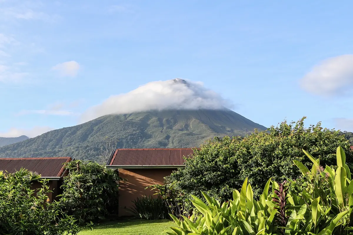
The decision that shapes a Costa Rica route is where you pick up the car. Tortuguero can only be reached by boat or plane, so a rental would sit parked for three days, and parked cars are exactly what thieves here go for. This itinerary therefore starts without one and collects it in La Fortuna. The second surprise is on the map: Arenal and Monteverde look close together, but the road around the lake takes more than two and a half hours of pure driving.
The route at a glance
| Day | Stop | Distance | Pure driving |
|---|---|---|---|
| 1 | Arrive, night near San José | – | – |
| 2–4 | Airport → Cariari → boat to Tortuguero | 102 km plus boat | approx. 1:51 h |
| 5–7 | Cariari → La Fortuna (Arenal) | 143 km | approx. 2:28 h |
| 8–9 | La Fortuna → Monteverde | 111 km | approx. 2:35 h |
| 10–11 | Monteverde → Quepos (Manuel Antonio) | 183 km | approx. 3:52 h |
| 12–13 | Quepos → Uvita | 63 km | approx. 1:13 h |
| 14 | Uvita → San José airport | 210 km | approx. 4:02 h |
Driving times: route calculation based on OpenStreetMap, without breaks. Add about a third, and more in the rainy season: the UK government notes that potholes and landslides can block roads then, and many bridges narrow to a single lane. The first two legs, up to La Fortuna, are not driven in your own rental car, because you collect it only there, so the self-drive part is 567 km; the 812 km is the whole loop by road.
- San José airport
- Tortuguero
- La Fortuna
- Monteverde
- Quepos
- Uvita
Base map: Natural Earth
What the travel advice means for this route
Neither the UK nor the German government advises against any region of Costa Rica. Both do say plainly that crime is getting worse. The FCDO reports more frequent gang-related violence, including in some visitor hotspots, and muggings on the Atlantic coast. Germany's Foreign Office singles out Puntarenas and the Caribbean coast around Limón and Moín for violent crime, and reports serious sexual assaults on women in the Caribbean region and in Jacó.
That leads to three practical choices here. You travel to Tortuguero via La Pavona rather than Moín, Puntarenas city and Jacó are places you drive past rather than stop in, and you leave nothing visible in the car. Read the current advice on gov.uk before you leave.
Days 2–4: Tortuguero without a car
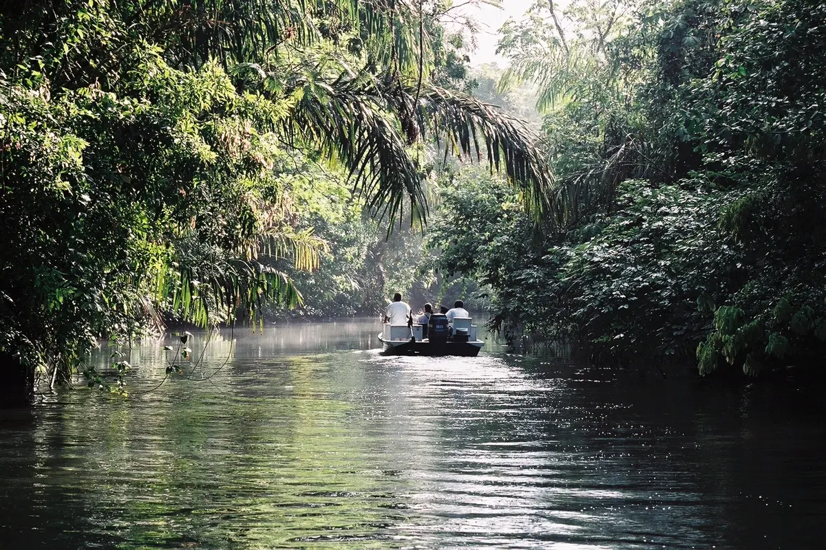
The village of Tortuguero sits on a sandbar between the river and the Caribbean, with no road in. Boats run via La Pavona in the north or Moín in the south along canals linking lagoons and rivers. The national park protects over 30 km of turtle-nesting coast, and from the water you can expect caimans and herons.
The easiest way in is a transfer from San José* to the landing, with the boat arranged through your lodge. Pick an established company: the FCDO cites several incidents with small boats around Tortuguero. During nesting season nobody but the scientists may dig up a nest or touch a turtle, whatever someone on the beach offers you.
The Caribbean side has no real dry season, so pack for rain whenever you go. Our guide to the best time to visit Costa Rica has the full picture by region.
Days 5–7: La Fortuna and Arenal
The car section starts here. When you compare a rental car for Costa Rica*, check first whether the provider has an office in La Fortuna and allows a return at the airport. If not, take the car at the airport and leave it somewhere guarded during Tortuguero.
Arenal is an almost perfect cone, 1,633 m high. It erupted continuously from 1968 to 2010 and has been quiet since, so forget the lava photos you may have seen. What you will often see is cloud: even in March La Fortuna averages about 300 mm of rain. Three nights give you a fair chance of one clear morning. The FCDO's general advice is to stay out of volcanic areas during and just after heavy rain.
Days 8–9: Monteverde, the awkward leg
This is the leg to think about in advance. By car it is 111 km and 2:35 h of pure driving around Lake Arenal, the last part on only partly paved roads. Operators also run a taxi, boat and taxi combination across the lake in about 3.5 hours, but that only makes sense if you collect the car afterwards.
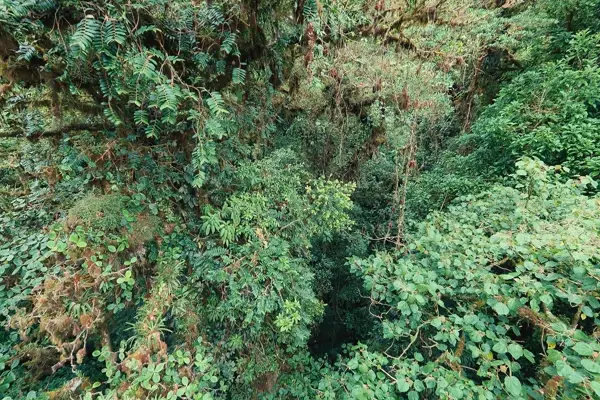
Monteverde sits above 1,300 m, far cooler than anywhere else on this route, so bring a jacket. In the Monteverde Cloud Forest Preserve you can walk the trails on your own or join guided and night walks. According to the preserve, under 0.26% of the planet's land is tropical cloud forest. A guide is well worth having, because much of the wildlife stays invisible in that dense green to an untrained eye.
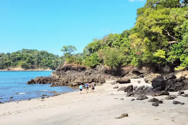
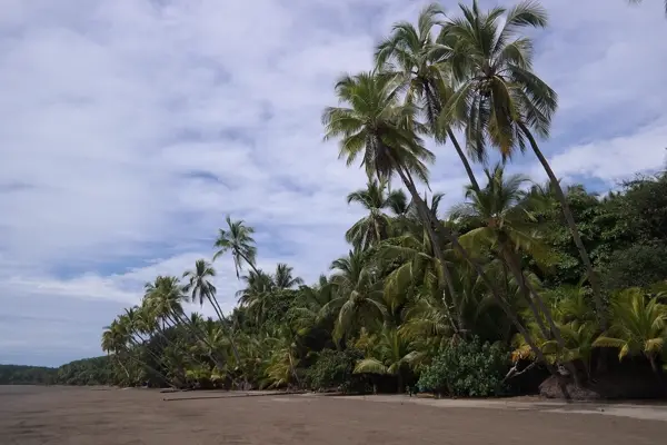
Days 10–13: Manuel Antonio and Uvita
From Monteverde you drop down to the Pacific, 3:52 h of pure driving. Leave early and arrive before dark. Manuel Antonio is small at about 20 km², but sloths and three monkey species live here. It is one of the parks whose entry the conservation agency SINAC sells online, so get yours before the day. Guided tours from Quepos* pay off for the same reason as in Monteverde: someone with a spotting scope finds what you would walk past.
Uvita is just over an hour further south, by Marino Ballena National Park, which was created to protect migrating humpback whales. It makes a quiet end to the trip. Be careful in the sea: the FCDO says rip currents are very common, lifeguards are often absent, and an average of 50 to 60 people drown each year, a third of them tourists.
Where to stay on this route
- Tortuguero: rooms in the village or lodges on the canal; settle the boat transfer when you book.
- La Fortuna: in town you can walk to restaurants and tour operators; closer to the volcano you need the car.
- Uvita: don't sleep too far south on the last night, or the four hours to the airport get longer.
The best time for this exact loop
The route crosses two climates. On the Pacific the seasons are dramatically different; around Arenal they barely are.
| Month | Quepos rain | La Fortuna rain | Quepos day |
|---|---|---|---|
| January | 62 mm | 566 mm | 28.7 °C |
| February | 33 mm | 320 mm | 29.9 °C |
| March | 50 mm | 303 mm | 30.6 °C |
| April | 206 mm | 227 mm | 29.7 °C |
| May | 609 mm | 330 mm | 28.7 °C |
| July | 666 mm | 511 mm | 27.7 °C |
| October | 937 mm | 505 mm | 27.5 °C |
| December | 186 mm | 607 mm | 27.7 °C |
Climate: monthly averages 2015–2024 from the ERA5 reanalysis (Open-Meteo), rounded. February and March are the best choice. October is the month to avoid: the Pacific stretch averages 937 mm then, and heavy rain can block roads with landslides.
What to cut
With only 10 days, drop Tortuguero. That saves two travel days and solves the car problem. Don't assume Poás is an easy volcano substitute: the FCDO reports an increasing series of significant eruptions there, so check the current state. If you want beach days after the loop, stay on in Uvita rather than adding another long drive.
For a similar self-drive trip in the tropics, see our Yucatan itinerary. If you'd rather have high mountains than rainforest, try the Peru itinerary.
Good to know before you go
- Entry: rules can change, so check the current ones on gov.uk or with your own government.
- Flights: from London a direct flight to San José takes approx. 11 hours.
- Driving: private cars face restrictions in San José on certain weekdays depending on the last digit of the plate. After an accident with injuries or disputed fault, don't move the car until traffic police arrive.
- Cash: carry some colones or US dollars for markets and small stalls.
- Mobile data: our eSIM comparison for Costa Rica shows the plans, so you have navigation from the moment you land.
- With children: the driving days are short enough for families; our guide to long-haul travel with kids helps with the planning.
How YesTrip helps with this trip
Set up one trip in YesTrip with all six stops. The map shows the whole loop, the AI builds a day plan for each place, and the forecast for your travel days matters most at Monteverde and Arenal, where weather decides your tours. The packing list covers rain gear and the plug adapter. The offline package stores the maps of your places on your device, handy in Tortuguero. You book with each provider; YesTrip itself books nothing.
* Ad – Partner link: if you book there, we earn a commission. Your price stays the same.
Free
Plan your trip in 30 seconds.
Tell YesTrip where and when – the app plans day by day with real places on the map, shows the weather, splits costs with your travel companions and guides you to the next stop on the go.
Frequently asked questions
How many days do you need for Costa Rica?
Two weeks are enough for Tortuguero, Arenal, Monteverde, Manuel Antonio and Uvita. With 10 days, drop Tortuguero, because getting there and back by boat costs two travel days.
Do you need a rental car in Costa Rica?
For this route from La Fortuna onwards, yes, because it lets you split the legs to Monteverde, Quepos and Uvita as you like. You don't need one for Tortuguero, which can only be reached by boat or plane.
How do you get from La Fortuna to Monteverde?
By car around Lake Arenal it is 111 km and about 2:35 h of pure driving. Operators also offer a taxi, boat and taxi combination across the lake that takes about 3.5 hours.
When is the best time for this Costa Rica route?
February and March. Quepos on the Pacific averages 33 to 50 mm of rain a month then, against 937 mm in October. Around Arenal it stays damp all year.
Is Costa Rica safe for a self-drive trip?
No region is under an advisory, but the UK and German governments both report rising crime, and Germany highlights Limón, Moín and Puntarenas. Drive in daylight, leave nothing visible in the car and read the current advice before you travel.
Sources
- Driving times: OSRM route calculation based on OpenStreetMap data – project-osrm.org
- Climate: Open-Meteo Historical Weather API (ERA5), averages 2015–2024 – open-meteo.com
- Safety, roads, boats, rip currents, Poás: UK Foreign Travel Advice – www.gov.uk
- Entry requirements: UK Foreign Travel Advice – www.gov.uk
- Safety advice for Costa Rica: German Foreign Office – www.auswaertiges-amt.de
- Online park entry sales: SINAC – serviciosenlinea.sinac.go.cr
- Monteverde Cloud Forest Preserve – reservamonteverde.com
- Green turtles and the northern Caribbean: Visit Costa Rica – www.visitcostarica.com
- Tortuguero village and access: Wikipedia – en.wikipedia.org
- Tortuguero National Park: Wikipedia – en.wikipedia.org
- Arenal Volcano: Wikipedia – en.wikipedia.org
- Manuel Antonio National Park: Wikipedia – en.wikipedia.org
- Marino Ballena National Park: Wikipedia – en.wikipedia.org
- Taxi, boat and taxi between Monteverde and Arenal: MonteverdeInfo – monteverdeinfo.com
Researched with AI support and checked by our editors. Prices, opening hours and weather can change – please check before you go. YesTrip is not a travel agency. Published: .
More articles
 Road trips & itineraries
Amalfi Coast itinerary: 5 days, no car needed
This 5-day route runs from Pompeii through Sorrento, Positano, Amalfi and Ravello to Salerno, with no car. Travelmar lists the boat from … · 9 min read Road trips & itineraries
Australia East Coast itinerary: 3 weeks by car
This Australia East Coast itinerary takes 21 days from Sydney via Byron Bay, Noosa, K'gari and the Whitsundays to Cairns and Port Douglas, … · 7 min read Road trips & itineraries
Bali itinerary: 2 weeks, 5 bases, no scooter
This 14-day loop covers about 410 km and almost 7 hours of pure driving through Ubud, Sidemen, Amed, Munduk and Uluwatu, by car with a … · 8 min read


