
Australia East Coast itinerary: 3 weeks by car
In short
This Australia East Coast itinerary takes 21 days from Sydney via Byron Bay, Noosa, K'gari and the Whitsundays to Cairns and Port Douglas, about 2,840 km and just over 37 hours of pure driving. The longest leg is Rockhampton to Airlie Beach, 480 km and 6:10 h. September to October suits it best: Cairns gets 42 to 47 mm of rain a month and stinger season starts in November.
Australia's East Coast isn't hard to plan, it's just long. The real trap is the season. Sydney and Cairns have nearly opposite best months, and in the tropical north, rain and jellyfish decide whether you should go in the sea at all. So the answer for this route is September to October, south to north, flying home from Cairns. Sydney is already pleasant then, and you reach the reef before stinger season begins.
The route at a glance
| Day | Leg | Distance | Pure driving |
|---|---|---|---|
| 1–4 | Sydney and the Blue Mountains | – | – |
| 5 | Sydney → Port Macquarie | 384 km | approx. 4:43 h |
| 6–7 | Port Macquarie → Byron Bay | 387 km | approx. 4:42 h |
| 8–9 | Byron Bay → Noosa | 302 km | approx. 3:51 h |
| 10–11 | Noosa → Hervey Bay, K'gari | 181 km | approx. 2:33 h |
| 12 | Hervey Bay → Rockhampton | 390 km | approx. 5:10 h |
| 13–15 | Rockhampton → Airlie Beach | 480 km | approx. 6:10 h |
| 16–17 | Airlie Beach → Townsville | 276 km | approx. 3:42 h |
| 18 | Townsville → Mission Beach | 234 km | approx. 3:13 h |
| 19–20 | Mission Beach → Cairns | 138 km | approx. 2:00 h |
| 21 | Cairns → Port Douglas, fly from Cairns | 67 km | approx. 1:09 h |
Driving times: route calculation based on OpenStreetMap, without breaks. Add about a third. Traffic drives on the left; see our guide to countries that drive on the left.
- Sydney
- Port Macquarie
- Byron Bay
- Noosa
- Hervey Bay
- Rockhampton
- Airlie Beach
- Townsville
- Mission Beach
- Cairns
- Port Douglas
Base map: Natural Earth
Car or train: the first decision
Take the rental car from Sydney* as a one-way hire returned in Cairns, and look at the total, since a one-way fee adds up over this distance. The Bruce Highway alone is 1,679 km from Brisbane to Cairns.
If you don't want to drive the long north, there's a train. The Spirit of Queensland runs from Brisbane to Cairns, 1,681 km in just under 25 hours, five times a week. It skips the slog, but you have to get off for the Whitsundays and then rely on tours locally. With fixed stops and side trips like K'gari, the car is the better choice.
Days 1–4: Sydney and the Blue Mountains
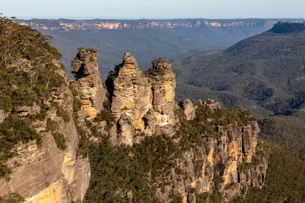
Plan this part without a car: our guide on how many days to spend in Sydney divides the days. Give the Blue Mountains one of them. The national park is World Heritage, and from Echo Point in Katoomba you see the Three Sisters. It is 102 km and about 1:34 h by car, and the Blue Mountains railway line also runs there. Melbourne isn't included because it lies the other way and would stretch the trip too far; we have a separate guide to Melbourne.
Days 5–9: Byron Bay and Noosa
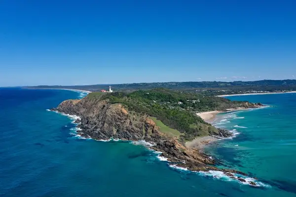
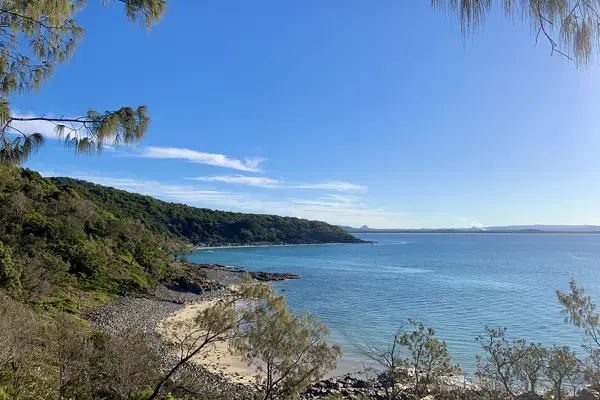
The two driving days to Byron Bay are just under 5 hours each of pure driving, with Port Macquarie as the stopover. Cape Byron Lighthouse stands at Australia's most easterly point, and the walking track there is a good spot for whale watching, according to the national parks service. In New South Wales the migration runs from May to November. Noosa is the calmer stop that follows, with a national park right on the sea.
Days 10–11: K'gari
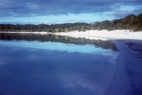
K'gari off Hervey Bay, formerly Fraser Island, is the world's largest sand island at 1,840 km² and World Heritage since 1992. It is 123 km long, and outside the Kingfisher Bay Resort you need a four-wheel drive and a vehicle permit, so an ordinary rental car stays on the mainland. For most people a guided day tour from Hervey Bay* is the simple answer; ferries run from River Heads and Inskip Point. Hervey Bay itself is known for humpback whales, migrating past between April and October.
Days 12–15: the long haul and the Whitsundays
Hervey Bay to Airlie Beach is 870 km and over 11 hours of pure driving. This is the leg you really must split. Stay in Rockhampton, which gives you two manageable days, and plan them so you don't drive at night.
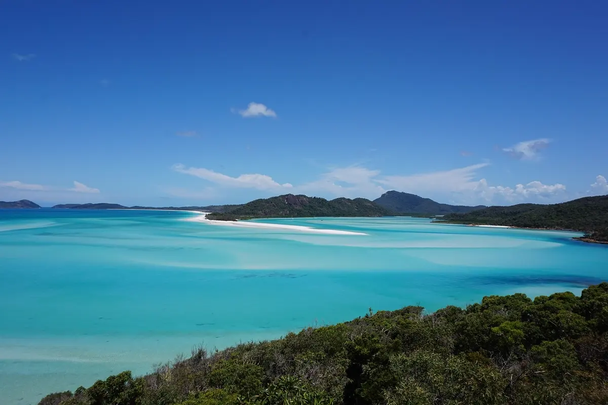
From Airlie Beach you can reach Whitehaven Beach only by boat, seaplane or helicopter. The beach is seven kilometres long and famous for its white silica sand. The boat takes a whole day, and three nights in Airlie Beach give you a buffer for wind.
Days 16–21: Townsville, Cairns and the reef
At Townsville the ferry to Magnetic Island is worthwhile, with a national park and walking tracks. Then comes Mission Beach as a stopover, and Cairns.
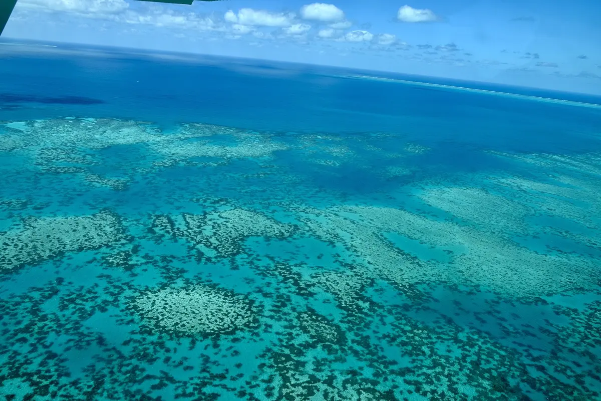
For the Great Barrier Reef, the world's largest coral reef system with over 2,900 individual reefs stretching more than 2,300 km, set aside a full day from Cairns. The reef suffers from coral bleaching, so conditions vary by section. A boat tour from Cairns* is the usual way.
On the last day you drive to Port Douglas and on to the cable ferry across the Daintree River, where the Daintree Rainforest begins, much of it part of the Wet Tropics World Heritage Site. The Daintree is among the Queensland rivers with the most saltwater crocodile sightings. Don't swim there, and obey warning signs. Allow for the 67 km back when timing your flight from Cairns.
Stingers, crocodiles and rain
This is the part many people underestimate. According to the Queensland Government, marine stingers are present in tropical waters all year, but the risk is higher from November to May. Swim only at patrolled beaches between the red and yellow flags, stay out when a beach is closed, and consider a full-body lycra suit. If stung, call Triple Zero (000) and pour vinegar on the sting.
Rain shows why September and October are the best window:
| Month | Cairns rain | Cairns day | Sydney day |
|---|---|---|---|
| January | 406 mm | 30.0 °C | 27.2 °C |
| March | 318 mm | 29.4 °C | 25.0 °C |
| May | 91 mm | 26.0 °C | 19.5 °C |
| July | 54 mm | 23.9 °C | 16.9 °C |
| September | 42 mm | 25.9 °C | 20.8 °C |
| October | 47 mm | 27.6 °C | 23.0 °C |
| November | 55 mm | 29.0 °C | 24.4 °C |
| December | 291 mm | 29.6 °C | 26.5 °C |
Climate: monthly averages 2015–2024 from the ERA5 reanalysis (Open-Meteo), rounded. Our guide to the best time to visit Australia has the detail. The FCDO also flags a higher bushfire risk from October to February, so check the local situation.
Where to stay on this route
- Hervey Bay: two nights, so you have a full day on K'gari.
- Airlie Beach: three nights because of the boat tours and the weather.
- Cairns: near the harbour and the reef boats.
Good to know before you go
- Entry: you need an electronic authority before you travel. Check gov.uk and Australia's Department of Home Affairs for the current rules.
- Flying home: you return from Cairns via a bigger city, so book an open-jaw ticket, into Sydney and out of Cairns.
- Travel advice: neither the FCDO nor Germany's Foreign Office advises against any part of this route.
- Mobile data: our eSIM comparison for Australia shows the plans; on long stretches north of Rockhampton, offline maps help too.
- More of the same: if you enjoy driving through big landscapes, see our New Zealand itinerary.
 Sydney trip planDay by day, with map and tips
How YesTrip helps with this trip
Set up the route as one trip. There's a ready-made city plan for Sydney that you can adjust, and the AI builds a day plan for the other stops. The map shows all eleven stops, the forecast for your travel days helps with your reef and boat days, and the packing list covers the change in climate and the plug adapter. The offline package stores the maps for the long days in the north. Travelling in a group, you share the trip and log expenses. You book with the provider; YesTrip itself books nothing.
* Ad – Partner link: if you book there, we earn a commission. Your price stays the same.
Free
Plan your trip in 30 seconds.
Tell YesTrip where and when – the app plans day by day with real places on the map, shows the weather, splits costs with your travel companions and guides you to the next stop on the go.
Frequently asked questions
How many days do you need for Australia's East Coast?
Three weeks make sense for Sydney to Cairns by car. The route is about 2,840 km, and two driving days exceed 5 hours. With two weeks, drop a section such as Sydney to Noosa, or take the train from Brisbane to Cairns.
Which direction is best for the East Coast?
South to north in September and October. You start in a pleasantly warm Sydney and reach Cairns before the higher stinger risk from November and before the rainy season.
When is stinger season in Queensland?
The risk is higher from November to May, but marine stingers are present in tropical waters all year. Swim only at patrolled beaches between the red and yellow flags.
Do you need a 4WD for K'gari?
Yes. Outside Kingfisher Bay Resort you need a four-wheel drive and a vehicle permit. A guided day tour from Hervey Bay is simpler, and your rental car stays on the mainland.
How do you get to Whitehaven Beach?
Only by boat, seaplane or helicopter, usually from Airlie Beach or Hamilton Island. Allow a whole day, and keep a spare day in case of wind.
Sources
- Driving times: OSRM route calculation based on OpenStreetMap data – project-osrm.org
- Climate: Open-Meteo Historical Weather API (ERA5), averages 2015–2024 – open-meteo.com
- Marine stingers and crocodiles: Queensland Government – www.qld.gov.au
- Bushfire risk: UK Foreign Travel Advice – www.gov.uk
- Dangerous wildlife and flooding: UK Foreign Travel Advice – www.gov.uk
- Entry requirements: UK Foreign Travel Advice – www.gov.uk
- eVisitor: Australian Department of Home Affairs – immi.homeaffairs.gov.au
- Germany's advice on Australia: German Foreign Office – www.auswaertiges-amt.de
- Blue Mountains National Park: NSW National Parks – www.nationalparks.nsw.gov.au
- Rail lines in New South Wales: Transport for NSW – transportnsw.info
- Cape Byron and whale migration: NSW National Parks – www.nationalparks.nsw.gov.au
- Spirit of Queensland: Wikipedia – en.wikipedia.org
- Bruce Highway: Wikipedia – en.wikipedia.org
- K'gari and access: Wikipedia – en.wikipedia.org
- Hervey Bay and whales: Wikipedia – en.wikipedia.org
- Whitehaven Beach: Wikipedia – en.wikipedia.org
- Magnetic Island: Wikipedia – en.wikipedia.org
- Great Barrier Reef: Wikipedia – en.wikipedia.org
- Daintree Rainforest: Wikipedia – en.wikipedia.org
- Daintree River and crocodiles: Wikipedia – en.wikipedia.org
Researched with AI support and checked by our editors. Prices, opening hours and weather can change – please check before you go. YesTrip is not a travel agency. Published: .
More articles
 Road trips & itineraries
Amalfi Coast itinerary: 5 days, no car needed
This 5-day route runs from Pompeii through Sorrento, Positano, Amalfi and Ravello to Salerno, with no car. Travelmar lists the boat from … · 9 min read Road trips & itineraries
Bali itinerary: 2 weeks, 5 bases, no scooter
This 14-day loop covers about 410 km and almost 7 hours of pure driving through Ubud, Sidemen, Amed, Munduk and Uluwatu, by car with a … · 8 min read Road trips & itineraries
Baltics itinerary: 10 days, Tallinn to Vilnius
This route links Tallinn, Pärnu, Riga and Vilnius in 10 days, about 680 km by car; the longest day, Riga to Vilnius via Rundāle and the Hill … · 8 min read


