
Day-by-day itinerary with walking routes
In short
A walkable day groups 4 to 7 stops in one or two neighbourhoods, keeps each walk under about 1 km and shows the distance of every leg. In our Porto example, seven old-town stops add up to 2.0 km in a straight line, while a typical mixed draft covers 14.1 km. Trip planners such as YesTrip show stops, time on the move and each walking leg per day.
A list of sights is not yet a plan. What turns it into one is the order: which places you see on the same day, and how far you walk between them. A good day-by-day itinerary answers both, and shows the walking route between every pair of stops so you can see at a glance whether a day works on foot. This guide explains what makes a day walkable, walks through a real example day in Porto leg by leg and shows which kinds of tools build such plans for you. If you want the AI to do the first draft, read AI travel itinerary: how to get a good one first – this article is about the walking part.
What makes a day walkable
Three things decide whether you will enjoy a day on foot or spend it looking at a map.
1. One cluster per day. Pick one or two neighbourhoods that touch each other and put every stop of the day there. A city that looks small on the map still costs you an hour if you cross it twice.
2. Short walking legs. As a rule of thumb, keep each walk between two stops under about 1 km in a straight line. At an easy pace of 4 km/h, 1 km takes about 15 minutes, and streets are never straight, so the real walk is longer. Anything further is a leg for the metro, a tram or a taxi – which is fine, as long as you plan it as such.
3. A visible total. Add up the legs. Two to four kilometres in a straight line make a relaxed sightseeing day; on foot that becomes more, plus everything you walk inside museums, parks and markets. If the total is twice that, the day is either too full or in the wrong order.
Then there are the details a straight line does not show: hills, stairs, river crossings and the heat at midday. Porto is a good example: the old town falls steeply from the cathedral down to the river, so 300 metres can feel like a kilometre.
The example: one day in Porto's old town
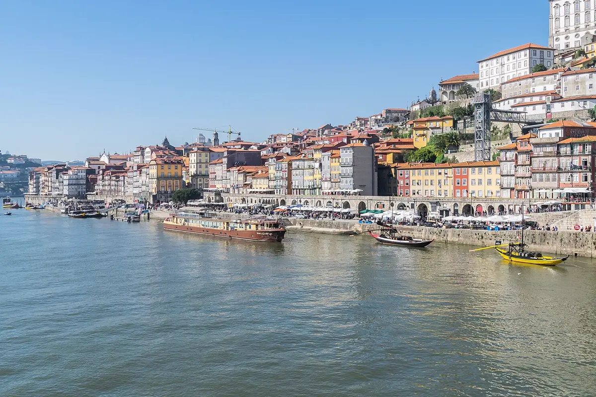
The first day of our ready-made Porto plan stays within the old town and the riverbank. Every stop is a short walk from the one before.
| Stop | Time | Straight line from previous stop |
|---|---|---|
| São Bento station | 09:30 | start |
| Porto Cathedral (Sé) | 10:15 | 320 m |
| Torre dos Clérigos | 11:15 | 420 m |
| Livraria Lello | 12:00 | 140 m |
| Palácio da Bolsa | 14:30 | 620 m |
| Ribeira | 16:00 | 220 m |
| Dom Luís I Bridge | 18:30 | 320 m |
Calculated as the straight line between the stops from the coordinates in our city plan (Wikipedia and OpenStreetMap). The total is 2.0 km. On foot you walk more, because the streets wind and climb.
No leg is longer than about 600 metres, and the day ends where the evening is best: on the upper deck of the bridge, with a walk across to Gaia for the view back over the city. Lunch fits between Livraria Lello and the Palácio da Bolsa, where there is a gap of two and a half hours.

The same city, planned badly
Now the same city in the order a first draft often uses: the best-known names, one after another, without looking at the map. Clérigos tower in the morning, then the Serralves museum and park in the west, back to the Ribeira, up to Café Majestic and finally out to Foz do Douro on the Atlantic.
| Day | Stops | Straight line in total |
|---|---|---|
| Mixed draft | Clérigos, Serralves, Ribeira, Café Majestic, Foz do Douro | 14.1 km |
| Day 1: old town and Ribeira | 7 stops, see table above | 2.0 km |
| Day 2: Serralves, the Atlantic and port wine | Serralves, Foz do Douro, Cálem cellar, Gaia Cable Car, Jardim do Morro | 6.6 km |
| Day 3: market, tiles and gardens | Bolhão Market, Chapel of Souls, Café Majestic, Carmo Church, Crystal Palace Gardens | 2.1 km |
Same method: straight line between the stops in the order given, from our city plan's coordinates.
Two lessons from this table. First, grouping by area cuts the old-town day to about a seventh of the distance of the mixed draft. Second, not every day has to be a walking day. Day two has one long leg of 4.9 km from Foz back to the cellars in Gaia – our plan covers it with the historic tram 1 along the river and a short walk across the bridge. A good itinerary says that clearly instead of pretending everything is a stroll.

Which tools create day-by-day itineraries with walking routes
There are three common ways to get a plan like this.
- A map app with saved lists: you pin every place and draw the days yourself. You see the spread, but you work out the order and the distances by hand, and the walking route only appears when you ask for directions between two places.
- A general AI chat: it writes a day plan in seconds, but as text. It has no map of its own, often underestimates distances and does not show the walk between stops, so you check every day on a map anyway.
- A trip planner app: the plan, the map and the routes are in one place. Wanderlog, for example, pins every place you add on a map; its homepage lists route optimisation as a Pro feature. YesTrip shows the walking leg between every two stops for free. For a wider comparison, see Best AI trip planner apps.
Whatever you use, the check is the same: open each day, look at the longest leg and the total, and move a stop to another day if it sits on the far side of the city.
How YesTrip builds a walkable day
In YesTrip you say where you want to go, for how long and what you enjoy, and the AI suggests a plan day by day – with times, short walks and a map. Every day starts with a line that shows the number of stops, the time on the move and the distance. Between the stops you see each leg, for example "6 min walk, 450 m", with a Route link that opens the way. The way in from the airport, for example, shows the time by public transport. If a public holiday falls on a travel day, a note says so, and the forecast weather appears next to the date.

You move, remove and add stops until the plan fits. If you do not want to start from zero, copy the ready-made Porto plan from this article and let the AI adapt it to your dates and pace.
On the trip itself, the Today view shows the next stop and roughly how long it takes from the previous one. You choose on foot, transit, car or bike, start the route and tick the stop off when you are done; below it you see what comes after. If rain is forecast, a card suggests asking the AI how to rearrange the day.

What YesTrip does not do: it does not book anything and cannot guarantee opening hours – check them on the official websites. Guided tours of the Palácio da Bolsa and tickets for Livraria Lello* you get from the provider, for example through Tiqets. The AI needs an internet connection; maps of your destinations can be downloaded beforehand with the offline package, which our guide to offline maps for travel explains. To keep routes working on the go without roaming costs, an eSIM for Portugal* is an option.
If Porto is part of a longer trip, the train to Lisbon takes the stress out of the transfer; you can compare train connections to Lisbon* at Omio. How long to stay is covered in How many days in Porto?.
How many stops fit in a day in the first place is worked out with a time budget in How many sights per day?
* Ad – Partner link: if you book there, we earn a commission. Your price stays the same.
Free
Plan your trip in 30 seconds.
Tell YesTrip where and when – the app plans day by day with real places on the map, shows the weather, splits costs with your travel companions and guides you to the next stop on the go.
Frequently asked questions
What tools create day-by-day itineraries with walking routes?
Trip planner apps combine the day plan, a map and the routes between stops. YesTrip shows the walking leg between every two stops of a day, with time and distance, for free. A map app with saved lists or a general AI chat also work, but you put the days on the map and work out the walks yourself.
How far should you walk between sights in a day?
As a rule of thumb, keep each walk between two stops under about 1 km in a straight line and the whole day around 2 to 4 km in a straight line. The real distance on foot is longer, because streets wind and you also walk inside museums and parks.
How many stops fit into a walkable city day?
Four to seven, if they are close together and at most one or two of them are large museums. In our Porto example, seven old-town stops fit into one day because no walk is longer than about 600 metres.
How do I check whether my itinerary is walkable?
Open each day on a map, look at the longest leg and add up all legs. If a single leg crosses the city or the total is far above 4 km in a straight line, move stops to another day or plan that leg by public transport.
Does YesTrip show walking routes offline?
Your trips and tickets are stored on the device. With the offline package you download the maps of your destinations before you go. The AI and the search for flights, hotels and tours need an internet connection.
Sources
- Coordinates of the stops: Wikipedia and OpenStreetMap, as used in the YesTrip city plan for Porto – www.openstreetmap.org
- Wanderlog: features and Pro plan – wanderlog.com
- Palácio da Bolsa: visits – www.palaciodabolsa.com
- Livraria Lello: visits and tickets – www.livrarialello.pt
Researched with AI support and checked by our editors. Prices, opening hours and weather can change – please check before you go. YesTrip is not a travel agency. Published: .
More articles
 Planning & packing
Cherry blossom Japan: when and where, by city
On 1991 to 2020 averages, cherry blossom opens in Tokyo on 24 March and reaches full bloom on 31 March, on 4 April in Kyoto, 13 April in … · 6 min read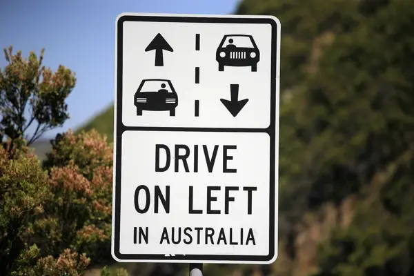 Planning & packing
Countries that drive on the left: all 54 listed
54 of 195 countries drive on the left, in Europe only the UK, Ireland, Malta and Cyprus. Japan, Thailand, India, Australia, New Zealand and … · 6 min read Planning & packing
Honeymoon destinations by month: 12 places
The right trip depends on your wedding month: January Maldives (27.9 °C, 74 mm of rain), March Cape Town (24.0 °C, 29 mm), June Amalfi Coast … · 7 min read


