
Morocco itinerary: a 12-day road trip
In short
The classic 12-day Morocco itinerary runs from Marrakech over the High Atlas to Aït Benhaddou, through the Dades and Todra gorges to the Sahara at Merzouga and on to Fes and Chefchaouen – about 1,200 km by hire car. The longest leg is Merzouga to Fes at 460 km, split with a night in Midelt. The best times to go are March to May and October to November.
Morocco is only about three and a half hours' flight from London and yet a different world: medinas with souks, mud-brick fortresses in river valleys, mountain gorges and sand dunes on the edge of the Sahara. This route is the classic loop from Marrakech through the south to the north. It is planned for a hire car but works just as well with a car and driver or – for the desert part – a multi-day tour from Marrakech.
The route at a glance
| Day | Leg | Distance | Pure driving time |
|---|---|---|---|
| 1–2 | Marrakech | – | – |
| 3 | Marrakech → Tizi n'Tichka → Aït Benhaddou | 170 km | approx. 3:20 h |
| 4 | Aït Benhaddou → Ouarzazate → Dades Valley (Boumalne) | 146 km | approx. 2:55 h |
| 5 | Dades → Todra Gorge (Tinghir) → Merzouga | 244 km | approx. 4:30 h |
| 6 | Merzouga and the Erg Chebbi dunes | – | – |
| 7 | Merzouga → Midelt | 259 km | approx. 4:30 h |
| 8 | Midelt → Fes | 201 km | approx. 3:45 h |
| 9–10 | Fes | – | – |
| 11 | Fes → Chefchaouen | 195 km | approx. 3:55 h |
| 12 | Chefchaouen → Fes (flight home) or on to Rabat | 196 km / 246 km | approx. 3:55 h / approx. 4:15 h |
Driving times: route calculation based on OpenStreetMap, without breaks. On mountain roads, behind lorries and with photo stops, add about a third. To Chefchaouen it is about 1,200 km.
- Marrakech
- Aït Benhaddou
- Ouarzazate
- Dades
- Todra
- Merzouga
- Midelt
- Fes
- Chefchaouen
- Rabat
- Casablanca
Base map: Natural Earth
If you don't want to return to Marrakech, book an open-jaw flight: into Marrakech, out of Fes or Casablanca. Hire companies usually charge extra for dropping a car off at a different location.
Days 1–2: Marrakech
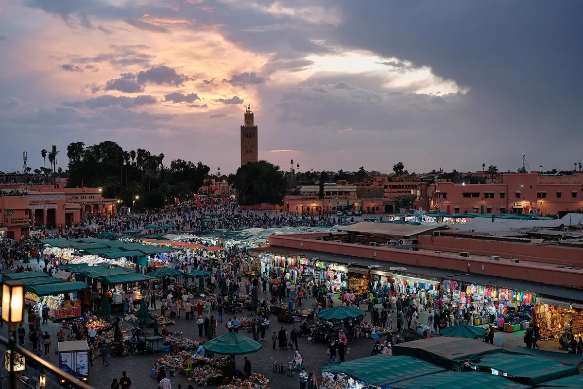
Marrakech is the starting point with the most flights. The heart of the city is Jemaa el-Fnaa square: juice stalls and snake charmers by day, food stalls, musicians and storytellers in the evening. The souks spread north from here. Also worth seeing are the Koutoubia Mosque, whose minaret is visible from everywhere, Bahia Palace, the Saadian Tombs and the Jardin Majorelle with its vivid blue. Pick up the hire car on day three – you won't need it in the medina.
 Marrakech trip planDay by day, with map and tips
Day 3: Over the High Atlas to Aït Benhaddou
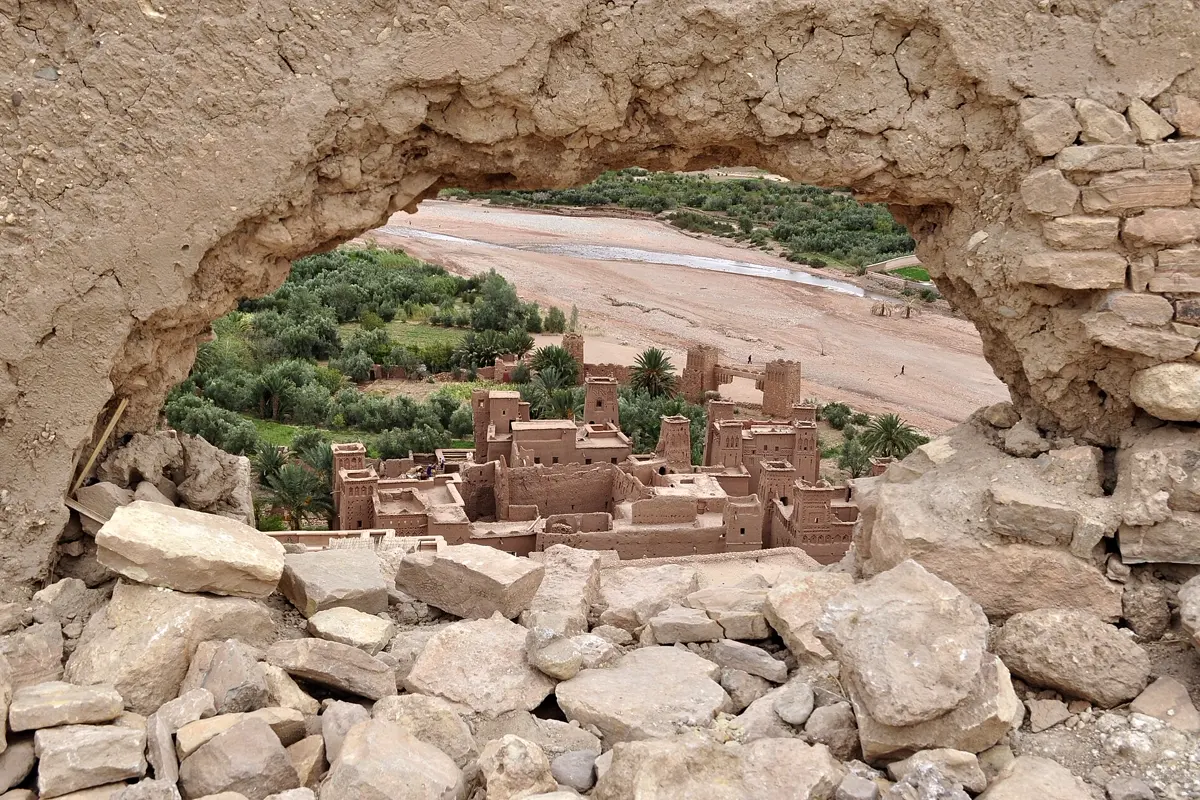
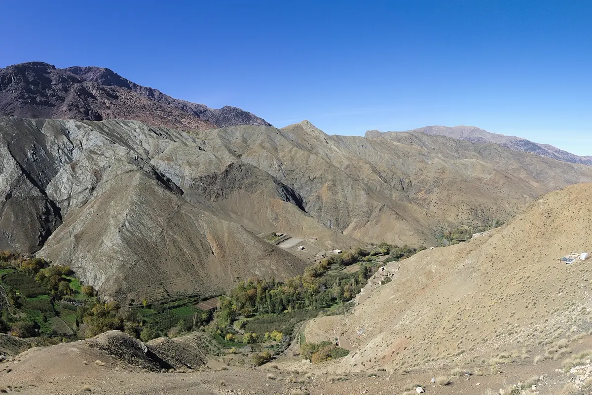
The road south crosses the Tizi n'Tichka pass, more than 2,200 m high. The road is well built but winding – in winter there can be snow at the top. Beyond the pass the landscape changes: red earth, oases, mud-brick villages. Aït Benhaddou is a fortified village (ksar) of rammed earth on a hillside above a river, a UNESCO World Heritage Site and the backdrop to many films. Stay the night here or nearby – in the evening and early morning you have the ksar almost to yourself.
Days 4–5: Ouarzazate, the Dades and Todra gorges
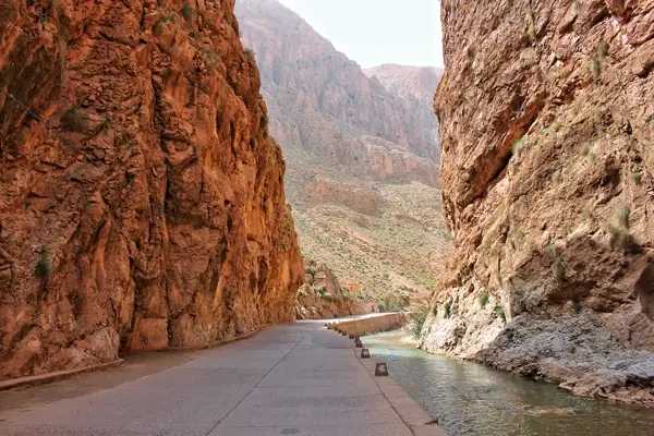
Via Ouarzazate, with its film studios and Kasbah Taourirt, the "Road of a Thousand Kasbahs" leads east. In the Dades Valley, drive a little way into the gorge in the afternoon, where the road climbs in tight hairpins. Next morning the Todra Gorge near Tinghir is on the way: at its narrowest point the rock walls stand only a few metres apart and rise more than a hundred metres. From there it is just over three hours to Merzouga.

Days 5–6: Merzouga and the Sahara
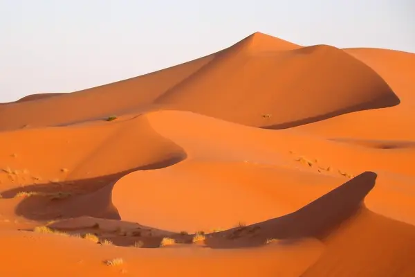
Near Merzouga rises the Erg Chebbi, a field of sand dunes more than a hundred metres high. Most visitors ride dromedaries or take a 4x4 to a tented camp in the dunes in the late afternoon, watch the sunset from a dune crest and sleep under the stars. Plan two nights in the area so the long drive doesn't follow straight after the short night. In winter the desert gets cold at night – only 3.8 °C on average in January.
Days 7–8: Via Midelt to Fes
From Merzouga to Fes is 460 km and a little over eight hours of pure driving – too much for one day. Split it with a night in Midelt at the foot of the Middle Atlas. On the second day the road passes through cedar forests and over the plateau at Ifrane, a mountain town with European-style houses.
Days 9–10: Fes
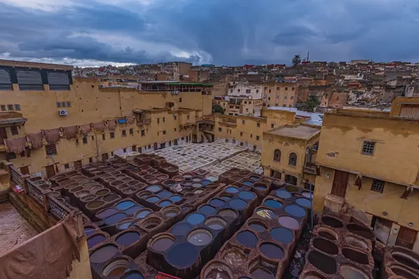
The old town of Fes el-Bali is one of the largest medieval medinas in the world and largely car-free – goods are carried by donkey and handcart. It is easy to get lost in its countless lanes; an official guide is worthwhile on the first day. From the roof terraces around the Chouara tannery you look down into the pits where leather is dyed as it has been for centuries. Also worth seeing are the Bou Inania Madrasa and al-Qarawiyyin university, considered one of the oldest in the world (the interior is open to Muslims only).
Days 11–12: Chefchaouen
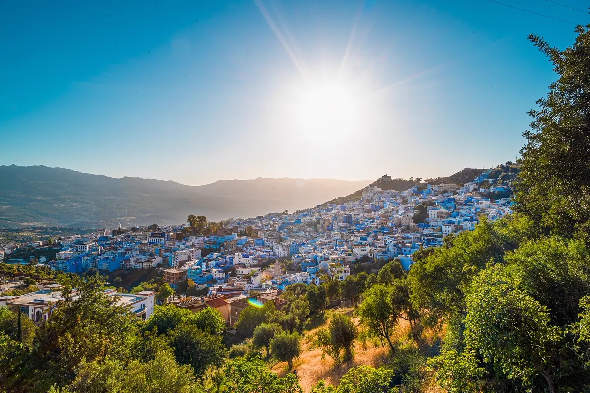
In the Rif Mountains lies Chefchaouen, the "blue city": the houses of its medina are painted in every shade of blue. It is calmer than Fes and ideal for a slow day, with a walk up to the Spanish Mosque on the hill at sunset. From here drive back to Fes (196 km) for your flight home, or add a day or two on the Atlantic coast: via Rabat, the capital, to Casablanca with the Hassan II Mosque right on the sea (246 km and 90 km).
Weather through the year
| Month | Marrakech day | Marrakech night | Merzouga day | Merzouga night | Fes rain |
|---|---|---|---|---|---|
| Jan | 19.7 °C | 5.3 °C | 17.9 °C | 3.8 °C | 52 mm |
| Feb | 21.3 °C | 6.9 °C | 20.1 °C | 6.6 °C | 50 mm |
| Mar | 23.2 °C | 8.7 °C | 24.3 °C | 10.6 °C | 83 mm |
| Apr | 26.1 °C | 11.7 °C | 29.2 °C | 15.4 °C | 61 mm |
| May | 30.4 °C | 14.9 °C | 33.4 °C | 19.8 °C | 41 mm |
| Jun | 33.1 °C | 17.4 °C | 37.9 °C | 24.0 °C | 10 mm |
| Jul | 38.5 °C | 20.9 °C | 41.8 °C | 27.9 °C | 2 mm |
| Aug | 38.1 °C | 21.4 °C | 40.4 °C | 27.2 °C | 6 mm |
| Sep | 33.1 °C | 18.3 °C | 35.2 °C | 22.3 °C | 18 mm |
| Oct | 29.6 °C | 15.3 °C | 29.1 °C | 16.4 °C | 47 mm |
| Nov | 24.1 °C | 10.0 °C | 22.9 °C | 9.8 °C | 45 mm |
| Dec | 21.0 °C | 6.9 °C | 18.5 °C | 5.2 °C | 50 mm |
Temperatures and rain: monthly averages 2015–2024 from the ERA5 reanalysis (Open-Meteo), rounded. Values apply to a grid cell of about 25 km.
Best time for the trip
The best months are March to May and October to November. Marrakech is then pleasant at 23 to 30 °C by day, and even in the desert at Merzouga it usually stays below 30 °C – only in May does it get hot there at 33.4 °C. In summer the route is hard going: in July Merzouga averages 41.8 °C and Marrakech 38.5 °C. In winter the days are mild at around 18 to 21 °C, but desert nights are cold and there can be snow on the Atlas pass. Fes and the north get most rain from November to April, 83 mm on average in March.
How YesTrip helps with this trip
In YesTrip you set up the itinerary with all its stops. For Marrakech there is a ready-made city plan with the medina, souks, palaces and gardens that you can adopt; for Fes, Chefchaouen and the places in the south the AI builds a day plan. The weather forecast covers your travel days – important, because desert and mountains differ widely. The packing list remembers warm clothes for the night in the desert. Travelling with others, you share the trip and settle shared expenses. The map also works offline – handy in the medinas and in areas without signal.
What to know before you go
- Entry: UK and EU citizens can visit Morocco as tourists for up to 90 days without a visa; you need a valid passport. Check the current rules on gov.uk or with your own government.
- Driving: traffic drives on the right. Expect police checks and speed traps, as well as donkey carts, pedestrians and animals on the road. Avoid driving after dark where you can.
- Power: 220 volts, European two-pin plugs; UK plugs need an adapter.
- Clothing: cover shoulders and knees, especially outside Marrakech and in the countryside.
- Mobile data: roaming in Morocco is expensive on most plans. A travel eSIM helps with navigation.
Free
Plan your trip in 30 seconds.
Tell YesTrip where and when – the app plans day by day with real places on the map, shows the weather, splits costs with your travel companions and guides you to the next stop on the go.
Frequently asked questions
How many days do you need for a Morocco itinerary?
For Marrakech, the south with the Sahara at Merzouga, Fes and Chefchaouen, 10 to 12 days is ideal. With one week, focus on Marrakech and a three-day desert tour. For the Atlantic coast with Essaouira or Rabat and Casablanca, add two to three days.
Can you drive yourself in Morocco?
Yes. The main roads on this route are paved and well signposted, and traffic drives on the right. Allow more time than the pure driving time, avoid driving at night and expect police checks. You don't need a car inside the medinas of Marrakech and Fes – park outside.
How far is the Sahara from Marrakech?
From Marrakech to Merzouga on this route is about 560 km and just over ten hours of pure driving. That is why the route splits it over three days with stops in Aït Benhaddou and the Dades Valley. Smaller dunes closer to Marrakech lie near Zagora.
When is the best time to visit Morocco?
March to May and October to November. Marrakech is then 23 to 30 °C by day and the desert is not too hot. In July Merzouga averages 41.8 °C, while in January nights there drop to 3.8 °C.
Do I need a visa for Morocco?
UK and EU citizens do not need a visa for tourist stays of up to 90 days, only a valid passport. Check the current requirements on gov.uk or with your own government.
Sources
- Driving times: OSRM route calculation based on OpenStreetMap data – project-osrm.org
- Climate data: ERA5 reanalysis via Open-Meteo, monthly averages 2015–2024 – open-meteo.com
- Entry requirements for Morocco: UK Foreign Travel Advice – www.gov.uk
Researched with AI support and checked by our editors. Prices, opening hours and weather can change – please check before you go. YesTrip is not a travel agency. Published: .
More articles
 Road trips & itineraries
Iceland road trip itinerary: Ring Road in 12 days
The classic Iceland road trip follows the Ring Road for 12 days from Reykjavík: Golden Circle, the south coast with Skógafoss and Vík, the … · 8 min read Road trips & itineraries
Ireland road trip: a 10-day itinerary
The classic 10-day Ireland road trip runs from Dublin via Glendalough and Kilkenny to Cork and Kinsale, around the Ring of Kerry, to the … · 7 min read Road trips & itineraries
Japan itinerary: 2 weeks by train
The classic two-week Japan itinerary runs by train from Tokyo via Hakone near Mount Fuji to Kyoto, Nara, Osaka and Hiroshima with the island … · 7 min read


