
Iceland road trip itinerary: Ring Road in 12 days
In short
The classic Iceland road trip follows the Ring Road for 12 days from Reykjavík: Golden Circle, the south coast with Skógafoss and Vík, the Jökulsárlón glacier lagoon, the Eastfjords, Mývatn, Akureyri and finally Snæfellsnes – about 1,780 km by car. No leg takes more than 4.5 hours of pure driving. The best time to go is June to August, with average highs of 11 to 14 °C in Reykjavík.
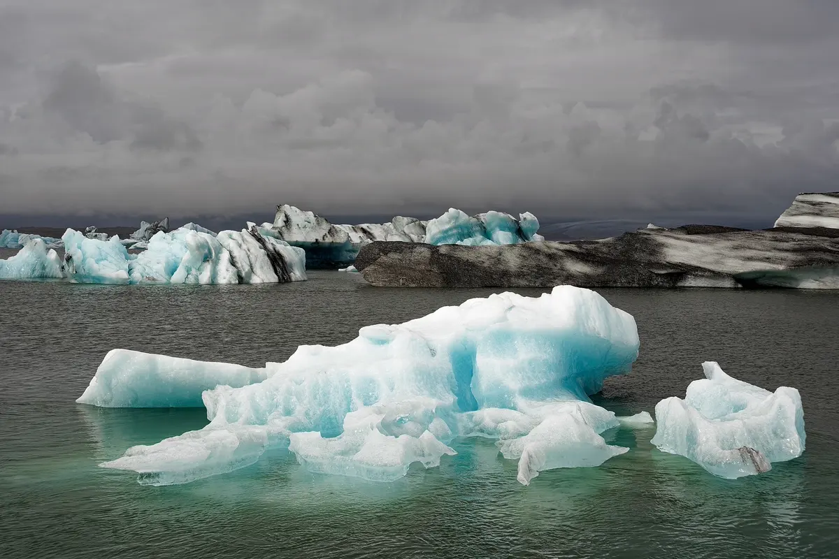
Iceland is made for a road trip: the Ring Road, Route 1, runs all the way round the island, and almost every famous sight lies on or near it – waterfalls, black beaches, glaciers, volcanic landscapes. This itinerary takes 12 days, starts and ends in Reykjavík and adds the Snæfellsnes peninsula at the end. If you have less time, there is a 10-day and a 7-day version further down.
The route at a glance
| Day | Leg | Distance | Pure driving time |
|---|---|---|---|
| 1–2 | Reykjavík | – | – |
| 3 | Reykjavík → Þingvellir → Geysir → Gullfoss → Selfoss | 188 km | approx. 3:00 h |
| 4 | Selfoss → Seljalandsfoss → Skógafoss → Vík | 135 km | approx. 2:05 h |
| 5 | Vík → Skaftafell | 140 km | approx. 2:00 h |
| 6 | Skaftafell → Jökulsárlón → Höfn | 126 km | approx. 2:15 h |
| 7 | Höfn → Eastfjords → Egilsstaðir | 247 km | approx. 3:40 h |
| 8 | Egilsstaðir → Dettifoss → Mývatn | 230 km | approx. 3:25 h |
| 9 | Mývatn → Goðafoss → Akureyri | 86 km | approx. 1:20 h |
| 10 | Akureyri → Borgarnes | 307 km | approx. 4:25 h |
| 11 | Borgarnes → Kirkjufell → Stykkishólmur | 143 km | approx. 2:05 h |
| 12 | Stykkishólmur → Reykjavík | 173 km | approx. 2:35 h |
Driving times: route calculation based on OpenStreetMap, without breaks. With photo stops, wind and roadworks, add about a third. From Reykjavík to Keflavík airport it is another 47 km, approx. 0:45 h.
- Reykjavík
- Þingvellir
- Geysir
- Gullfoss
- Selfoss
- Skógafoss
- Vík
- Skaftafell
- Jökulsárlón
- Höfn
- Egilsstaðir
- Dettifoss
- Mývatn
- Akureyri
- Borgarnes
- Kirkjufell
- Stykkishólmur
Base map: Natural Earth
Days 1–2: Reykjavík
The capital is small, walkable and the natural starting point. From Hallgrímskirkja church you look across colourful roofs to the sea, and the Harpa concert hall sits by the harbour. On day two, take a whale-watching trip from the old harbour or soak in one of the geothermal pools. Pick up the hire car on day three – you won't need it in town.
Day 3: the Golden Circle
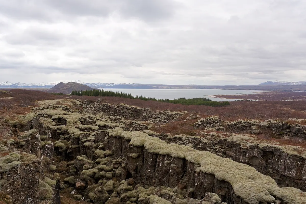
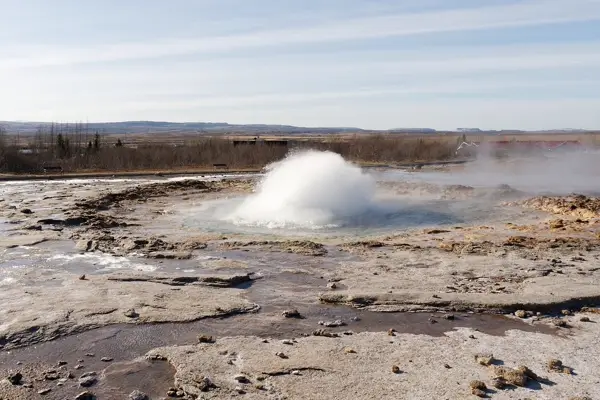
The Golden Circle is Iceland's best-known day loop and sits perfectly at the start of the Ring Road. In Þingvellir National Park the rifts between the North American and Eurasian plates lie open in the landscape, and Iceland's parliament met here from the year 930. Just under an hour on, the Strokkur geyser erupts every few minutes in the Geysir geothermal area. Ten minutes later the Gullfoss waterfall drops in two steps into a gorge. Stay in or near Selfoss so the next day on the south coast can start early.
Days 4–5: the south coast to Vík and Skaftafell
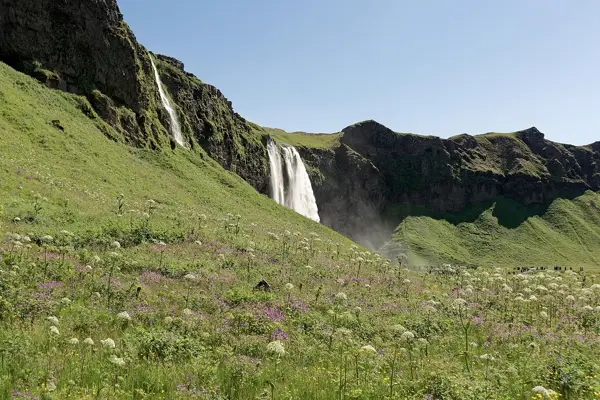
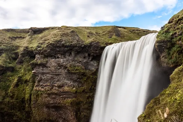
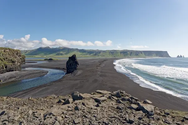
The south coast has more photo stops per kilometre than anywhere else on the trip. A path leads behind Seljalandsfoss, while Skógafoss falls wide and loud over an old coastline. Just before Vík lies the black beach of Reynisfjara with basalt columns and sea stacks offshore. Take care here: so-called sneaker waves run unexpectedly far up the beach – keep well back from the water.
On day five the road crosses the Eldhraun lava field and wide outwash plains to Skaftafell on the edge of Vatnajökull, Iceland's largest glacier. Marked trails lead to the Svartifoss waterfall and to viewpoints over the glacier tongue.
Days 6–7: Jökulsárlón, Höfn and the Eastfjords
For many, the Jökulsárlón glacier lagoon is the highlight of the trip: icebergs break off the glacier, drift through the lagoon and wash up on the beach opposite, known as Diamond Beach. Allow at least two hours. Spend the night in the harbour town of Höfn.
After that it gets quieter. The Ring Road follows the coast through the Eastfjords and small fishing villages such as Djúpivogur and Fáskrúðsfjörður to Egilsstaðir – 247 km by our route calculation. A shortcut over the Öxi pass saves about 60 km, but it is a steep gravel road that is only passable in summer; with a normal hire car the coast road is the more relaxed choice.
Days 8–9: Dettifoss, Mývatn and Akureyri
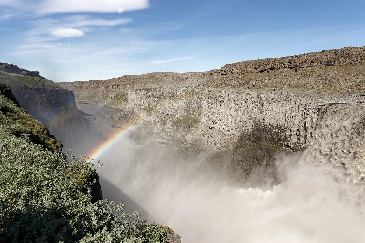
In the north-east, Dettifoss, one of the most powerful waterfalls in Europe, thunders through a grey canyon. Further west is the area around Lake Mývatn: steaming mud pots at Námafjall, pseudo-craters, lava formations and a nature bath that is quieter than the Blue Lagoon. On day nine you pass Goðafoss on the way to Akureyri, the largest town in the north, with a botanical garden and whale-watching boats on the Eyjafjörður.
Days 10–12: Snæfellsnes and back to Reykjavík
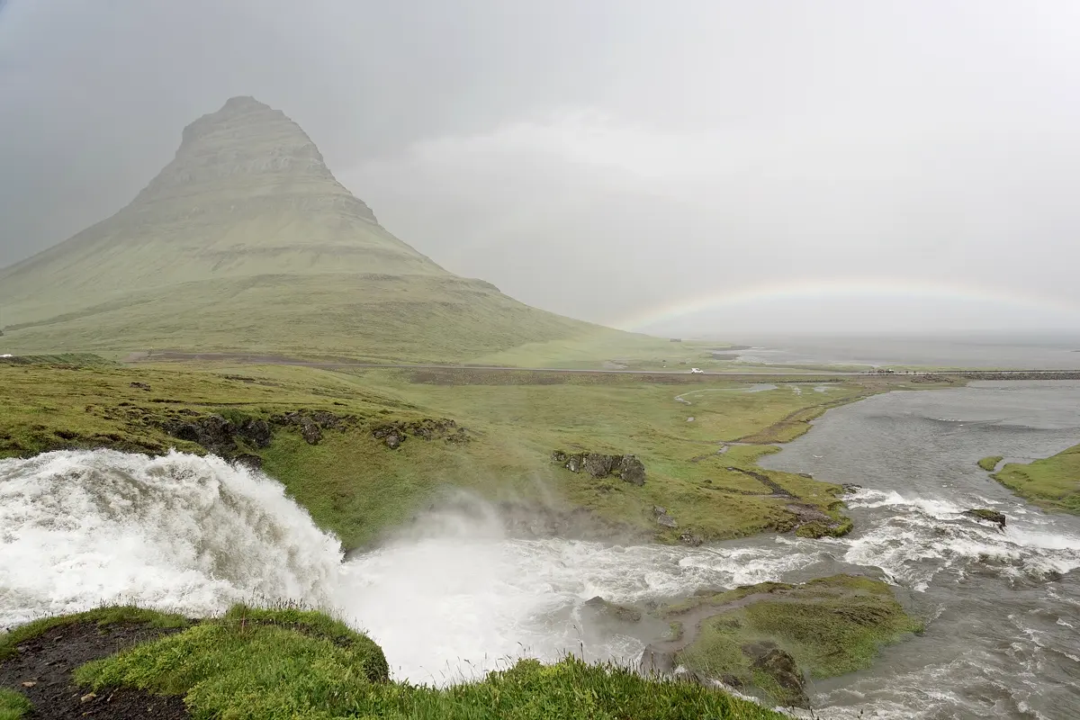
The leg from Akureyri over the Holtavörðuheiði plateau to Borgarnes is the longest of the trip at about four and a half hours of pure driving. On day eleven you explore the Snæfellsnes peninsula, often called "Iceland in miniature": Kirkjufell mountain near Grundarfjörður, lava coastlines and, at the western tip, the glacier-capped volcano Snæfellsjökull. Stay in the small harbour town of Stykkishólmur; on the last day it is about two and a half hours back to Reykjavík.
Shorter versions: 10 or 7 days
10 days: Skip Snæfellsnes and drive from Akureyri straight to Reykjavík – 381 km, approx. 5:35 h of pure driving. All other legs stay the same.
7 days: Skip the full ring and drive only the Golden Circle and the south coast as far as Jökulsárlón, with two nights in Reykjavík. The way back from the glacier lagoon to Reykjavík is long at 378 km, approx. 5:40 h – split it with a night in Vík or Selfoss.
Best time for the Ring Road
The Ring Road is open all year, but only really predictable in summer. In June and July it hardly gets dark, the weather is at its most stable, and most accommodation and tours are open. From September to April the chances of seeing the northern lights are good, but days are short and storms or snow can close sections of road. In winter only drive the ring if you are used to snow and have spare days.
| Month | Day (avg high) | Night (avg low) | Rain |
|---|---|---|---|
| January | 1.6 °C | -2.9 °C | 152 mm |
| February | 2.0 °C | -2.6 °C | 151 mm |
| March | 3.1 °C | -1.5 °C | 133 mm |
| April | 6.2 °C | 1.0 °C | 132 mm |
| May | 8.7 °C | 3.7 °C | 122 mm |
| June | 11.5 °C | 6.8 °C | 94 mm |
| July | 13.5 °C | 8.7 °C | 85 mm |
| August | 13.1 °C | 8.3 °C | 105 mm |
| September | 10.3 °C | 5.9 °C | 137 mm |
| October | 6.8 °C | 2.8 °C | 158 mm |
| November | 3.9 °C | 0.2 °C | 129 mm |
| December | 1.6 °C | -2.5 °C | 135 mm |
Climate in Reykjavík: 2015–2024 averages from the ERA5 reanalysis (Open-Meteo), rounded. In the north around Akureyri summers are often a little drier, in the south-east by Vatnajökull wetter.
Good to know before you go
- Entry: Iceland is part of the Schengen Area, so the same entry rules apply as for the rest of Schengen.
- Mobile data: Iceland is in the European Economic Area, so EU and EEA plans roam there like at home. With a plan from elsewhere, check your roaming rates before you go.
- Driving: Outside towns the limit is usually 90 km/h on tarmac and 80 km/h on gravel. Off-road driving is strictly forbidden. Many Ring Road bridges are single-lane – whoever gets there first goes first.
- Road conditions and weather: Check the official road map on road.is and the weather warnings on vedur.is every morning. Closures due to wind are not unusual.
- Accommodation: There are few beds along the south coast and around Mývatn. Book them early for summer, ideally first.
- Flight: A direct flight from London to Keflavík takes approx. 3 hours.
How YesTrip helps with this trip
Create a trip in YesTrip with the stops of this route: the app shows every place on the map, uses AI to build a day plan for the stops along the way and shows the weather for your travel days. The packing list suggests clothing to match the forecast – in Iceland that almost always means a rain jacket and a hat, even in July. The offline map helps in the Eastfjords and the north, where reception is patchy, and if you travel with friends you can share the trip and the expenses in the app. For the first days there is our ready-made plan for Reykjavík.
Free
Plan your trip in 30 seconds.
Tell YesTrip where and when – the app plans day by day with real places on the map, shows the weather, splits costs with your travel companions and guides you to the next stop on the go.
Frequently asked questions
How many days do you need for Iceland's Ring Road?
Plan at least 10 days for the full Ring Road with the main stops, ideally 12. Then you never drive more than about 4.5 hours a day. With only 7 days, a loop of the Golden Circle and the south coast to the Jökulsárlón glacier lagoon is more relaxed than the whole ring.
How long is the Ring Road in Iceland?
Route 1 is about 1,300 km long. With the detours to the Golden Circle, Dettifoss and the Snæfellsnes peninsula, this itinerary comes to about 1,780 km of pure driving.
When is the best time for an Iceland road trip?
June to August. Average highs in Reykjavík are then 11 to 14 °C, it hardly gets dark, and the whole Ring Road is normally clear. September to April is better for the northern lights, but expect short days and road closures.
Do you need a 4x4 in Iceland?
Not for the Ring Road and the detours on this route – they are paved. You need a 4x4 for the highland tracks, the so-called F-roads, which are only open in summer, and it is advisable in winter because of snow and ice.
Where should I stay on an Iceland road trip?
Good bases on this route are Reykjavík, Selfoss, Vík, Skaftafell, Höfn, Egilsstaðir, Mývatn, Akureyri, Borgarnes and Stykkishólmur. Outside Reykjavík there are few beds, so book the south coast and Mývatn first.
Sources
- Driving times: OSRM route calculation based on OpenStreetMap data – project-osrm.org
- Climate: Open-Meteo Historical Weather API (ERA5), averages 2015–2024 – open-meteo.com
- Road conditions and closures: Vegagerðin (Icelandic Road Administration) – www.road.is
- Weather warnings: Icelandic Met Office – en.vedur.is
- Safety advice for travellers: Safetravel – safetravel.is
Researched with AI support and checked by our editors. Prices, opening hours and weather can change – please check before you go. YesTrip is not a travel agency. Published: .
More articles
 Road trips & itineraries
Ireland road trip: a 10-day itinerary
The classic 10-day Ireland road trip runs from Dublin via Glendalough and Kilkenny to Cork and Kinsale, around the Ring of Kerry, to the … · 7 min read Road trips & itineraries
Japan itinerary: 2 weeks by train
The classic two-week Japan itinerary runs by train from Tokyo via Hakone near Mount Fuji to Kyoto, Nara, Osaka and Hiroshima with the island … · 7 min read Road trips & itineraries
Morocco itinerary: a 12-day road trip
The classic 12-day Morocco itinerary runs from Marrakech over the High Atlas to Aït Benhaddou, through the Dades and Todra gorges to the … · 8 min read


