
Ireland road trip: a 10-day itinerary
In short
The classic 10-day Ireland road trip runs from Dublin via Glendalough and Kilkenny to Cork and Kinsale, around the Ring of Kerry, to the Cliffs of Moher, Galway and Connemara and back to Dublin – about 1,260 km by hire car, driving on the left. The longest leg is Clifden to Dublin at 3.5 hours of pure driving. The best time to go is May to September.
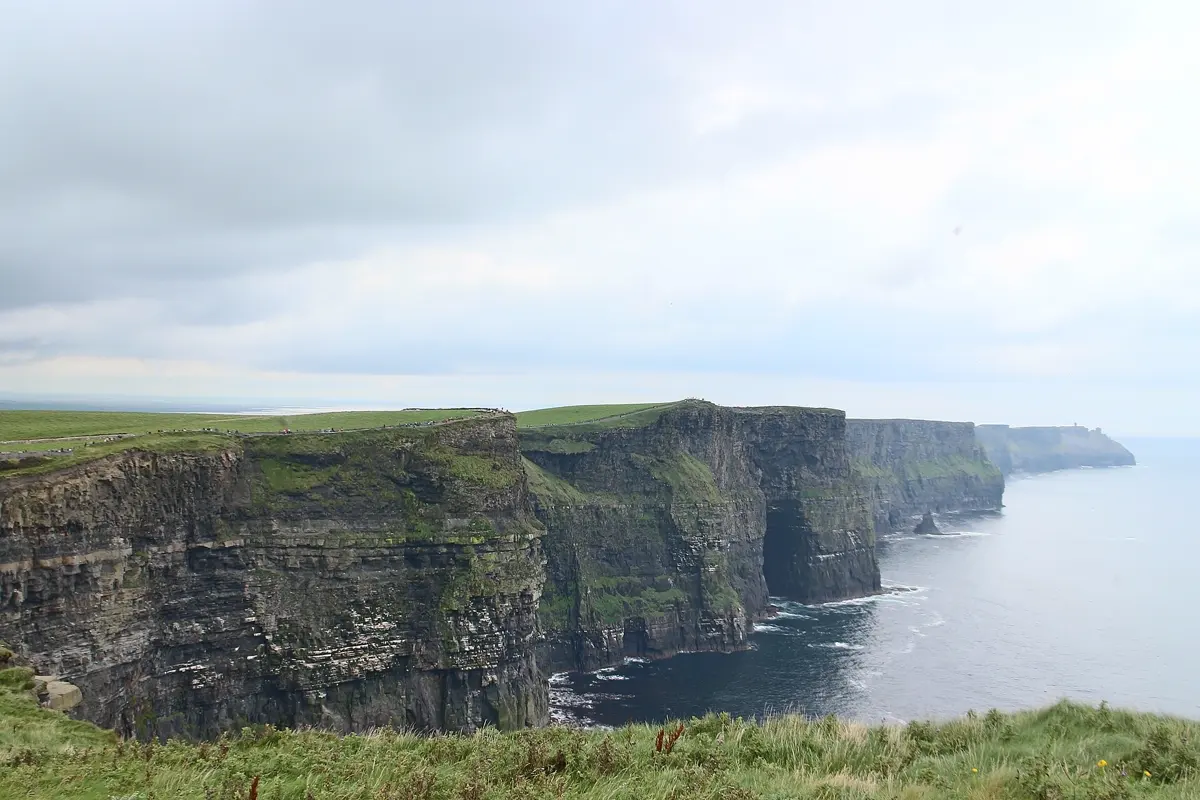
Ireland is small enough to drive around in ten days and varied enough that every day looks different: monastic ruins in the Wicklow Mountains, medieval towns in the south, the peninsulas of Kerry, the sea cliffs of Clare and the empty expanse of Connemara. This route is a loop from and back to Dublin, with no more than three and a half hours of driving a day.
The route at a glance
| Day | Leg | Distance | Pure driving time |
|---|---|---|---|
| 1–2 | Dublin | – | – |
| 3 | Dublin → Glendalough → Kilkenny | 157 km | approx. 2:30 h |
| 4 | Kilkenny → Rock of Cashel → Cork | 153 km | approx. 2:05 h |
| 5 | Cork → Kinsale → Killarney | 132 km | approx. 1:55 h |
| 6 | Ring of Kerry (loop from Killarney) | 172 km | approx. 2:40 h |
| 7 | Killarney → Cliffs of Moher → Doolin | 196 km | approx. 2:50 h |
| 8 | Doolin → Burren → Galway | 72 km | approx. 1:15 h |
| 9 | Galway → Kylemore Abbey → Clifden | 97 km | approx. 1:30 h |
| 10 | Clifden → Dublin | 284 km | approx. 3:30 h |
Driving times: route calculation based on OpenStreetMap, without breaks. On narrow country roads between stone walls, behind tractors and with photo stops, add about a third.
- Dublin
- Glendalough
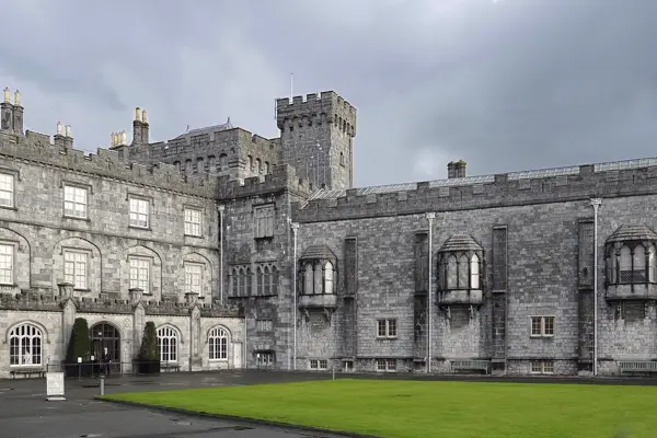
- Kilkenny
- Cashel
- Cork
- Kinsale
- Killarney
- Cahersiveen
- Waterville
- Kenmare
- Cliffs of Moher
- Galway
- Kylemore Abbey
- Clifden
Base map: Natural Earth
Days 1–2: Dublin
Two days in the capital are a good start before heading into the countryside. Trinity College keeps the Book of Kells in its Old Library, the Ha'penny Bridge leads to the pub quarter of Temple Bar, and on the edge of the centre the Guinness Storehouse tells the story of the stout. Pick up the hire car on day three – you won't need it in Dublin, and parking is expensive.
Days 3–4: Wicklow, Kilkenny and Cashel
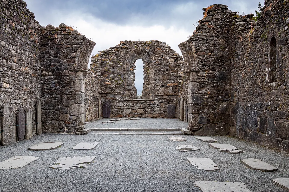
South of Dublin the Wicklow Mountains begin. In the valley of Glendalough the remains of an early medieval monastic settlement with a round tower lie between two lakes; trails lead along the upper lake. In the evening you reach Kilkenny with its castle on the River Nore and the "Medieval Mile" through the old town.
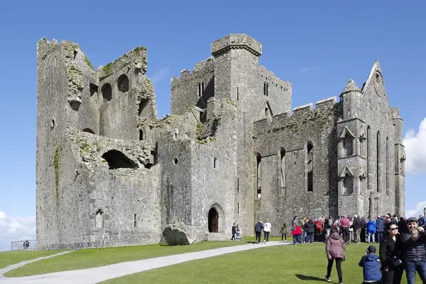
On day four, halfway to Cork, stands the Rock of Cashel: cathedral, round tower and chapel on a limestone outcrop above the plain, once the seat of the kings of Munster. In Cork, take a stroll through the covered English Market.
Days 5–6: Kinsale and the Ring of Kerry
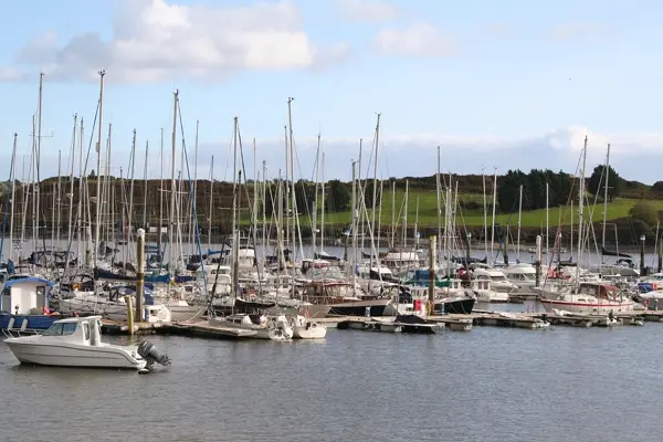
Kinsale is a small harbour town with colourful houses, good restaurants and the star-shaped Charles Fort; it is the southern end of the Wild Atlantic Way, the signposted coastal route along the west coast. In the afternoon drive on to Killarney on the edge of the national park of the same name, with Muckross House and the Lakes of Killarney.
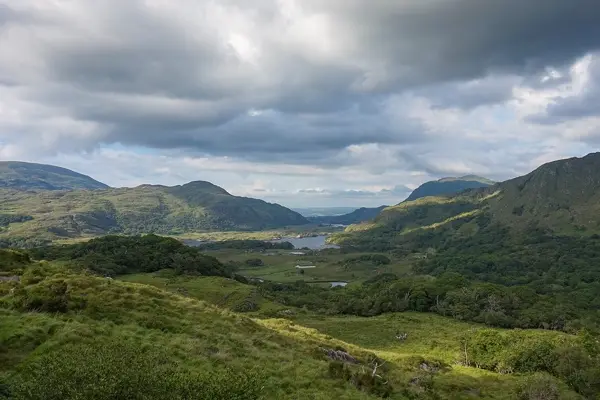
Day six belongs to the Ring of Kerry, the loop road around the Iveragh peninsula. Tour coaches drive it anticlockwise – so do we, so set off early to avoid getting stuck behind them. On the way are Cahersiveen, the resort of Waterville and Kenmare, and on the way back to Killarney the Ladies View lookout. In summer, boats from Portmagee go to the rock island of Skellig Michael, a UNESCO World Heritage Site; places are limited and go early.
Days 7–8: Cliffs of Moher, the Burren and Galway
Via Limerick you head north into County Clare. The Cliffs of Moher rise up to 214 m straight out of the Atlantic; paths run along the edge in both directions from the visitor centre. Spend the night in Doolin, where traditional Irish music plays in the pubs almost every evening.
On day eight you drive through the Burren, a bare limestone landscape with the Poulnabrone portal tomb, to Galway. The university town has the liveliest centre on the west coast: buskers on Quay Street, small pubs and the Spanish Arch by the river.
Days 9–10: Connemara and back to Dublin
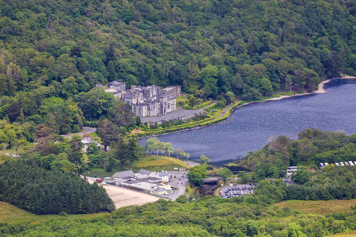
West of Galway lies Connemara – bogs, lakes and the Twelve Bens mountains. Kylemore Abbey sits on a lakeshore in front of a wooded slope, and right next to it is Connemara National Park with the trail up Diamond Hill. Spend the night in the small town of Clifden, from where the Sky Road makes a short scenic loop along the coast.
The last day is the longest at three and a half hours of pure driving; from Galway it is motorway almost all the way to Dublin. If you fly out in the evening, drop the car at the airport.
Best time to visit Ireland
May to September. It is warmest then, the days are long, and all visitor centres and boat trips are open. May and June are often a little drier than high summer. Rain is part of every season in Ireland, but it rarely gets really cold even in winter – the west coast is shaped by the Gulf Stream.
| Month | Day (avg high) | Night (avg low) | Rain |
|---|---|---|---|
| January | 8.7 °C | 3.9 °C | 130 mm |
| February | 9.3 °C | 4.3 °C | 131 mm |
| March | 10.3 °C | 4.1 °C | 127 mm |
| April | 12.7 °C | 5.5 °C | 82 mm |
| May | 15.4 °C | 8.2 °C | 82 mm |
| June | 17.5 °C | 10.7 °C | 82 mm |
| July | 18.6 °C | 12.4 °C | 97 mm |
| August | 18.3 °C | 12.3 °C | 126 mm |
| September | 16.7 °C | 10.9 °C | 116 mm |
| October | 14.0 °C | 8.8 °C | 123 mm |
| November | 10.8 °C | 6.3 °C | 128 mm |
| December | 9.7 °C | 5.3 °C | 166 mm |
Climate in Killarney (Kerry): 2015–2024 averages from the ERA5 reanalysis (Open-Meteo), rounded. The east around Dublin is much drier than the west.
Good to know before you go
- Driving on the left: Ireland drives on the left; at roundabouts give way to traffic from the right. Unlike in the UK, distances and speed limits are in kilometres.
- Roads: Many country roads are narrow and lined with stone walls or hedges. A small car is an advantage.
- Tolls: The M50 ring motorway around Dublin has a barrier-free toll recorded by camera. Ask the rental company how it is billed.
- Entry: Ireland is in the EU but not in the Schengen Area, so it has its own entry rules and passport control. UK and Irish citizens travel freely within the Common Travel Area.
- Mobile data: EU and EEA plans roam in Ireland like at home. With a plan from elsewhere, a travel eSIM is often cheaper than roaming.
- Flight: A direct flight from London to Dublin takes approx. 1 to 1.5 hours.
How YesTrip helps with this trip
Create a trip in YesTrip with the stops of this route: the app shows every place on the map, uses AI to plan your days in Dublin, Kilkenny and Galway and shows the weather for your travel days – so you can put the Ring of Kerry on the driest day. The packing list suggests clothing to match the forecast and reminds you of the adapter for the Type G sockets used in Ireland. The offline map helps in Connemara, and if you travel with friends you can share the trip and the expenses in the app. For the first days there is our ready-made plan for Dublin.
Free
Plan your trip in 30 seconds.
Tell YesTrip where and when – the app plans day by day with real places on the map, shows the weather, splits costs with your travel companions and guides you to the next stop on the go.
Frequently asked questions
How many days do you need for an Ireland road trip?
Ten days are ideal for the loop Dublin – Kilkenny – Cork – Kerry – Cliffs of Moher – Galway – Connemara. Seven days work too, without Kinsale and Connemara. If you also want to see the Dingle peninsula or Northern Ireland, plan 14 days.
When is the best time for a road trip in Ireland?
May to September. Average daily highs in Killarney are then between 15 and 19 °C, and May and June are among the drier months with about 80 mm of rain each. In winter some sights have shorter opening hours.
Is driving in Ireland difficult?
For most people not after a day or two. What takes getting used to is driving on the left, changing gear with your left hand if you are used to driving on the right, and the narrow country roads. An automatic and a small car make it easier.
Which direction should you drive the Ring of Kerry?
Tour coaches drive the Ring of Kerry anticlockwise, heading west from Killarney towards Cahersiveen first. If you go the same way, you won't meet them on the narrow stretches – set off early to avoid driving behind them.
Do I need an eSIM for Ireland?
Not with an EU or EEA plan – roaming works like at home. With a plan from the UK or outside Europe, check your roaming rates; a travel eSIM is often cheaper.
Sources
- Driving times: OSRM route calculation based on OpenStreetMap data – project-osrm.org
- Climate: Open-Meteo Historical Weather API (ERA5), averages 2015–2024 – open-meteo.com
- Skellig Michael: UNESCO World Heritage – whc.unesco.org
- M50 toll: eFlow – www.eflow.ie
- Travel information for Ireland: Tourism Ireland – www.ireland.com
Researched with AI support and checked by our editors. Prices, opening hours and weather can change – please check before you go. YesTrip is not a travel agency. Published: .
More articles
 Road trips & itineraries
Iceland road trip itinerary: Ring Road in 12 days
The classic Iceland road trip follows the Ring Road for 12 days from Reykjavík: Golden Circle, the south coast with Skógafoss and Vík, the … · 8 min read Road trips & itineraries
Japan itinerary: 2 weeks by train
The classic two-week Japan itinerary runs by train from Tokyo via Hakone near Mount Fuji to Kyoto, Nara, Osaka and Hiroshima with the island … · 7 min read Road trips & itineraries
Morocco itinerary: a 12-day road trip
The classic 12-day Morocco itinerary runs from Marrakech over the High Atlas to Aït Benhaddou, through the Dades and Todra gorges to the … · 8 min read


.jpg)