
Best time to visit Sardinia, month by month
In short
For a beach holiday in Sardinia, June to September is best, with daytime highs of 27 to 32 °C; in July Cagliari averages just 1 mm of rain. For hiking and towns, April, May and October are ideal at 19 to 23 °C. The south around Cagliari is the driest part of the island, while nights inland near Nuoro are much cooler.
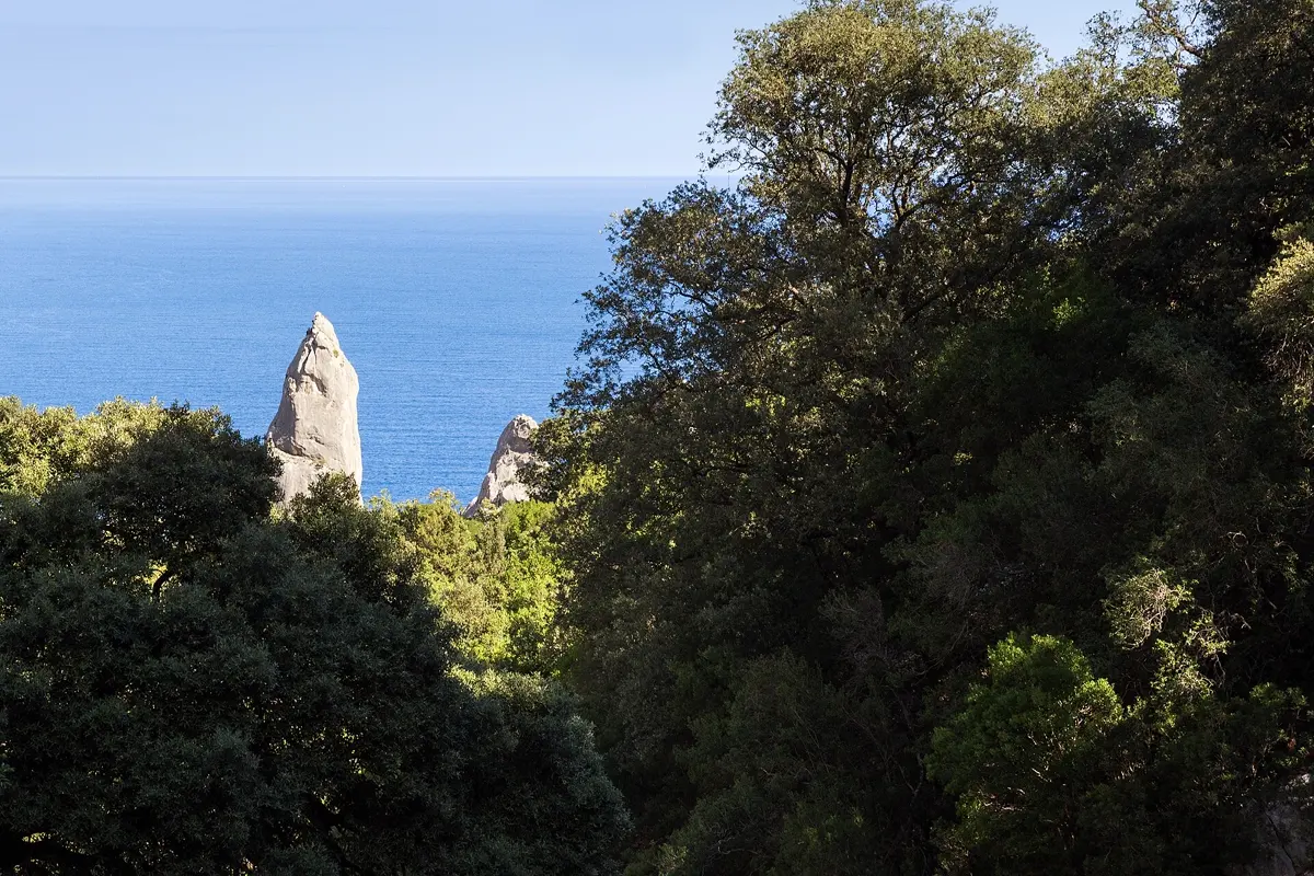
Sardinia is the second-largest island in the Mediterranean after Sicily – big enough that the weather is not the same everywhere. The south around Cagliari is dry and sunny, the north-west around Alghero gets more rain, and the mountainous interior around Nuoro is genuinely cool in winter but just as hot as the coast in summer. We analysed the weather of 2015 to 2024 for four places and tell you which month suits which kind of trip.
The short answer
- Beach holiday: June to September. 27 to 32 °C by day, warm nights of 19 to 22 °C, and almost no rain in July and August. July and August are the hottest months and the busiest at the famous beaches.
- Hiking, road trip, towns: April, May and October. 19 to 23 °C by day on the coast, green countryside in spring and far fewer people. In October you can often still swim.
- Quiet winter: November to March. 14 to 19 °C by day in Cagliari, but more rain and short days. Good for Cagliari and Alghero as towns, not for a beach holiday; many hotels in the resorts are closed.
Sardinia's climate: all 12 months in Cagliari
| Month | Day (avg. high) | Night (avg. low) | Rain per month |
|---|---|---|---|
| January | 14.1 °C | 7.9 °C | 42 mm |
| February | 14.9 °C | 8.2 °C | 40 mm |
| March | 16.3 °C | 9.3 °C | 48 mm |
| April | 19.2 °C | 11.2 °C | 36 mm |
| May | 22.9 °C | 14.6 °C | 53 mm |
| June | 28.1 °C | 19.4 °C | 11 mm |
| July | 31.7 °C | 22.4 °C | 1 mm |
| August | 31.2 °C | 22.4 °C | 13 mm |
| September | 27.8 °C | 19.8 °C | 31 mm |
| October | 23.5 °C | 16.4 °C | 49 mm |
| November | 18.7 °C | 12.6 °C | 74 mm |
| December | 15.6 °C | 9.4 °C | 44 mm |
Temperature and rain: average of 2015–2024 from the ERA5 reanalysis (via Open-Meteo) for Cagliari, rounded. A grid cell is about 25 km wide, so the figures describe the area rather than a single beach.
Summer in the south is extremely dry: from June to August Cagliari gets only about 25 mm of rain in total, and July averages 1 mm. The wettest month is November at 74 mm. Over the year Cagliari sees around 440 mm – the driest of the four places.
North, south, inland: how different the island is
| Place | January: day / night | May: day / night | July: day / night | October: day / night | Rain per year |
|---|---|---|---|---|---|
| Cagliari (south) | 14.1 / 7.9 °C | 22.9 / 14.6 °C | 31.7 / 22.4 °C | 23.5 / 16.4 °C | approx. 440 mm |
| Alghero (north-west) | 13.7 / 8.7 °C | 21.9 / 14.7 °C | 30.3 / 22.0 °C | 22.7 / 16.5 °C | approx. 620 mm |
| Olbia (north-east) | 13.6 / 7.2 °C | 22.6 / 14.0 °C | 32.4 / 21.9 °C | 23.0 / 15.0 °C | approx. 580 mm |
| Nuoro (inland) | 10.8 / 4.0 °C | 21.7 / 11.6 °C | 32.5 / 20.0 °C | 21.4 / 12.6 °C | approx. 610 mm |
Same source and period; yearly rain added up from the monthly figures and rounded.
Three things stand out. First, Alghero on the west coast is a little milder in summer (30.3 °C in July) but gets the most rain in autumn and winter – November averages 103 mm there. Second, Olbia in the north-east is the hottest of the coastal places in midsummer, at 32.4 °C in July. Third, the interior around Nuoro has a climate of its own: in July it is just as hot by day as the coast at 32.5 °C, but cooler at night, and in January nights drop to 4.0 °C. If you head into the mountains of the Barbagia in winter or early spring, pack warm clothes.
Sardinia month by month
January and February
The coolest months: 14 to 15 °C by day in Cagliari, around 8 °C at night, and much colder inland. Rain comes and goes, with clear, sunny days in between. Cagliari and Alghero are quiet towns with restaurants and museums open, while the resorts of the Costa Smeralda are largely closed. In February many places celebrate carnival, inland with traditional masks.
March and April
Spring arrives: 16 to 19 °C by day, the island turns green and the roadsides are in flower. A good time for hikes in the Supramonte and along the east coast while the heat is still far off. April is one of the drier spring months in Cagliari at 36 mm. The sea is still cold for swimming.
May
22 to 23 °C by day on the coast, 21.7 °C inland. Hiking, a road trip and the first warm beach days now combine well. Expect the odd shower – May brings 53 mm in Cagliari and 79 mm in Nuoro.
June
Summer begins at 27 to 28.5 °C by day. Cagliari gets only 11 mm of rain. The beaches are warm but not yet as crowded as in July and August – for many the best month for swimming.
July and August
The hottest months: 30 to 32.5 °C by day and around 22 °C at night on the coast. Rain is very unlikely. Famous beaches such as La Pelosa in the north-west and the coves of the Gulf of Orosei are busy, and in August many Italian holidaymakers come to the island. Hiking only makes sense early in the morning. Boat trips and tickets for sights* are best planned ahead at this time.
September
Still full summer at 26.5 to 28 °C by day, and the sea is warm after the long summer. Once the Italian school holidays end it gets noticeably quieter. The odd thunderstorm is possible, more often in the north than in the south.
October
22 to 23.5 °C by day, mild evenings, and swimming is still possible on warm days. Hiking season starts again. It does rain more, though: around 70 mm on average in Alghero and Olbia, 49 mm in Cagliari.
November and December
November is the wettest month everywhere, with 103 mm in Alghero. Daytime highs on the coast are still 18 to 19 °C, falling to 15 to 16 °C in December. The island belongs to the Sardinians then; for a city break in Cagliari it is still a calm, pleasant time.
Where to go when
Cagliari, the capital in the south, works all year round. The old quarter of Castello sits on a hill above the port, with the cathedral, bastions and views across the city to the lagoons. The long city beach of Poetto is only a few kilometres from the centre.
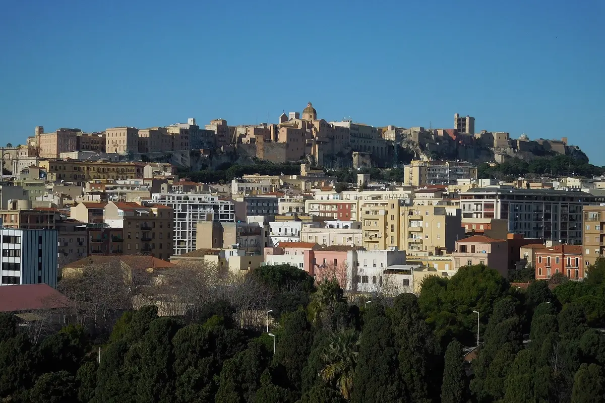
 Cagliari trip planDay by day, with map and tips
Alghero in the north-west has an old town with walls and towers right on the sea and a Catalan past that still shows in street names and the local dialect. West of town the cliffs of Capo Caccia drop steeply into the sea, with Neptune's Grotto below. In spring and autumn Alghero is a very good base, because town, coast and excursions are close together.
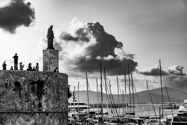
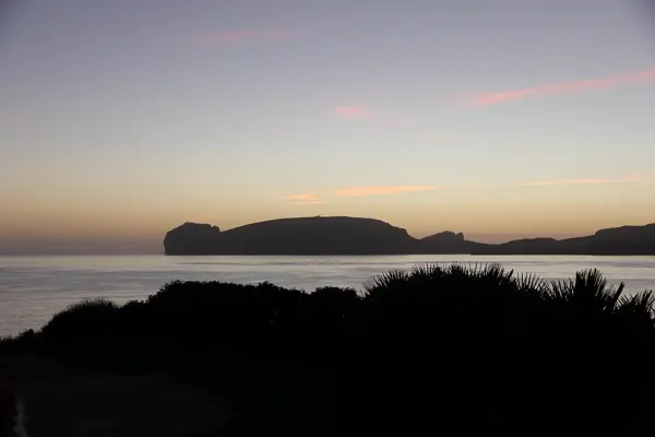
 Alghero trip planDay by day, with map and tips
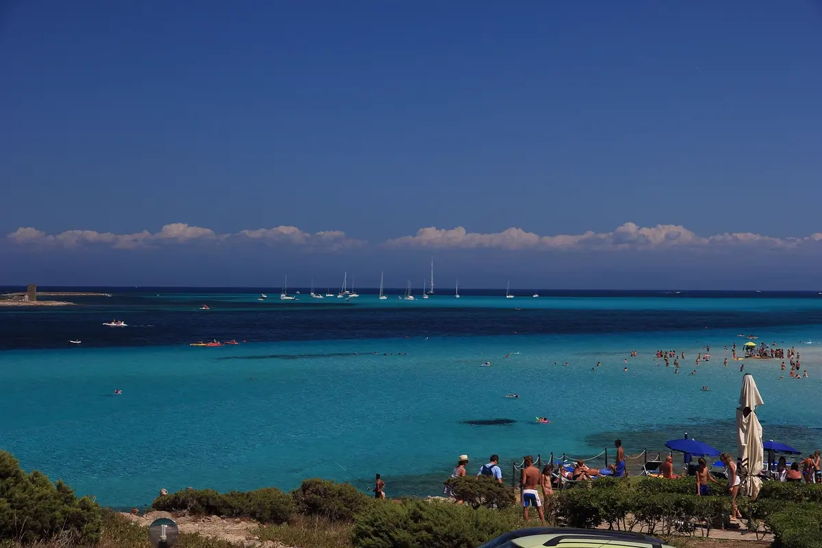
The best-known beaches are in the north and east: La Pelosa near Stintino with shallow, pale water, the Costa Smeralda near Olbia, and the coves of the Gulf of Orosei such as Cala Goloritzé, which you reach on foot or by boat. They are at their best in June and September.
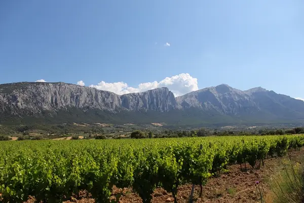
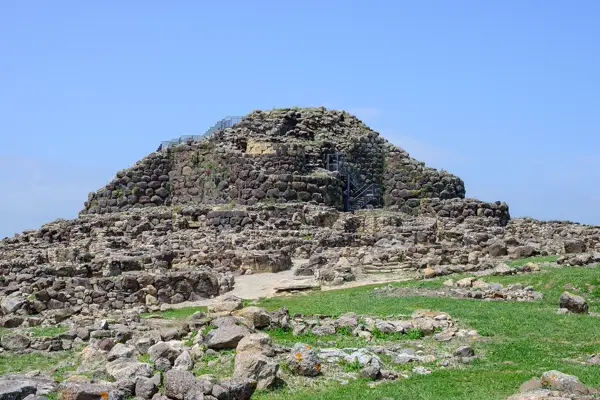
Inland lie the Supramonte mountains near Oliena and Orgosolo and the Barbagia region around Nuoro – places for hikers, best in April, May and October. All over the island stand nuraghi, stone towers from the Bronze Age. The complex of Su Nuraxi near Barumini is a UNESCO World Heritage Site.
Road trip: driving times between the towns
Sardinia is bigger than it looks on the map. Pure driving times between the four places in this article:
| Leg | Distance | Pure driving time |
|---|---|---|
| Cagliari – Alghero | 203 km | 3:16 h |
| Alghero – Olbia | 137 km | 1:58 h |
| Olbia – Nuoro | 100 km | 1:38 h |
| Nuoro – Cagliari | 181 km | 2:36 h |
Driving times without breaks, calculated from OpenStreetMap data; allow about a third more, and more in August because of coastal traffic. For a loop around the whole island, ten days to two weeks is comfortable. With only a week, focus on the south around Cagliari or the north between Alghero and Olbia.
How YesTrip helps with this trip
In YesTrip you will find ready-made plans for Cagliari and Alghero, which you can take over and adapt to your dates. For a road trip you enter the places and get a day-by-day plan with a map that shows which stops are close together. The forecast for your travel days helps you decide between a hike and the beach, and the packing list adapts: sun protection in summer, hiking boots and a rain jacket in spring and autumn. If you travel as a group, you share the trip and log shared expenses; the map also works offline – handy in the mountains, where reception can be patchy.
Before you go
- Entry: Sardinia is part of Italy and the Schengen area. Check the current entry rules on gov.uk before you travel.
- Getting there: From London a direct flight takes approx. 2.5 hours; there are airports in Cagliari, Alghero and Olbia. Ferries also run from mainland Italy, for example to Olbia.
- Power: 230 volts, sockets type C, F and L. From the UK you need an adapter.
- Mobile data: Whether EU roaming is included depends on your provider. Alternatively, an eSIM for Italy* covers the whole trip.
- Hire car: For beaches, the interior and a road trip a car is almost essential; buses between towns run less often. You can compare rental car offers in Cagliari* at Economybookings, for example.
* Ad – Partner link: if you book there, we earn a commission. Your price stays the same.
Free
Plan your trip in 30 seconds.
Tell YesTrip where and when – the app plans day by day with real places on the map, shows the weather, splits costs with your travel companions and guides you to the next stop on the go.
Frequently asked questions
When is the best time to visit Sardinia?
For a beach holiday, June to September with 27 to 32 °C by day and hardly any rain. For hiking and a road trip, April, May and October with 19 to 23 °C on the coast are best. June and September combine warm weather with less crowded beaches.
How hot does Sardinia get in summer?
In July the average daytime high is 31.7 °C in Cagliari, 32.4 °C in Olbia and 32.5 °C inland near Nuoro. Nights on the coast are around 22 °C. Cagliari averages only 1 mm of rain in July.
When does it rain most in Sardinia?
In autumn and winter, most of all in November: Alghero then averages 103 mm, Olbia 83 mm and Cagliari 74 mm. The south around Cagliari is the driest part of the island at about 440 mm a year.
Is the north or the south of Sardinia better?
The south around Cagliari is drier and has the city as a year-round destination. The north, with Alghero, La Pelosa and the Costa Smeralda, has some of the most famous beaches but gets more rain in autumn and winter. For a summer beach holiday both are equally good.
Can you visit Sardinia in winter?
For towns and nature, yes; for a beach holiday, no. In January Cagliari averages 14.1 °C by day and 7.9 °C at night, while nights inland near Nuoro drop to 4.0 °C. Many hotels in the resorts are closed.
Sources
- Open-Meteo Historical Weather API (ERA5), average 2015–2024 – open-meteo.com
- Copernicus ERA5 reanalysis (Hersbach et al. 2020) – cds.climate.copernicus.eu
- Driving times: OSRM routing on OpenStreetMap data – project-osrm.org
- Su Nuraxi di Barumini: UNESCO World Heritage List – whc.unesco.org
- Italy entry requirements: UK Foreign Travel Advice – www.gov.uk
Researched with AI support and checked by our editors. Prices, opening hours and weather can change – please check before you go. YesTrip is not a travel agency. Published: .
More best-time guides
 When to go
Best time to visit Scotland: month by month
The best time to visit Scotland is May to September: Edinburgh then reaches 14 to 18 °C by day and the days are long. May and June are often … · 7 min read When to go
Best time to visit Switzerland: month by month
The best time to visit Switzerland for hiking, lakes and mountain views is mid-June to mid-September: Zurich reaches 23 to 25 °C by day and … · 7 min read When to go
Best time to visit the Seychelles: month by month
The Seychelles are warm all year at around 25 to 28 °C by day, so the best time depends on rain and wind. June to August is driest (63 to 98 … · 7 min read
All destinations: best time to visit and warm places by month


