
Italy · 3 days · 16 stops
3 days in Alghero, Sardinia – a ready-made itinerary
Alghero sits on Sardinia's north-west coast and was Catalan for a long time; its street signs are still bilingual. One day covers the old town and the ramparts, one Capo Caccia and Neptune's Grotto, one the beaches and the Nuraghe Palmavera. The stops are in walking order.
In short
- Length
- 3 days, 16 stops
- Highlights
- Torre di Porta Terra, Capo Caccia, Porto Conte bay, Church of San Francesco, Alghero Cathedral
- Where to stay
- Old town, Lido and Viale Garibaldi
- Getting around
- Explore the old town and the harbour on foot.
- Best time to go
- May, June and September are ideal: the sea is warm, the beaches are not packed and boats run to Neptune's Grotto.
Free, sign in with an email code. In the app you only pick your start date and adjust the plan.
Plan created with AI support – please check opening hours, prices and routes before you go. YesTrip editorial team · Updated: .
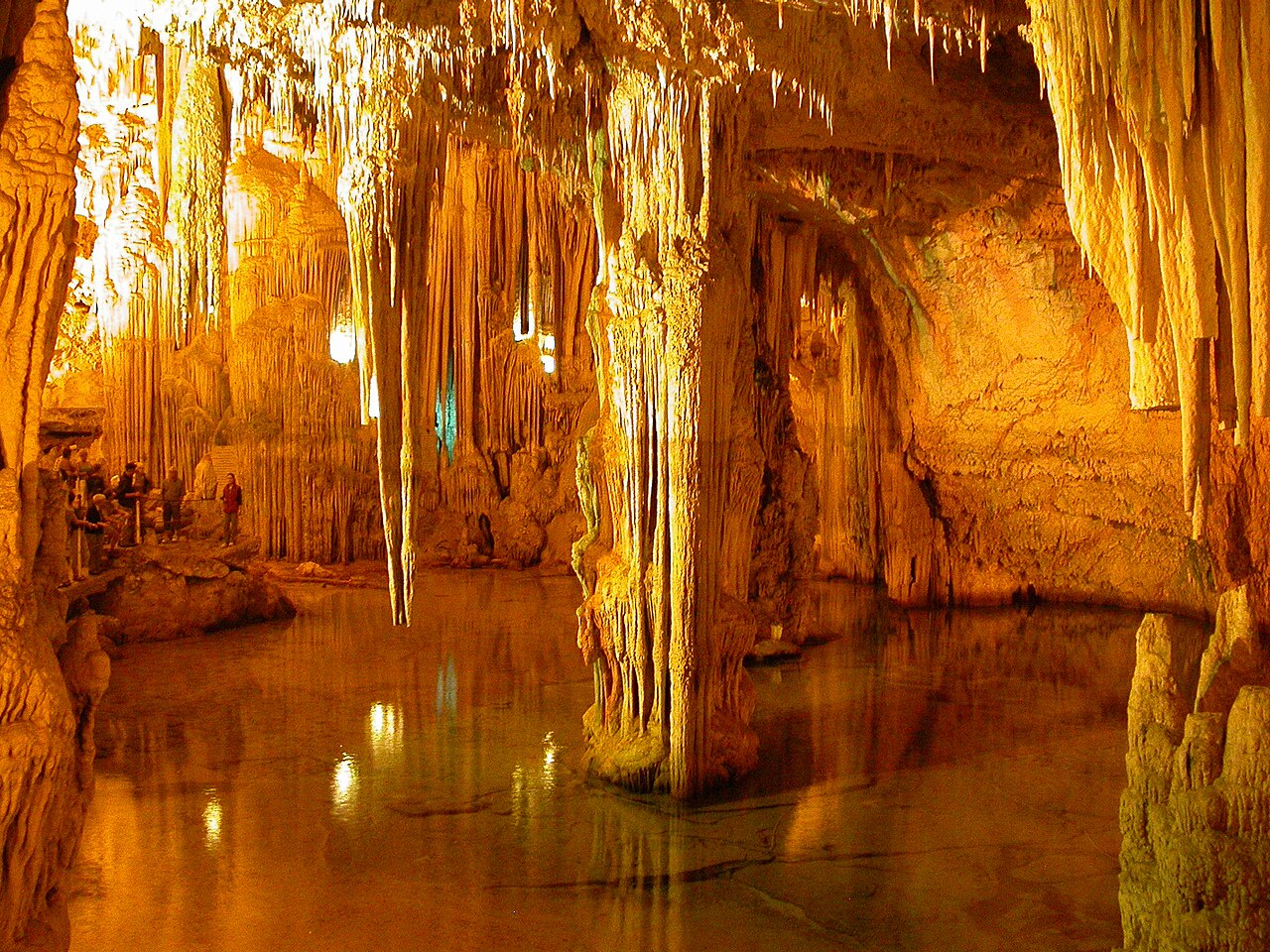
Top things to do in Alghero
13 places you should not miss in Alghero – each one is in the plan below with a time and the way there.
- Torre di Porta TerraThe old gate tower on the land side, once the main way into the fortified town. From here you walk straight into the old town lanes.Day 1
- Church of San FrancescoA church with a quiet cloister of pale sandstone, a fine example of Catalan Gothic.Day 1
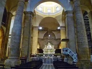 Alghero CathedralThe cathedral of Santa Maria with its Gothic bell tower rising above the old town roofs.Day 1
- Church of San MicheleIts dome of colourful majolica tiles is the old town's landmark, easy to spot from the walls.Day 1
- Bastioni Marco PoloThe promenade along the sea walls. At sunset you look across the bay as far as Capo Caccia.Day 1
- Capo CacciaThe limestone headland west of Alghero, with sheer cliffs above the sea and a lighthouse at the tip. From the viewpoint by the road you can see as far as the town.Day 2
- Escala del CabirolThe 654 steps lead down the cliff face to the grotto entrance. Wear sturdy shoes – the climb back up is hard work.Day 2
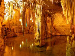 Neptune's GrottoA stalactite cave at sea level with an underground salt lake. Visits are by guided tour only.Day 2
- Maria Pia beachA long sandy beach north of town, backed by dunes and a pine wood. Swim in the afternoon and rest in the shade.Day 2
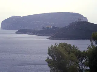 Porto Conte bayA sheltered bay below Capo Caccia with calm, clear water. Swim in the morning before it fills up.Day 3
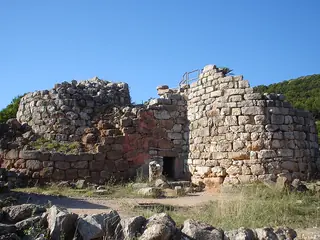 Nuraghe PalmaveraA Bronze Age tower with the foundations of a village and a round meeting hut. A good introduction to Sardinia's Nuragic civilisation.Day 3
- Roman bridge of FertiliaThe remains of a Roman bridge across the Calich lagoon, at the edge of town. From here the coast leads back towards Alghero.Day 3
- Lido di San GiovanniAlghero's town beach, just a few minutes from the old town. One last swim, then back to the lanes for the evening.Day 3
Day 1
The old town and the ramparts

Torre di Porta Terra
The old gate tower on the land side, once the main way into the fortified town. From here you walk straight into the old town lanes.
On the map (OpenStreetMap): Torre di Porta Terraright next door
Church of San Francesco
A church with a quiet cloister of pale sandstone, a fine example of Catalan Gothic.
On the map (OpenStreetMap): Church of San Francescoright next door
Alghero Cathedral
The cathedral of Santa Maria with its Gothic bell tower rising above the old town roofs.
On the map (OpenStreetMap): Alghero Cathedralabout 5 min on foot
Church of San Michele
Its dome of colourful majolica tiles is the old town's landmark, easy to spot from the walls.
On the map (OpenStreetMap): Church of San Micheleright next door
Mercato Civico (market hall)
The market hall just outside the old town, with local fish, cheese and vegetables. Then try fregola or Catalan-style lobster in the lanes.
On the map (OpenStreetMap): Mercato Civico (market hall)about 5 min on foot
Bastioni Marco Polo
The promenade along the sea walls. At sunset you look across the bay as far as Capo Caccia.
On the map (OpenStreetMap): Bastioni Marco Polo
Day 2
Capo Caccia and Neptune's Grotto
Two options: a bus runs from Alghero to Capo Caccia, with only a few departures a day. In season, excursion boats also go from the harbour straight to the grotto. Both are seasonal – check the timetable beforehand. In rough seas the grotto is closed.

Capo Caccia
The limestone headland west of Alghero, with sheer cliffs above the sea and a lighthouse at the tip. From the viewpoint by the road you can see as far as the town.
On the map (OpenStreetMap): Capo Cacciaabout 10 min on foot
Escala del Cabirol
The 654 steps lead down the cliff face to the grotto entrance. Wear sturdy shoes – the climb back up is hard work.
On the map (OpenStreetMap): Escala del Cabirolabout 15 min on foot
Neptune's Grotto
A stalactite cave at sea level with an underground salt lake. Visits are by guided tour only.
On the map (OpenStreetMap): Neptune's Grottoabout 12.9 km as the crow flies – by bus, train or taxi
Alghero harbour
Back in town, around the harbour below the walls there are many places serving fish and seafood.
On the map (OpenStreetMap): Alghero harbourabout 2.9 km as the crow flies – by bus, train or taxi
Maria Pia beach
A long sandy beach north of town, backed by dunes and a pine wood. Swim in the afternoon and rest in the shade.
On the map (OpenStreetMap): Maria Pia beach
Day 3
Porto Conte, Palmavera and Fertilia
Easiest by rental car or bike. Buses run towards Fertilia and Porto Conte, but not often and depending on the season – check the timetable.

Porto Conte bay
A sheltered bay below Capo Caccia with calm, clear water. Swim in the morning before it fills up.
On the map (OpenStreetMap): Porto Conte bayabout 4.5 km as the crow flies – by bus, train or taxi
Nuraghe Palmavera
A Bronze Age tower with the foundations of a village and a round meeting hut. A good introduction to Sardinia's Nuragic civilisation.
On the map (OpenStreetMap): Nuraghe Palmaveraabout 4.1 km as the crow flies – by bus, train or taxi
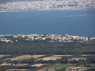
Fertilia
The small town on the lagoon was founded in the 1930s. Around the piazza and the seafront there are bars and places to eat.
On the map (OpenStreetMap): Fertiliaabout 10 min on foot
Roman bridge of Fertilia
The remains of a Roman bridge across the Calich lagoon, at the edge of town. From here the coast leads back towards Alghero.
On the map (OpenStreetMap): Roman bridge of Fertiliaabout 3.8 km as the crow flies – by bus, train or taxi
Lido di San Giovanni
Alghero's town beach, just a few minutes from the old town. One last swim, then back to the lanes for the evening.
On the map (OpenStreetMap): Lido di San Giovanni
Good to know
Best time to go
May, June and September are ideal: the sea is warm, the beaches are not packed and boats run to Neptune's Grotto. July and August are hot and crowded. In winter Alghero is quiet, and boats and buses run less often.
Getting around
Explore the old town and the harbour on foot. Buses run to Capo Caccia, Fertilia and Porto Conte, but not often; a rental car, scooter or bike gives you more freedom. In season, boats go from the harbour to Neptune's Grotto. From Alghero-Fertilia airport a bus runs into town.
Where to stay
Old town
Right in the lanes inside the walls, close to the harbour, restaurants and ramparts. Lively in the evening.
Lido and Viale Garibaldi
By the town beach north of the old town, quieter and close to the water. The old town is a few minutes' walk along the sea.
Ad Where to stay in Alghero? Compare prices: Old town · Lido and Viale Garibaldi
Your plan
Start with this plan.
Copy it into YesTrip, pick your dates and make it yours: move stops, drop them or let the AI add more. On the road the app shows you the next stop and how to get there.
Alghero: frequently asked questions
What are the must-see sights in Alghero?
The must-see sights in Alghero are Torre di Porta Terra, Church of San Francesco, Alghero Cathedral, Church of San Michele, Bastioni Marco Polo and Capo Caccia. This plan links 13 of them into short walks over 3 days – with times, a map and tips.
Are 3 days enough for Alghero?
Yes, for the old town, Capo Caccia and the nearby beaches. With more time, Stintino to the north or the coast road to Bosa are worth it.
Boat or stairs to Neptune's Grotto?
The boat from the harbour is more comfortable and shows the cliffs from the sea, but it only runs in season and in calm water. Via the Escala del Cabirol you get there by bus or car – either way, check the timetable.
Do I need a car in Alghero?
Not for the old town. For Capo Caccia, Porto Conte and other beaches a rental car is handy, because buses are infrequent.
Why is Catalan spoken in Alghero?
The town was settled by Catalans in the 14th century. Some residents still speak a Catalan dialect, and the street signs are bilingual.
Plan created with AI support – please check opening hours, prices and routes before you go. Coordinates checked with Wikipedia and OpenStreetMap (Photon). Photo: Tobias Helfrich, CC BY-SA 2.5, via Wikimedia Commons. More in Sources & licences. YesTrip is a trip planner, not a travel agency – nothing is booked.
More trip plans
 Italy · 3 days
Cagliari
Photo: Laurettapossamai, CC BY-SA 4.0, via Wikimedia Commons
 Italy · 3 days
Rome
Photo: FeaturedPics, CC BY-SA 4.0, via Wikimedia Commons
 Italy · 3 days
Florence
Photo: Giorgio Galeotti, CC BY 4.0, via Wikimedia Commons


