
Canada · 3 days · 15 stops
3 days in Toronto – a ready-made itinerary
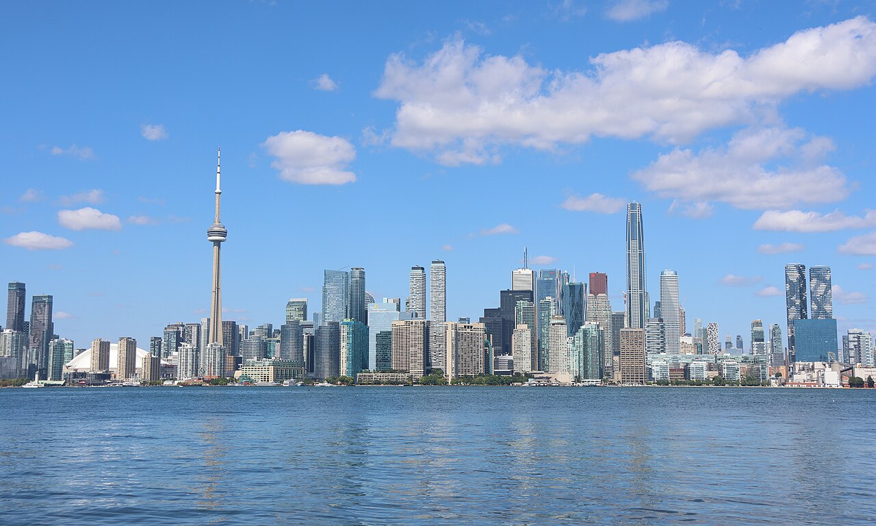
Toronto is Canada's largest city, with towers on the shore of Lake Ontario and neighbourhoods that each have a character of their own. Two days belong to the city: the harbour with the CN Tower and the islands, then the museums and Kensington Market. On the third day you head out to Niagara Falls, about two hours away.
In short

- Length
- 3 days, 15 stops
- Highlights
- CN Tower, Royal Ontario Museum, Horseshoe Falls, Distillery District, Toronto Islands
- Day trips
- CN Tower, the old town and the islands; Museums, Kensington and City Hall; Day trip to Niagara Falls
- Where to stay
- Downtown and the Entertainment District, Queen West
- Getting around
- Downtown is easy to explore on foot; for longer trips take the TTC subway and streetcars.
- Best time to go
- Late May to September is the most pleasant time, and the island ferries run most often then.
Free, sign in with an email code. In the app you only pick your start date and adjust the plan.
Plan created with AI support – please check opening hours, prices and routes before you go. YesTrip editorial team · Updated: .
Top things to do in Toronto
9 places you should not miss in Toronto – each one is in the plan below with a time and the way there.
- CN TowerThe broadcast tower is the city's landmark. At the top you stand on a glass floor, and on a clear day you see far across the lake.Day 1
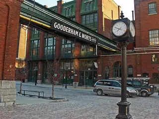
- Distillery DistrictBrick buildings of an old whisky distillery, now car-free with galleries, shops and cafés.Day 1
 Toronto IslandsCar-free islands with beaches and parks. In the early evening they give you the best view of the skyline.Day 1
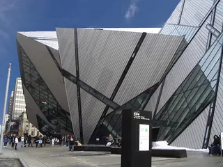
- Royal Ontario MuseumA large museum of natural history and world cultures, with dinosaurs. The angular glass extension is by Daniel Libeskind.Day 2
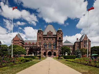 Ontario Legislative BuildingThe provincial parliament in pink sandstone, in the middle of Queen's Park. A short stop on the way south.Day 2
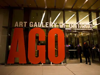 Art Gallery of OntarioCanadian painting, including the Group of Seven, and a Frank Gehry redesign with a long wooden gallery.Day 2
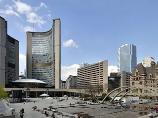 Nathan Phillips SquareThe square in front of City Hall with its two curved towers. In winter the pool becomes a skating rink.Day 2
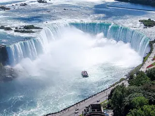
- Horseshoe FallsThe main horseshoe-shaped fall on the Canadian side. At the railing on the brink you feel the spray.Day 3
 View of the American FallsFrom the riverside promenade on the Canadian side you see the American Falls face on. Then back to Toronto.Day 3
Day 1
CN Tower, the old town and the islands

CN Tower
The broadcast tower is the city's landmark. At the top you stand on a glass floor, and on a clear day you see far across the lake.
On the map (OpenStreetMap): CN Towerabout 20 min on foot
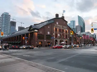
St. Lawrence Market
A market hall with stalls for cheese, fish and baked goods. It is known for the peameal bacon sandwich.
On the map (OpenStreetMap): St. Lawrence Marketabout 15 min on foot
Distillery District
Brick buildings of an old whisky distillery, now car-free with galleries, shops and cafés.
On the map (OpenStreetMap): Distillery Districtabout 25 min on foot
Jack Layton Ferry Terminal
Ferries to the islands leave from here; the crossing is short. About 25 minutes on foot from the Distillery District.
On the map (OpenStreetMap): Jack Layton Ferry Terminalabout 2.2 km as the crow flies – by bus, train or taxi
Toronto Islands
Car-free islands with beaches and parks. In the early evening they give you the best view of the skyline.
On the map (OpenStreetMap): Toronto Islands
Day 2
Museums, Kensington and City Hall

Royal Ontario Museum
A large museum of natural history and world cultures, with dinosaurs. The angular glass extension is by Daniel Libeskind.
On the map (OpenStreetMap): Royal Ontario Museumabout 10 min on foot
Ontario Legislative Building
The provincial parliament in pink sandstone, in the middle of Queen's Park. A short stop on the way south.
On the map (OpenStreetMap): Ontario Legislative Buildingabout 20 min on foot
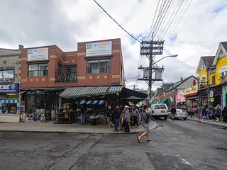
Kensington Market
Colourful streets with vintage shops and food from many countries, right next to Chinatown on Spadina Avenue.
On the map (OpenStreetMap): Kensington Marketabout 10 min on foot
Art Gallery of Ontario
Canadian painting, including the Group of Seven, and a Frank Gehry redesign with a long wooden gallery.
On the map (OpenStreetMap): Art Gallery of Ontarioabout 10 min on foot
Nathan Phillips Square
The square in front of City Hall with its two curved towers. In winter the pool becomes a skating rink.
On the map (OpenStreetMap): Nathan Phillips Square
Day 3
Day trip to Niagara Falls
Niagara Falls is about 130 km outside the city. GO trains or buses from Union Station take about 2 hours – check connections ahead.

Union Station
Toronto's main station. Leave early to have the whole day at the falls.
On the map (OpenStreetMap): Union Stationabout 67.7 km as the crow flies – by bus, train or taxi
Horseshoe Falls
The main horseshoe-shaped fall on the Canadian side. At the railing on the brink you feel the spray.
On the map (OpenStreetMap): Horseshoe Fallsabout 5 min on foot
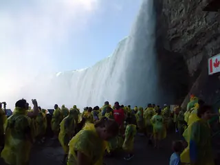
Journey Behind the Falls
Tunnels through the rock lead behind the falls and to a platform at their foot. Rain ponchos are handed out there.
On the map (OpenStreetMap): Journey Behind the Fallsabout 20 min on foot

Clifton Hill
A loud, colourful tourist street with lots of places to eat. Not pretty, but handy for lunch.
On the map (OpenStreetMap): Clifton Hillabout 10 min on foot
View of the American Falls
From the riverside promenade on the Canadian side you see the American Falls face on. Then back to Toronto.
On the map (OpenStreetMap): View of the American Falls
Good to know
Best time to go
Late May to September is the most pleasant time, and the island ferries run most often then. In October the trees turn, but it gets cooler. Winters are long, cold and often snowy.
Getting around
Downtown is easy to explore on foot; for longer trips take the TTC subway and streetcars. You can pay with a PRESTO card or contactless. From Pearson Airport the UP Express reaches Union Station in about 25 minutes.
Where to stay
Downtown and the Entertainment District
Central, between the CN Tower and Union Station, with lots of hotels. Handy for the early train to Niagara Falls.
Queen West
Lower buildings, shops, bars and restaurants along Queen Street. Close to Kensington Market and quick to the centre by streetcar.
Ad Where to stay in Toronto? Compare prices: Toronto
Ad Flights to Toronto: compare live prices →
More on Toronto in our blog: How many days in Toronto? Plans for 2–7 days
Your plan
Start with this plan.
Copy it into YesTrip, pick your dates and make it yours: move stops, drop them or let the AI add more. On the road the app shows you the next stop and how to get there.
Toronto: frequently asked questions
What are the must-see sights in Toronto?
The must-see sights in Toronto are CN Tower, Distillery District, Toronto Islands, Royal Ontario Museum, Ontario Legislative Building and Art Gallery of Ontario. This plan links 9 of them into short walks over 3 days – with times, a map and tips.
Are 3 days enough for Toronto?
For downtown, the islands and a day at Niagara Falls, yes. A fourth day leaves room for Casa Loma, Yorkville or a walk through High Park.
Can you do Niagara Falls without a car?
Yes – by GO train or bus from Union Station it is a manageable day trip. Check connections ahead, as they vary by day of the week and season.
What should I sort out before the trip?
Check entry requirements with your government's travel advice before you go – many visitors flying to Canada need an electronic travel authorisation (eTA).
Plan created with AI support – please check opening hours, prices and routes before you go. Coordinates checked with Wikipedia and OpenStreetMap (Photon). Photo: Dillan Payne, CC BY-SA 4.0, via Wikimedia Commons. More in Sources & licences. YesTrip is a trip planner, not a travel agency – nothing is booked.
More trip plans
 Canada · 3 days
Montreal
Photo: Quintin Soloviev, CC BY 4.0, via Wikimedia Commons
 Canada · 3 days
Vancouver
Photo: Nicolas Untz, CC BY-SA 2.0, via Wikimedia Commons
 USA · 3 days
New York
Photo: Daniele Pieroni, CC BY-SA 2.0, via Wikimedia Commons


