
Canada · 3 days · 17 stops
3 days in Vancouver – a ready-made itinerary
Few big cities have the sea, rainforest and mountains as close to downtown as Vancouver. The plan starts at the harbour and in the old quarters of Gastown and Chinatown, then follows the seawall through Stanley Park to the beaches and Granville Island, and on the last day crosses by ferry to the North Shore.
In short
- Length
- 3 days, 17 stops
- Highlights
- Canada Place, Stanley Park, SeaBus, Harbour Centre, Gastown
- Where to stay
- Downtown and Coal Harbour, West End, Kitsilano
- Getting around
- Downtown, Gastown and Stanley Park are easy on foot, and a rental bike is ideal around the park and along the water.
- Best time to go
- June to September is the driest and warmest time, ideal for the seawall, the beaches and the mountains.
Free, sign in with an email code. In the app you only pick your start date and adjust the plan.
Plan created with AI support – please check opening hours, prices and routes before you go. YesTrip editorial team · Updated: .
Top things to do in Vancouver
14 places you should not miss in Vancouver – each one is in the plan below with a time and the way there.
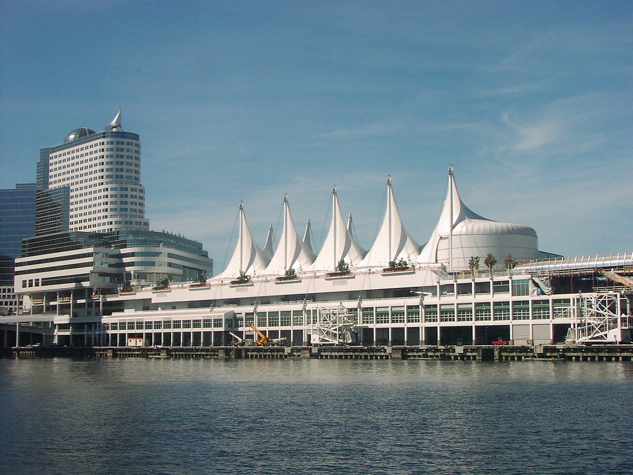
 Canada PlaceThe cruise terminal with white sail roofs, built for Expo 86. From the promenade you look across the harbour to the North Shore mountains.Day 1
- Harbour CentreA glass elevator on the outside wall takes you up to the round lookout level, with the whole city spread out between sea and mountains.Day 1
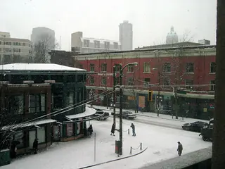 GastownThe city's oldest quarter, with cobblestones and brick buildings. The steam-powered clock stands at the corner of Water and Cambie Street.Day 1
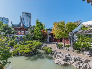 Dr. Sun Yat-Sen Classical Chinese GardenA Ming-style garden built by craftsmen from Suzhou, with a pond, pavilions and rocks packed into a small space.Day 1
- Vancouver Art GalleryHoused in the old courthouse downtown, with a large collection of paintings by Emily Carr.Day 1
- Stanley ParkThe park from 1888 on a peninsula next to downtown, larger than New York's Central Park and largely forest. The seawall runs all the way round.Day 2
- Brockton PointHome of the First Nations totem poles, with the harbour and a view back to the skyline behind them.Day 2
- Siwash RockA lone rock pillar in the water off the west side of the park, on a quiet stretch of the seawall below tall cliffs.Day 2
- English BayThe West End's city beach, with driftwood logs on the sand, where the seawall comes out of the park.Day 2
- Kitsilano BeachA walk along the water brings you to the beach with its saltwater pool and views across the bay to downtown and the mountains.Day 2
- SeaBusThe passenger ferry crosses Burrard Inlet from Waterfront station to North Vancouver in a few minutes, with views back to the skyline.Day 3
- Capilano Suspension BridgeThe suspension bridge sways high above the Capilano River through the rainforest, with walkways strung between the treetops.Day 3
- Grouse MountainTake the gondola up the city's local mountain. Vancouver, the harbour and the islands lie below you, and on clear days you see far out to sea.Day 3
- Queen Elizabeth ParkThe park on Little Mountain with gardens set in an old quarry. From the city's highest point you look over downtown to the mountains.Day 3
Day 1
Harbour, Gastown and Chinatown

Canada Place
The cruise terminal with white sail roofs, built for Expo 86. From the promenade you look across the harbour to the North Shore mountains.
On the map (OpenStreetMap): Canada Placeabout 5 min on foot
Harbour Centre
A glass elevator on the outside wall takes you up to the round lookout level, with the whole city spread out between sea and mountains.
On the map (OpenStreetMap): Harbour Centreright next door
Gastown
The city's oldest quarter, with cobblestones and brick buildings. The steam-powered clock stands at the corner of Water and Cambie Street.
On the map (OpenStreetMap): Gastownabout 10 min on foot
Dr. Sun Yat-Sen Classical Chinese Garden
A Ming-style garden built by craftsmen from Suzhou, with a pond, pavilions and rocks packed into a small space.
On the map (OpenStreetMap): Dr. Sun Yat-Sen Classical Chinese Gardenabout 5 min on foot
Chinatown
One of the largest Chinatowns in North America, with bakeries, dim sum places and noodle kitchens around Pender Street.
On the map (OpenStreetMap): Chinatownabout 25 min on foot
Vancouver Art Gallery
Housed in the old courthouse downtown, with a large collection of paintings by Emily Carr.
On the map (OpenStreetMap): Vancouver Art Gallery
Day 2
Stanley Park, beaches and Granville Island

Stanley Park
The park from 1888 on a peninsula next to downtown, larger than New York's Central Park and largely forest. The seawall runs all the way round.
On the map (OpenStreetMap): Stanley Parkabout 25 min on foot
Brockton Point
Home of the First Nations totem poles, with the harbour and a view back to the skyline behind them.
On the map (OpenStreetMap): Brockton Pointabout 3.0 km as the crow flies – by bus, train or taxi
Siwash Rock
A lone rock pillar in the water off the west side of the park, on a quiet stretch of the seawall below tall cliffs.
On the map (OpenStreetMap): Siwash Rockabout 2.8 km as the crow flies – by bus, train or taxi
English Bay
The West End's city beach, with driftwood logs on the sand, where the seawall comes out of the park.
On the map (OpenStreetMap): English BaySmall ferry from Sunset Beach across False Creek to Granville Island, about 15 min.
Granville Island
A former industrial peninsula under the Granville Bridge. The Public Market hall has fish, fruit, bakeries and food stalls.
On the map (OpenStreetMap): Granville Islandabout 25 min on foot
Kitsilano Beach
A walk along the water brings you to the beach with its saltwater pool and views across the bay to downtown and the mountains.
On the map (OpenStreetMap): Kitsilano Beach
Day 3
North Shore and Queen Elizabeth Park

SeaBus
The passenger ferry crosses Burrard Inlet from Waterfront station to North Vancouver in a few minutes, with views back to the skyline.
On the map (OpenStreetMap): SeaBusFrom Lonsdale Quay, bus to Capilano Suspension Bridge, about 20 min.
Capilano Suspension Bridge
The suspension bridge sways high above the Capilano River through the rainforest, with walkways strung between the treetops.
On the map (OpenStreetMap): Capilano Suspension BridgeBus on to the base of Grouse Mountain, about 10 min.
Grouse Mountain
Take the gondola up the city's local mountain. Vancouver, the harbour and the islands lie below you, and on clear days you see far out to sea.
On the map (OpenStreetMap): Grouse MountainBus back to Lonsdale Quay, about 30 min.
Lonsdale Quay
A market hall right by the ferry dock, with food stalls and tables by the water facing the skyline.
On the map (OpenStreetMap): Lonsdale QuaySeaBus back, then the Canada Line to King Edward station, about 35 min.
Queen Elizabeth Park
The park on Little Mountain with gardens set in an old quarry. From the city's highest point you look over downtown to the mountains.
On the map (OpenStreetMap): Queen Elizabeth Park
Good to know
Best time to go
June to September is the driest and warmest time, ideal for the seawall, the beaches and the mountains. In spring, cherry trees bloom all over the city. From November to March it rains a lot, but there is snow on the North Shore mountains and you can ski a short drive from downtown.
Getting around
Downtown, Gastown and Stanley Park are easy on foot, and a rental bike is ideal around the park and along the water. SkyTrain, buses and the SeaBus run on the Compass Card or contactless payment. Small ferries shuttle across False Creek to Granville Island. The Canada Line runs from the airport to downtown in about 25 minutes.
Where to stay
Downtown and Coal Harbour
Between the harbour, Gastown and Stanley Park, with SkyTrain and SeaBus on the doorstep. The easiest base for three days.
West End
A quiet, leafy residential area with cafés between English Bay and Stanley Park, a short walk from downtown.
Kitsilano
For the beach and a relaxed neighbourhood on the south side of False Creek. Downtown is a bus ride away.
Ad Where to stay in Vancouver? Compare prices: Vancouver
Ad Flights to Vancouver: compare live prices →
More on Vancouver in our blog: Best time to visit Canada: month by month · How many days in Vancouver? Plans for 2–7 days
Your plan
Start with this plan.
Copy it into YesTrip, pick your dates and make it yours: move stops, drop them or let the AI add more. On the road the app shows you the next stop and how to get there.
Vancouver: frequently asked questions
What are the must-see sights in Vancouver?
The must-see sights in Vancouver are Canada Place, Harbour Centre, Gastown, Dr. Sun Yat-Sen Classical Chinese Garden, Vancouver Art Gallery and Stanley Park. This plan links 14 of them into short walks over 3 days – with times, a map and tips.
Capilano or Lynn Canyon?
Capilano Suspension Bridge is longer and higher and adds treetop walkways, but charges admission. Lynn Canyon Park in North Vancouver has a smaller suspension bridge that is free to cross, with forest trails around it.
Can you do the seawall in a day?
The loop around Stanley Park alone takes about two to three hours on foot, much less by bike. Beyond the park the path continues along the water to False Creek and Kitsilano.
Are 3 days enough for Vancouver?
For the city, yes. With more time, drive the Sea-to-Sky Highway to Squamish and Whistler, or take the ferry to Victoria on Vancouver Island.
What is the weather like in Vancouver?
Mild for Canada, with little frost in the city in winter but a lot of rain. Summers are mostly sunny and pleasantly warm. Outside summer, a rain jacket is always a good idea.
Plan created with AI support – please check opening hours, prices and routes before you go. Coordinates checked with Wikipedia and OpenStreetMap (Photon). Photo: Nicolas Untz, CC BY-SA 2.0, via Wikimedia Commons. More in Sources & licences. YesTrip is a trip planner, not a travel agency – nothing is booked.
More trip plans
 Canada · 3 days
Toronto
Photo: Dillan Payne, CC BY-SA 4.0, via Wikimedia Commons
 Canada · 3 days
Montreal
Photo: Quintin Soloviev, CC BY 4.0, via Wikimedia Commons
 USA · 3 days
San Francisco
Photo: Frank Schulenburg, CC BY-SA 4.0, via Wikimedia Commons


