
Provence itinerary: a 7-day road trip with map
In short
This 7-day loop runs from Marseille airport through Avignon, the Pont du Gard and Arles into the Luberon, on to Valensole and Moustiers at the Verdon, then via Aix to Cassis: about 520 km, with no driving day over 2 hours 7 minutes of pure driving. May, June and September suit it best; lavender only flowers from mid-June into July.
The usual Provence mistake is a new hotel every night. On the map everything looks close, so people try to sleep in six villages and spend the week unpacking. This route uses five bases, gives Avignon and the Luberon two nights each, and leaves the car parked wherever it would only get in the way. It starts and ends at Marseille airport, so there is no one-way fee, and runs clockwise: Romans and popes in the west first, then the hill villages, then the high plateau and the canyon, and finally the sea.
If the fields are your main reason for going, read lavender in Provence: when and where it blooms first, because it covers which area flowers when. This page is about a trip that still works if you never see a purple field.
The route at a glance
| Day | Leg | Distance | Pure driving time |
|---|---|---|---|
| 1 | Marseille airport → Avignon | 79 km | approx. 1:08 h |
| 2 | Avignon | – | – |
| 3 | Avignon → Pont du Gard → Arles | 72 km | approx. 1:27 h |
| 4 | Arles → Les Baux → Gordes | 66 km | approx. 1:34 h |
| 5 | Gordes, Sénanque, Roussillon | 10 km plus detour | approx. 0:14 h |
| 6 | Roussillon → Valensole → Moustiers | 99 km | approx. 1:46 h |
| 7 | Moustiers → Aix → Cassis | 148 km | approx. 2:07 h |
| Leaving | Cassis → Marseille airport | 50 km | approx. 0:57 h |
Driving times: route calculation based on OpenStreetMap, without breaks. On the narrow roads of the Luberon and the Verdon, add about a third.
- Marseille airport
- Avignon
- Pont du Gard
- Arles
- Les Baux
- Gordes
- Roussillon
- Valensole
- Moustiers
- Aix-en-Provence
- Cassis
Base map: Natural Earth
Days 1–2: Avignon
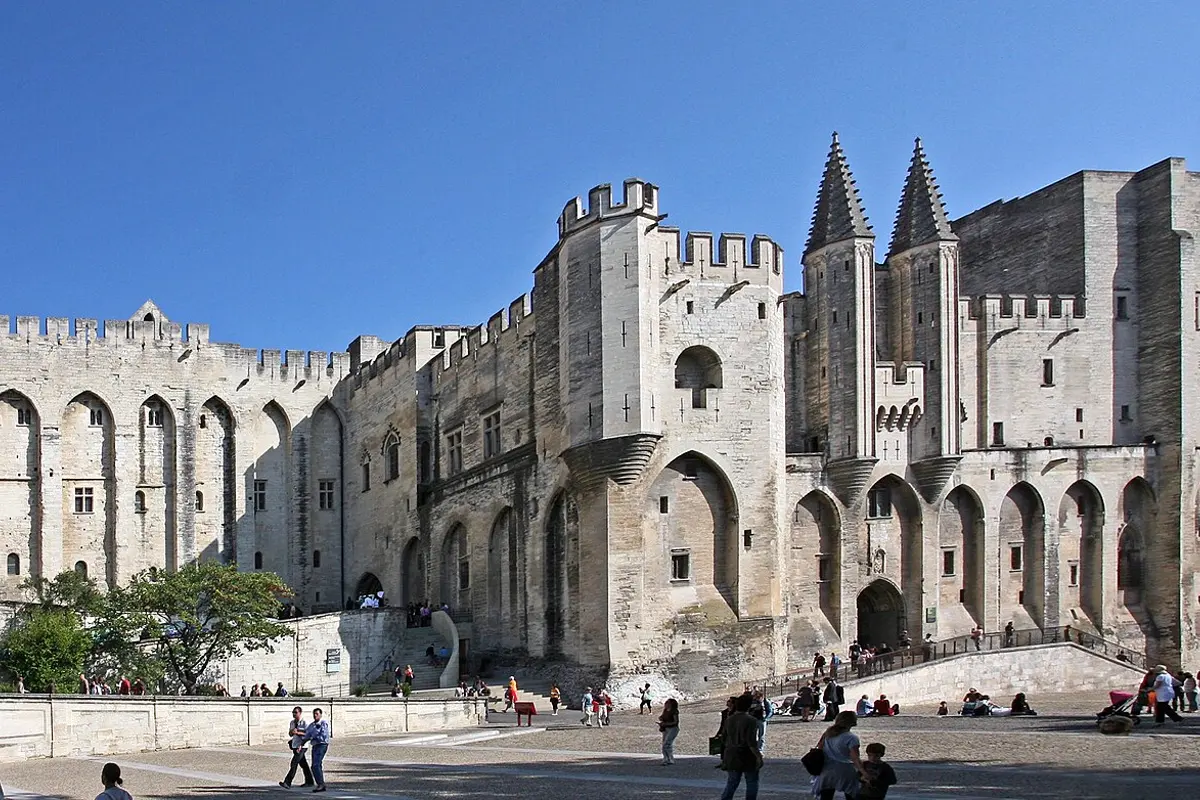
Direct flights from London to Marseille take approx. 2 hours. Collect the car at the airport; a hire car from Marseille* is easiest to compare with return to the same desk. In Avignon, park outside the walls and walk. The centre has pedestrian streets and you won't need the car for two days. The Palace of the Popes is the reason to come, and above it the Rocher des Doms garden looks over the rooftops, the famous bridge, the Rhône and out to Mont Ventoux. In summer, Palace of the Popes tickets* are worth buying ahead. July is festival time in Avignon, so rooms go early; book sooner or sleep outside town.
Day 3: Pont du Gard and Arles
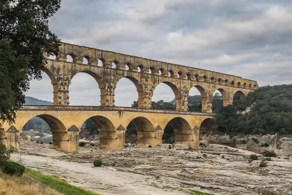
The Pont du Gard isn't on the direct road to Arles, but the detour is small: 29 km to the aqueduct and 43 km on to Arles, just under an hour and a half in all. Its three tiers stand nearly 50 metres high and once carried the water channel to Nîmes across the Gardon valley. Go early, have the riverbank nearly to yourself and reach Arles by lunch.
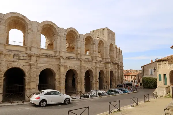
In Arles the Roman arena and theatre sit right in the old town, and you see both on foot. Van Gogh painted here and in nearby Saint-Rémy, where he stayed at the Saint-Paul de Mausole monastery in 1889 and 1890 and produced around 150 paintings, including The Starry Night. If you want Saint-Rémy too, fit it in next morning between Arles and Les Baux.
Day 4: Les Baux to Gordes
Les Baux-de-Provence is a rock-top village with a castle and pedestrian-only lanes. Next door, the Carrières de Lumières projects art around an old quarry with more than 70 projectors, a good choice for a hot midday. Then it's an hour into the Luberon and Gordes for two nights. Those two nights are the heart of the route: the best-known villages sit so close together that moving every day gains you nothing.
Day 5: Gordes, Sénanque and Roussillon
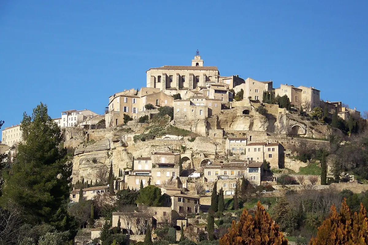
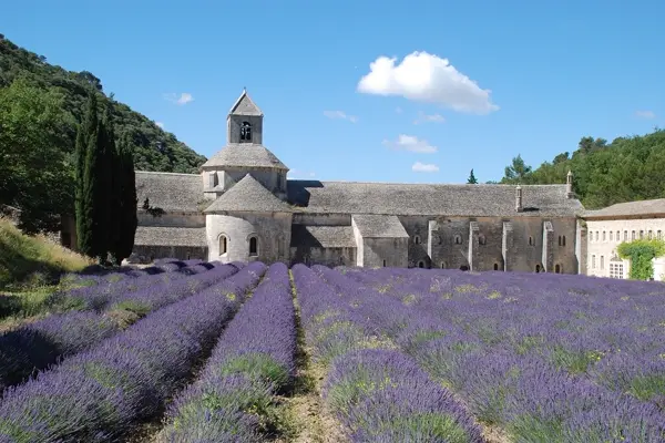
Gordes clings to the Vaucluse plateau in layers of stone; Chagall and Vasarely worked here after the war. Come in the morning, because it fills up later. A narrow road runs from here to Sénanque Abbey, founded by Cistercians in 1148 and still a working monastery. The monks pray seven times a day and the abbey asks for suitable clothing. The famous field in front is only purple in summer. Outside those weeks Sénanque is a fine Romanesque monastery but doesn't justify a day of its own.
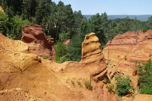
Roussillon, just 10 km on, sits on what the regional tourist board calls Europe's largest ochre deposit. The Sentier des Ocres runs through the old quarries in two versions of 30 or 50 minutes, with 350 steps, so leave the pushchair behind. It's at its best in the evening once the day visitors go.
Day 6: Valensole and Moustiers
This is the day people cut and then regret. From Roussillon it is 71 km to the Valensole plateau, a wide upland of wheat and lavender. Out of flower it is mostly a drive-through, and that's fine, because the real destination is 28 km further.
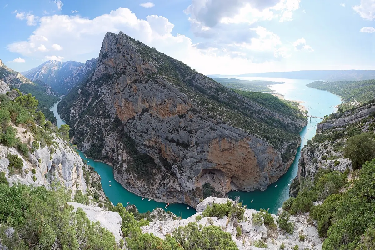
Moustiers-Sainte-Marie hangs off the rock face, known for its faience, with eight workshops still active. High above the village a gold star is strung on a 135-metre chain between two cliffs, 227 metres over the roofs. A few minutes away, the Verdon canyon opens at the turquoise Lac de Sainte-Croix. A pedalo up into the gorge is the easy way to see it, though boat access closes in strong wind.
Day 7: Aix and Cassis
The longest driving day of the trip brings you back down to Aix-en-Provence, 98 km in 1:23 hours. Lunchtime is enough for the Cours Mirabeau and the old town, Cézanne's home ground. In the afternoon you have another 50 km to the sea at Cassis (2:07 h of driving for the day), and the evening goes to the harbour.
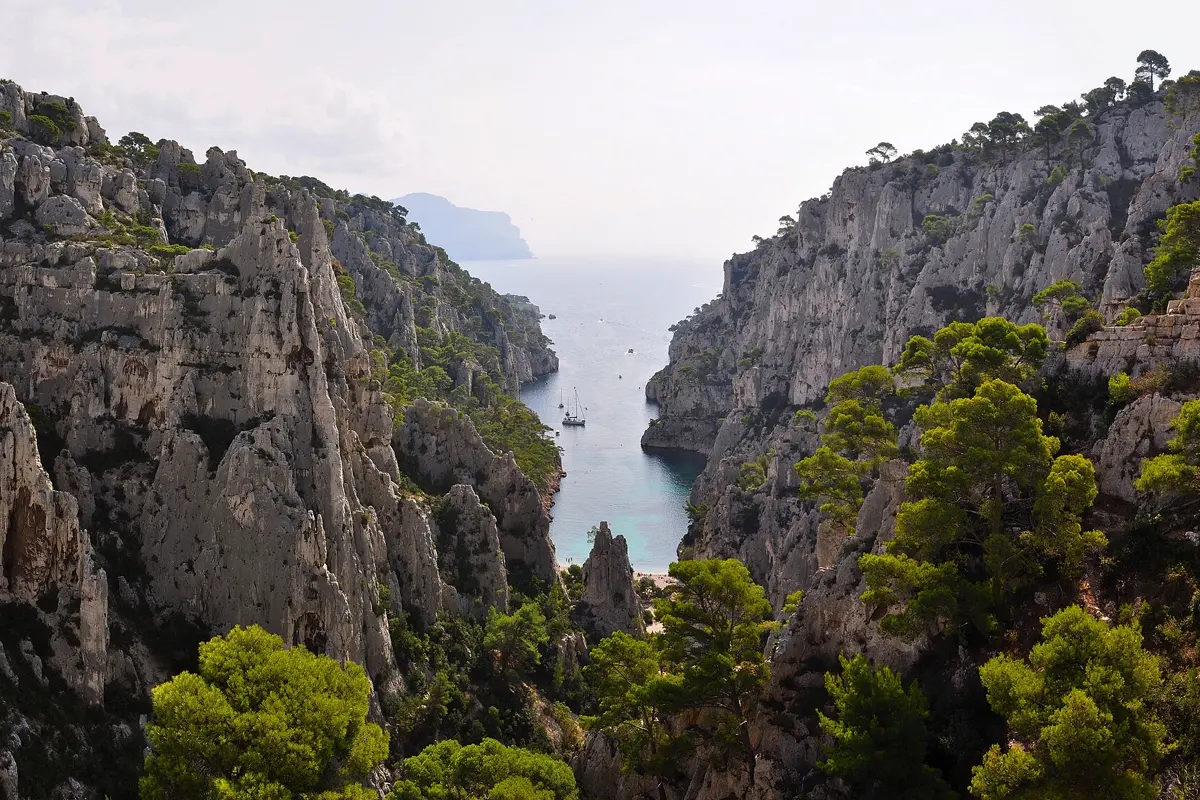
Build some uncertainty into the Calanques. From June to September access depends on fire risk: a colour-coded map, updated at 6 pm for the next day, shows the situation, and on red days the massif is closed even on foot. If you plan to hike in those months, check it the evening before. Otherwise take a boat from the harbour in Cassis, which is no bad way to spend a last day.
What to cut or add
With 5 days: drop Valensole and Moustiers. That saves the two longest driving days and takes you from the Luberon straight via Aix to Cassis. You lose the canyon and keep all the villages.
With 9 or 10 days: add the Riviera rather than stretching the loop. Valensole to Nice is 160 km, about 2:36 hours, and our guide to how many days in Nice helps you split the time. You'd return the car there, which usually means a one-way fee.
Marseille itself is left out on purpose. It's worth a visit, but a car is a burden there and with only 7 days you are trading it for the villages. If you want it, hand back the car on the last day and add two nights; from Cassis it's only 24 km.
When to go
May, June and September suit this loop best. Avignon averages 23 to 29 °C by day then, against 31 to 32 °C in July and August, when the villages are also at their busiest. October is the wettest month at 122 mm. Only go between late June and mid-July if you're after the fields and can take the heat.
| Month | Day (avg high) | Night (avg low) | Rain |
|---|---|---|---|
| April | 19.1 °C | 8.6 °C | 64 mm |
| May | 22.9 °C | 12.6 °C | 78 mm |
| June | 28.6 °C | 17.5 °C | 50 mm |
| July | 32.1 °C | 20.3 °C | 18 mm |
| August | 31.2 °C | 19.5 °C | 46 mm |
| September | 26.0 °C | 15.8 °C | 79 mm |
| October | 20.7 °C | 11.9 °C | 122 mm |
Climate in Avignon: 2015–2024 averages from the ERA5 reanalysis (Open-Meteo), rounded. For other options by season, see where to go in June.
Where to stay
- Avignon (2 nights): inside the walls if you want to walk everywhere, with the car left in a car park on the edge.
- Around Gordes and Roussillon (2 nights): a village hotel or guesthouse in the Luberon. Check the parking, as space in the villages themselves is tight.
- Moustiers or Lac de Sainte-Croix (1 night): sleep here rather than in Aix if you want to be in the canyon early.
How YesTrip helps with this trip
Create a trip in YesTrip with the stops of this route: the app shows every place on the map, uses AI to plan your days in Avignon and the Luberon, and shows the weather for your travel dates, which helps when heat or the mistral changes the plan. The packing list suggests clothing to match the forecast, the offline map helps in the villages and at the Verdon, and if you travel with others you can share the trip and the expenses. For general advice see how to plan a road trip. Nothing is booked in the app itself; you book with each provider. Visitors from outside the EU can also get a France eSIM*, and our eSIM price index compares costs per gigabyte.
* Ad – Partner link: if you book there, we earn a commission. Your price stays the same.
Free
Plan your trip in 30 seconds.
Tell YesTrip where and when – the app plans day by day with real places on the map, shows the weather, splits costs with your travel companions and guides you to the next stop on the go.
Frequently asked questions
How many days do you need for a Provence road trip?
Seven days cover Avignon, Arles, the Luberon, the Verdon and Cassis on a loop of about 520 km. With five days, leave out Valensole and Moustiers. Extra days are better spent on the Riviera or Marseille than on more villages.
When does the lavender flower along this route?
Depending on area and year, from mid-June to mid-July, and until late July at higher altitudes. Sénanque and Valensole are both on this route. Our lavender guide breaks the timing down by altitude.
Do you need a car in Provence?
For this loop, yes. Avignon, Arles and Aix are reachable by train, but Gordes, Roussillon, Sénanque, Valensole and the Verdon only really work with a car or on tours. In Avignon and Arles the car can stay parked.
Can you visit the Calanques in summer?
Yes, though not on foot every day. From 1 June to 30 September a map updated daily at 6 pm governs access, and on red days the massif is closed to walkers as well. The Cassis tourist office and the national park's app show the current status.
Which airport works best?
Marseille, because starting and ending at the same place avoids a one-way fee and Avignon is only about 1:08 hours away. Nice is well placed for Valensole and the Verdon but far from Avignon, so it suits a one-way route better.
Sources
- Driving times: OSRM route calculation based on OpenStreetMap data – project-osrm.org
- Climate: Open-Meteo Historical Weather API (ERA5), averages 2015–2024 – open-meteo.com
- Provence-Alpes-Côte d'Azur Tourism: road trips, Avignon and Arles – provence-alpes-cotedazur.com
- Provence-Alpes-Côte d'Azur Tourism: Gordes, Roussillon, Les Baux, Saint-Rémy – provence-alpes-cotedazur.com
- Provence-Alpes-Côte d'Azur Tourism: Sénanque Abbey – provence-alpes-cotedazur.com
- Provence-Alpes-Côte d'Azur Tourism: Sentier des Ocres – provence-alpes-cotedazur.com
- Pont du Gard, official website – www.pontdugard.fr
- Moustiers-Sainte-Marie tourist office: the star and village history – www.moustiers.fr
- Cassis tourist office: access rules for the Calanques and massifs – www.ot-cassis.com
Researched with AI support and checked by our editors. Prices, opening hours and weather can change – please check before you go. YesTrip is not a travel agency. Published: .
More articles
 Road trips & itineraries
Amalfi Coast itinerary: 5 days, no car needed
This 5-day route runs from Pompeii through Sorrento, Positano, Amalfi and Ravello to Salerno, with no car. Travelmar lists the boat from … · 9 min read Road trips & itineraries
Australia East Coast itinerary: 3 weeks by car
This Australia East Coast itinerary takes 21 days from Sydney via Byron Bay, Noosa, K'gari and the Whitsundays to Cairns and Port Douglas, … · 7 min read Road trips & itineraries
Bali itinerary: 2 weeks, 5 bases, no scooter
This 14-day loop covers about 410 km and almost 7 hours of pure driving through Ubud, Sidemen, Amed, Munduk and Uluwatu, by car with a … · 8 min read


