
South Korea · 3 days · 17 stops
3 days in Seoul – a ready-made itinerary
Seoul is fast, loud and surprisingly green. The plan takes you through the palaces and hanok quarters of the old city, across the big markets and up Namsan, and on the last day to Gangnam and the Han River.
In short
- Length
- 3 days, 17 stops
- Highlights
- Gyeongbokgung, Deoksugung, Bongeunsa, Bukchon Hanok Village, Changdeokgung
- Where to stay
- Jongno and Insadong, Myeongdong, Hongdae
- Getting around
- The metro reaches almost every stop in this plan, is clean and signposted in English.
- Best time to go
- Spring and autumn are ideal: cherry trees blossom in April, and from late September to November the air is clear and the leaves turn.
Free, sign in with an email code. In the app you only pick your start date and adjust the plan.
Plan created with AI support – please check opening hours, prices and routes before you go. YesTrip editorial team · Updated: .
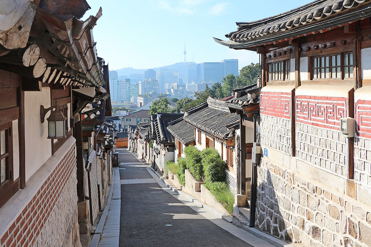
Top things to do in Seoul
12 places you should not miss in Seoul – each one is in the plan below with a time and the way there.
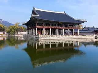 GyeongbokgungThe largest of the five royal palaces of the Joseon dynasty, with the changing of the guard at Gwanghwamun Gate.Day 1
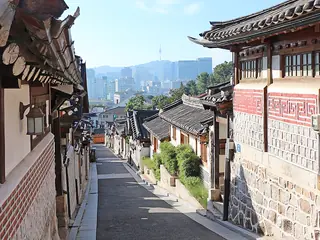 Bukchon Hanok VillageHilly lanes of traditional hanok houses between two palaces. People live here, so keep your voice down.Day 1
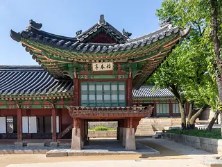 ChangdeokgungA UNESCO-listed palace set against the hills. The Secret Garden can only be seen on a guided tour.Day 1
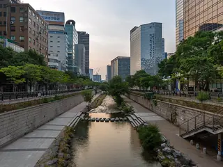 CheonggyecheonA restored stream through the middle of downtown, with footpaths down by the water.Day 1
- DeoksugungA small palace in the heart of the city, where traditional halls stand next to Western-style stone buildings.Day 2
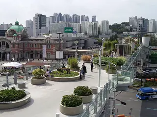 Seoullo 7017An old overpass by Seoul Station, now a walkway lined with plants in hundreds of planters.Day 2
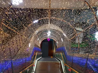 N Seoul TowerThe tower on Namsan. Take the cable car or walk up through the woods for a view over the whole city.Day 2
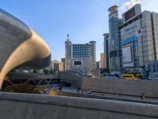 Dongdaemun Design PlazaZaha Hadid's curving building, lit up at night. Around it are fashion markets that stay open late.Day 2
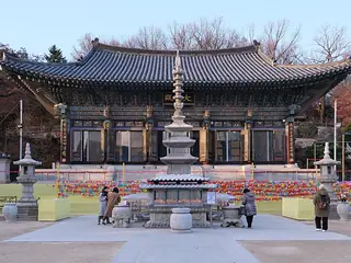 BongeunsaA Buddhist temple with a large Maitreya statue, right across from the towers of Gangnam.Day 3
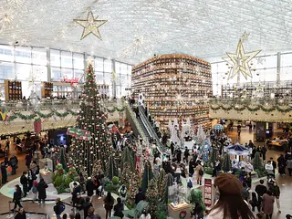 Starfield Library at COEXInside the underground COEX mall is an open library with towering bookshelves.Day 3
- Yeouido Hangang ParkWide lawns on the Han River. Rental bikes, picnics and fried chicken with beer are part of the scene.Day 3
- Banpo BridgeIn the evening the Moonlight Rainbow Fountain sends lit arcs of water off the bridge, only in the warmer months.Day 3
Day 1
Palaces and hanok lanes

Gyeongbokgung
The largest of the five royal palaces of the Joseon dynasty, with the changing of the guard at Gwanghwamun Gate.
On the map (OpenStreetMap): Gyeongbokgungabout 10 min on foot
Bukchon Hanok Village
Hilly lanes of traditional hanok houses between two palaces. People live here, so keep your voice down.
On the map (OpenStreetMap): Bukchon Hanok Villageabout 20 min on foot
Insadong
Lanes of tea houses, galleries and small places serving Korean home cooking.
On the map (OpenStreetMap): Insadongabout 15 min on foot
Changdeokgung
A UNESCO-listed palace set against the hills. The Secret Garden can only be seen on a guided tour.
On the map (OpenStreetMap): Changdeokgungabout 25 min on foot
Cheonggyecheon
A restored stream through the middle of downtown, with footpaths down by the water.
On the map (OpenStreetMap): Cheonggyecheonabout 10 min on foot
Gwangjang Market
One of Seoul's oldest markets. In the aisles you eat bindaetteok, mayak gimbap and noodles at long counters.
On the map (OpenStreetMap): Gwangjang Market
Day 2
Markets, Namsan and Myeongdong

Deoksugung
A small palace in the heart of the city, where traditional halls stand next to Western-style stone buildings.
On the map (OpenStreetMap): Deoksugungabout 15 min on foot
Seoullo 7017
An old overpass by Seoul Station, now a walkway lined with plants in hundreds of planters.
On the map (OpenStreetMap): Seoullo 7017about 5 min on foot
Namdaemun Market
The big traditional market by the old South Gate, with an alley full of kalguksu noodle soup stalls.
On the map (OpenStreetMap): Namdaemun Marketabout 20 min on foot
N Seoul Tower
The tower on Namsan. Take the cable car or walk up through the woods for a view over the whole city.
On the map (OpenStreetMap): N Seoul Towerabout 20 min on foot
Myeongdong
A shopping district with cosmetics shops and plenty of street food stalls in the evening, with Myeongdong Cathedral at its edge.
On the map (OpenStreetMap): Myeongdongabout 2.3 km as the crow flies – by bus, train or taxi
Dongdaemun Design Plaza
Zaha Hadid's curving building, lit up at night. Around it are fashion markets that stay open late.
On the map (OpenStreetMap): Dongdaemun Design Plaza
Day 3
Gangnam and the Han River

Bongeunsa
A Buddhist temple with a large Maitreya statue, right across from the towers of Gangnam.
On the map (OpenStreetMap): Bongeunsaabout 5 min on foot
Starfield Library at COEX
Inside the underground COEX mall is an open library with towering bookshelves.
On the map (OpenStreetMap): Starfield Library at COEXMetro line 9 from Bongeunsa to Noryangjin.
Noryangjin Fish Market
Pick fish and seafood at the stalls downstairs, then have it prepared in the restaurants upstairs.
On the map (OpenStreetMap): Noryangjin Fish Marketabout 20 min on foot
Yeouido Hangang Park
Wide lawns on the Han River. Rental bikes, picnics and fried chicken with beer are part of the scene.
On the map (OpenStreetMap): Yeouido Hangang Parkabout 5.4 km as the crow flies – by bus, train or taxi
Banpo Bridge
In the evening the Moonlight Rainbow Fountain sends lit arcs of water off the bridge, only in the warmer months.
On the map (OpenStreetMap): Banpo Bridge
Good to know
Best time to go
Spring and autumn are ideal: cherry trees blossom in April, and from late September to November the air is clear and the leaves turn. Summer is hot and humid, with the rainy season from late June. Winter is dry but often bitterly cold.
Getting around
The metro reaches almost every stop in this plan, is clean and signposted in English. A rechargeable T-money card from any convenience store works on the metro and buses. Google Maps is of little help for directions in Korea; Naver Map or KakaoMap work far better. The AREX train runs from Incheon Airport to Seoul Station.
Where to stay
Jongno and Insadong
Between the palaces and Bukchon: quiet in the evening, with a lot within walking distance.
Myeongdong
Very central with many hotels and metro links, busy by day and by night.
Hongdae
A student district with cafés, live music and nightlife, right on the airport rail line.
Ad Where to stay in Seoul? Compare prices: Seoul
Ad Flights to Seoul: compare live prices →
More on Seoul in our blog: Incheon airport to Seoul: AREX in 43 min or bus · How many days in Seoul? Plans for 2–7 days
Your plan
Start with this plan.
Copy it into YesTrip, pick your dates and make it yours: move stops, drop them or let the AI add more. On the road the app shows you the next stop and how to get there.
Seoul: frequently asked questions
What are the must-see sights in Seoul?
The must-see sights in Seoul are Gyeongbokgung, Bukchon Hanok Village, Changdeokgung, Cheonggyecheon, Deoksugung and Seoullo 7017. This plan links 12 of them into short walks over 3 days – with times, a map and tips.
Are 3 days enough for Seoul?
For the palaces, markets and Namsan, yes. With a fourth day, a trip to Hwaseong Fortress in Suwon or a guided tour to the Demilitarized Zone is worth it.
Does Google Maps work in Seoul?
For finding places, yes; for walking and transit directions, barely. Naver Map or KakaoMap show metro, buses and walking routes reliably, and both have an English interface.
Is it worth wearing a hanbok to the palaces?
Many people do, and there are plenty of rental shops around Gyeongbokgung. It makes for lovely photos at the palace and in Bukchon, though it is not the most comfortable outfit.
When is the best time to visit Seoul?
April and May, and late September to November. July and August are humid and rainy, and January is often well below freezing.
Plan created with AI support – please check opening hours, prices and routes before you go. Coordinates checked with Wikipedia and OpenStreetMap (Photon). Photo: Bgag, CC0, via Wikimedia Commons. More in Sources & licences. YesTrip is a trip planner, not a travel agency – nothing is booked.
More trip plans
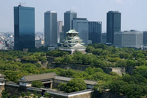 Japan · 3 days
Osaka
Photo: 663highland, CC BY 2.5, via Wikimedia Commons
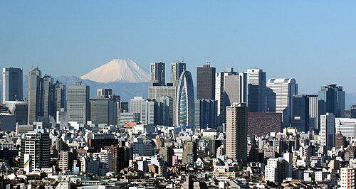 Japan · 3 days
Tokyo
Photo: Morio, CC BY-SA 3.0, via Wikimedia Commons
 Taiwan · 3 days
Taipei
Photo: This Photo was taken by Supanut Arunoprayote . Feel free to use any of my images, but please mention me as the author and may send me a message. (สามารถใช้ภาพได, CC BY 4.0, via Wikimedia Commons


