
Western Canada road trip: 12-day itinerary
In short
The classic Western Canada road trip takes 12 days from Vancouver via Whistler, Kamloops and Wells Gray Park to Jasper, along the Icefields Parkway to Lake Louise and Banff and on to Calgary – about 1,280 km by hire car. The longest leg is just under 5 hours of pure driving. The best time is mid-June to mid-September, with average highs of 18 to 23 °C in Banff.
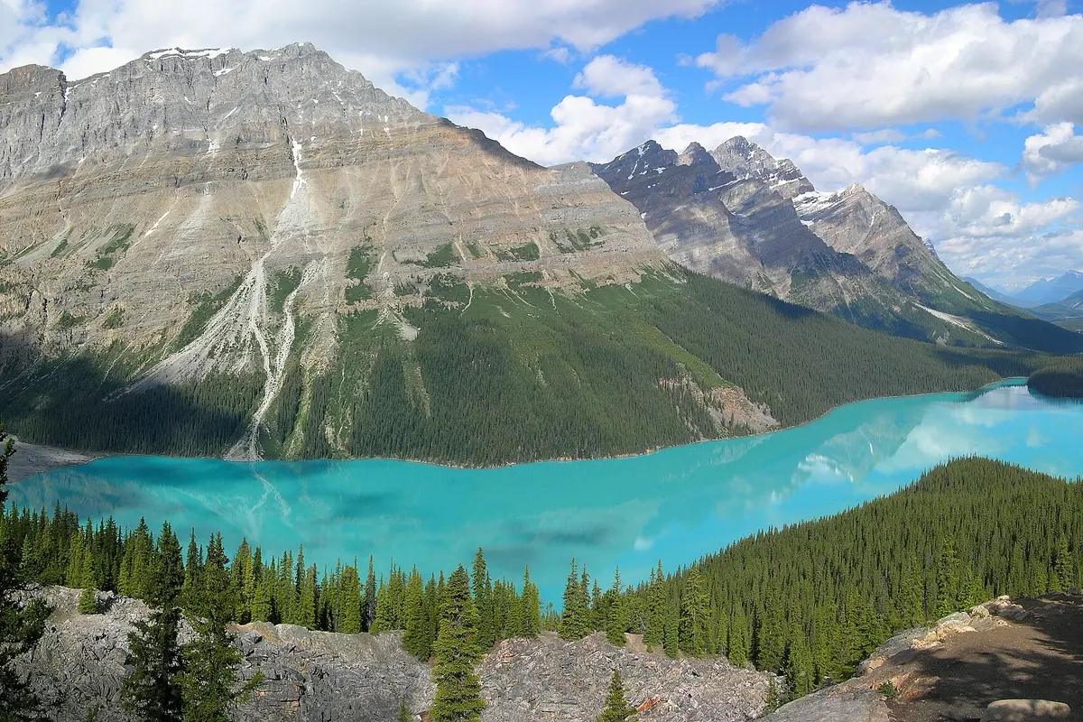
Western Canada is one of the great road trips: you start on the Pacific in Vancouver, drive the Sea-to-Sky Highway into the mountains of Whistler, cross the dry interior of British Columbia and then reach the Rocky Mountains with Jasper, the Icefields Parkway, Lake Louise and Banff. This route takes 12 days and ends in Calgary, where you fly home. Further down you will find a 10-day and a 14-day version.
The route at a glance
| Day | Leg | Distance | Pure driving time |
|---|---|---|---|
| 1–2 | Vancouver | – | – |
| 3 | Vancouver → Whistler | 122 km | approx. 2:00 h |
| 4 | Whistler | – | – |
| 5 | Whistler → Lillooet → Kamloops | 300 km | approx. 4:50 h |
| 6 | Kamloops → Clearwater (Wells Gray) | 126 km | approx. 1:35 h |
| 7 | Clearwater → Jasper | 318 km | approx. 4:05 h |
| 8 | Jasper: Maligne Canyon and Maligne Lake | – | – |
| 9 | Jasper → Columbia Icefield → Lake Louise | 232 km | approx. 3:35 h |
| 10 | Lake Louise, Moraine Lake, Yoho | – | – |
| 11 | Lake Louise → Banff | 57 km | approx. 0:50 h |
| 12 | Banff → Calgary | 127 km | approx. 1:40 h |
Driving times: route calculation based on OpenStreetMap, without breaks. On the Icefields Parkway you will stop constantly – for viewpoints, waterfalls and wildlife by the road. Add about a third, and on that day rather double it.
- Vancouver
- Whistler
- Kamloops
- Clearwater
- Jasper
- Columbia Icefield
- Lake Louise
- Banff
- Calgary
Base map: Natural Earth
Days 1–2: Vancouver
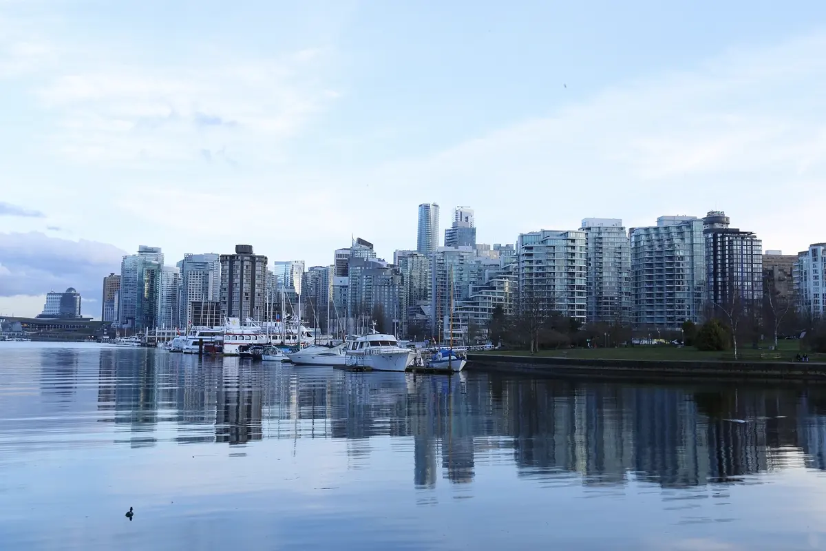
Vancouver sits between the Pacific and the Coast Mountains and is a relaxed start after a long flight. Stanley Park at the tip of the downtown peninsula is ringed by a seawall path you can walk or cycle. Add the old Gastown district, the market on Granville Island and the suspension bridges* on the North Shore. Pick up the hire car on the morning of day three – in the city, SkyTrain, buses and the SeaBus get you around easily.
Days 3–4: the Sea-to-Sky Highway and Whistler
The Sea-to-Sky Highway, Highway 99, follows the fjord of Howe Sound north. On the way, stop at Shannon Falls and, near Squamish, take the gondola up to a viewpoint over the sound. Whistler hosted events of the 2010 Winter Olympics and in summer is a base for hikers and mountain bikers. The Peak 2 Peak Gondola links the two mountains, Whistler and Blackcomb, and at the top trails lead above the tree line.
Days 5–7: through the interior to Jasper
Beyond Whistler it gets quiet. The Duffey Lake Road climbs over a pass, runs past mountain lakes and drops down to Lillooet, then continues through dry canyon country to Kamloops. At 300 km and almost 5 hours of pure driving, this is the longest leg of the trip.
On day six you head to Clearwater, the gateway to Wells Gray Provincial Park. The park is known for its waterfalls, above all Helmcken Falls, which plunge into a bowl of volcanic rock. On day seven you follow the Yellowhead Highway north-east. Shortly before the Alberta border you pass Mount Robson, the highest peak in the Canadian Rockies, and then reach Jasper.
Day 8: Jasper
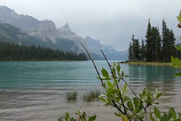
Jasper is the quieter of the two big national parks. Maligne Canyon is a narrow, deep gorge crossed by several footbridges. A good hour's drive further on lies Maligne Lake; tour boats run to tiny Spirit Island, one of the best-known views in Canada. By the road you often see elk, bighorn sheep and, with luck, bears. Wildfires have hit the park in recent years – read the current notices from Parks Canada before you go.
Day 9: the Icefields Parkway
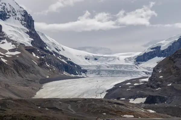
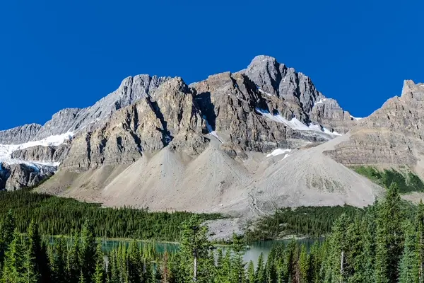
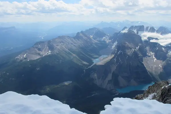
The Icefields Parkway, Highway 93 between Jasper and Lake Louise, is often called one of the most beautiful drives in the world. For a good 230 km it passes glaciers, waterfalls and turquoise lakes. The main stops from north to south: Athabasca Falls, Sunwapta Falls, the Columbia Icefield with the tongue of the Athabasca Glacier, then Bow Lake and the viewpoint above Peyto Lake. There are hardly any petrol stations and little mobile signal on the way – fill up in Jasper and download the map for offline use.
Days 10–11: Lake Louise, Moraine Lake and Banff
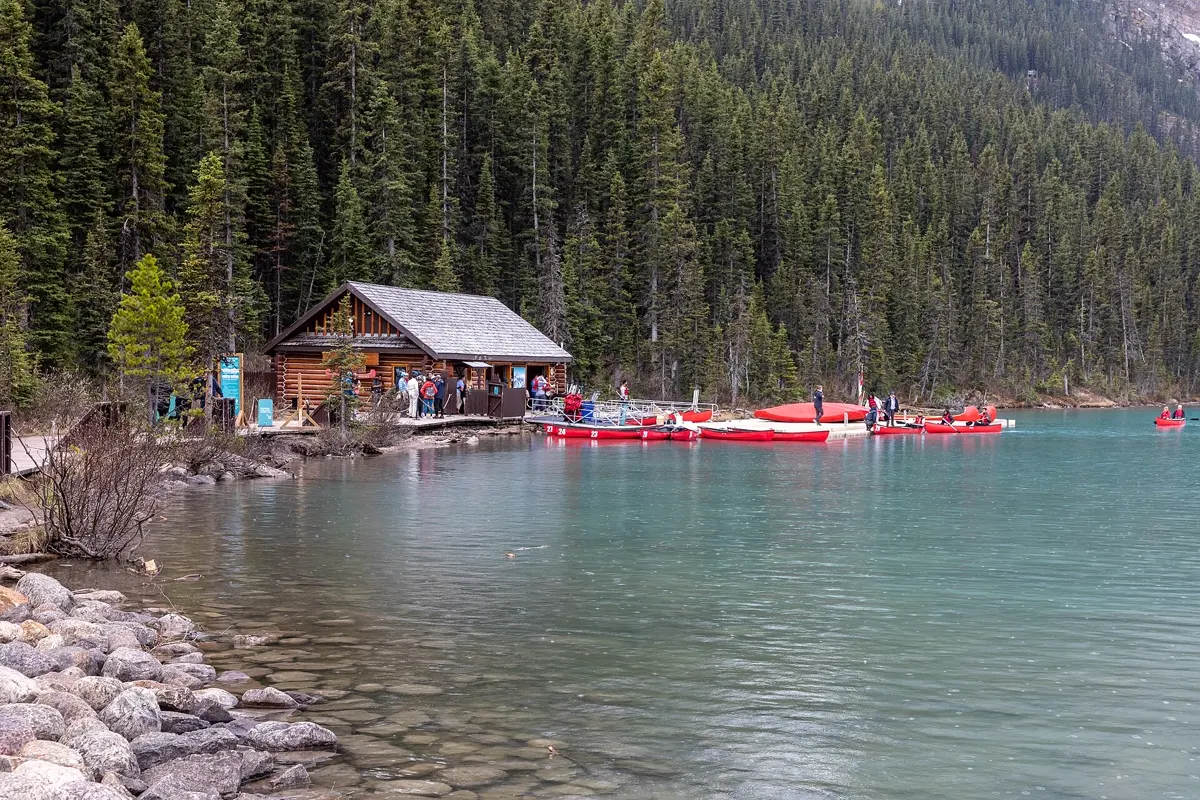
At Lake Louise glaciers and peaks reflect in milky green water. Trails climb to Lake Agnes and its teahouse and on to viewpoints above the lake. Moraine Lake lies a few kilometres away in the Valley of the Ten Peaks – you can no longer drive there in your own car; Parks Canada runs shuttle buses that you reserve in advance. The car parks at Lake Louise also fill up early in the morning. A good half-day trip takes you across the provincial border into Yoho National Park to Emerald Lake, 37 km and about 40 minutes from Lake Louise.
On day eleven take the Bow Valley Parkway past Johnston Canyon to Banff. The small town lies right inside the national park. A gondola climbs Sulphur Mountain, the Banff Upper Hot Springs are a hot outdoor pool with a mountain view, and at the Vermilion Lakes you see Mount Rundle reflected in the water in the evening.
Day 12: Calgary
From Banff it is a good hour and a half to Calgary. If your flight leaves in the evening, walk along the Bow River or take in the view from the Calgary Tower. Allow plenty of buffer for the drive to the airport.
Shorter and longer versions: 10 or 14 days
10 days: Skip Wells Gray and drive straight from Kamloops to Jasper – 444 km, approx. 5:40 h of pure driving. You then have only one day in Vancouver and no second night in Whistler.
14 days: Add one more night each in Jasper and Banff. That leaves time for a longer hike in Jasper and, from Banff, a trip to Lake Minnewanka or into Kootenay National Park.
Best time for a Western Canada road trip
The best time is mid-June to mid-September. The lakes in the Rockies are free of ice and glow turquoise, the trails are clear of snow and all shuttle buses run. July and August are the warmest months, but also the busiest, and in some years wildfire smoke dims the views. At the end of September the larches turn yellow, but nights can already drop below freezing. From November to April it is ski season; the Icefields Parkway is then only advisable with winter tyres and experience on snow.
| Month | Day (avg high) | Night (avg low) | Precipitation |
|---|---|---|---|
| January | -4.4 °C | -13.1 °C | 20 mm |
| February | -3.4 °C | -13.7 °C | 29 mm |
| March | 2.6 °C | -9.0 °C | 34 mm |
| April | 6.8 °C | -4.3 °C | 38 mm |
| May | 13.3 °C | 1.0 °C | 57 mm |
| June | 18.3 °C | 4.5 °C | 85 mm |
| July | 22.8 °C | 8.4 °C | 71 mm |
| August | 22.6 °C | 8.3 °C | 59 mm |
| September | 16.5 °C | 3.7 °C | 50 mm |
| October | 7.9 °C | -2.9 °C | 43 mm |
| November | -0.5 °C | -9.8 °C | 39 mm |
| December | -6.2 °C | -14.3 °C | 34 mm |
Climate in Banff: 2015–2024 averages from the ERA5 reanalysis (Open-Meteo), rounded. Jasper is similarly warm but wetter in summer (103 mm in July). On the Icefields Parkway at over 2,000 m it is noticeably colder. Vancouver is much milder and rainy in winter.
Good to know before you go
- Entry: Most visa-exempt travellers, including citizens of the UK and the EU, need an Electronic Travel Authorization (eTA) to fly to Canada. Apply only on the official Government of Canada website.
- National parks: Jasper, Banff and Yoho require a Parks Canada pass. There are daily passes and an annual Discovery Pass – compare them if you spend several days in the parks.
- Driving: Drive on the right, speeds in km/h. Highways inside the national parks usually have lower limits than outside. Never stop in the middle of the road to photograph wildlife, and stay in the car near bears.
- One-way rental: Picking up in Vancouver and returning in Calgary usually costs a substantial one-way fee. The alternative is the loop back to Vancouver, which means two more long driving days.
- Time zones: British Columbia and Alberta are in different time zones. Between Clearwater and Jasper you put your watch forward one hour.
- Bears: Black bears and grizzlies live in the national parks. Make noise on hikes, many hikers carry bear spray, and food is never left out in the car or at the tent.
- Flight: A direct flight* from London to Vancouver takes approx. 9.5 hours, from Calgary back to London approx. 8.5 hours.
How YesTrip helps with this trip
Create a trip in YesTrip with the stops of this route: the app shows every place on the map, uses AI to plan your days in Vancouver, Jasper and Banff and shows the weather for your travel days. The packing list suggests clothing to match the forecast – in the Rockies you need a warm layer for the mornings even in July – plus the right plug adapter for Canada. The offline map helps on the Icefields Parkway and between Whistler and Jasper, where you often have no signal. If you travel with friends you can share the trip and the expenses in the app.
* Ad – Partner link: if you book there, we earn a commission. Your price stays the same.
Free
Plan your trip in 30 seconds.
Tell YesTrip where and when – the app plans day by day with real places on the map, shows the weather, splits costs with your travel companions and guides you to the next stop on the go.
Frequently asked questions
How many days do you need for a Western Canada road trip?
Plan 12 days for the route from Vancouver via Whistler, Jasper and the Icefields Parkway to Banff and Calgary. Ten days work if you skip Wells Gray Park. With 14 days you get an extra, slower day each in Jasper and Banff.
When is the best time to visit the Canadian Rockies?
Mid-June to mid-September. Average daily highs in Banff are then between 16 and 23 °C, the lakes are free of ice and all trails and shuttle buses are open. Even in summer, nights can be only a few degrees above freezing.
How long is the Icefields Parkway and how much time do you need?
The Icefields Parkway between Jasper and Lake Louise is a good 230 km long, with about three and a half hours of pure driving. With stops at the waterfalls, the glacier and the lakes, plan a full day.
Can you drive your own car to Moraine Lake?
No. The road to Moraine Lake is closed to private vehicles. You reach the lake on Parks Canada shuttle buses, which you reserve in advance, or on commercial bus tours.
Do I need a visa for Canada?
Citizens of the UK, the EU and many other countries need no visa for a tourist stay, but they do need an Electronic Travel Authorization (eTA) when flying in. Check your own nationality on the Government of Canada website and apply online there.
Sources
- Driving times: OSRM route calculation based on OpenStreetMap data – project-osrm.org
- Climate: Open-Meteo Historical Weather API (ERA5), averages 2015–2024 – open-meteo.com
- Banff National Park and the Moraine Lake shuttle: Parks Canada – parks.canada.ca
- Jasper National Park: Parks Canada – parks.canada.ca
- Electronic Travel Authorization (eTA): Government of Canada – www.canada.ca
- Road conditions in British Columbia: DriveBC – www.drivebc.ca
Researched with AI support and checked by our editors. Prices, opening hours and weather can change – please check before you go. YesTrip is not a travel agency. Published: .
More articles
 Road trips & itineraries
Amalfi Coast itinerary: 5 days, no car needed
This 5-day route runs from Pompeii through Sorrento, Positano, Amalfi and Ravello to Salerno, with no car. Travelmar lists the boat from … · 9 min read Road trips & itineraries
Australia East Coast itinerary: 3 weeks by car
This Australia East Coast itinerary takes 21 days from Sydney via Byron Bay, Noosa, K'gari and the Whitsundays to Cairns and Port Douglas, … · 7 min read Road trips & itineraries
Bali itinerary: 2 weeks, 5 bases, no scooter
This 14-day loop covers about 410 km and almost 7 hours of pure driving through Ubud, Sidemen, Amed, Munduk and Uluwatu, by car with a … · 8 min read


