
Oman itinerary: 10 days, about 690 km
In short
This 10-day loop covers about 690 km from Muscat to Nizwa, through the Wahiba desert to Sur and back along the coast. Musandam is left out because Germany's Foreign Office advises against it, and Salalah is about 1,000 km away. November to March fits best: Muscat is 24 to 29 °C by day, while Jebel Shams drops to about 0 °C on January nights.
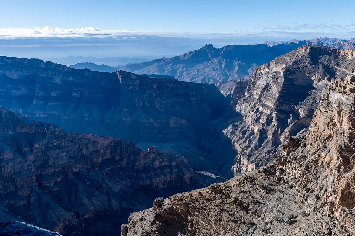
Distances in Oman look short and then take longer than the map suggests. The 161 km from Muscat to Nizwa take just under two hours of pure driving, while the last 43 km from Al Hamra up to Jebel Shams take about an hour and twenty minutes. So the question to settle before you book is whether a normal car will do or you need a 4x4. This plan answers that, and starts with what to leave out.
First: the security picture and what it rules out
The UK government calls the Middle East deeply unpredictable, with a high risk of sudden escalation, and says to expect possible flight cancellations and airspace closures, including when passing through the region. The German Foreign Office additionally advises against travel to the Musandam exclave on the Strait of Hormuz and the immediate border area with Yemen. Neither is on this route. Stay well clear of military sites, read both pages when you book and again before you fly, and keep the last day as a buffer.
Salalah is missing for a different reason. Muscat to Salalah is about 1,000 km, a distance the German Foreign Office says is often underestimated. It's a separate trip rather than a side trip.
The route at a glance
| Day | Leg | Distance | Pure driving time |
|---|---|---|---|
| 1–2 | Muscat | – | – |
| 3 | Muscat → Nizwa | 161 km | approx. 1:50 h |
| 4 | Nizwa → Bahla and Misfat al Abriyeen, and back | day trip | Nizwa–Bahla approx. 0:35 h |
| 5 | Jebel Shams and back | 179 km | approx. 4:05 h |
| 6 | Nizwa → Birkat al Mawz → Al Mintarib (Wahiba) | 183 km | approx. 2:40 h |
| 7 | Wahiba → Sur | 112 km | approx. 1:20 h |
| 8 | Sur, Qalhat, Ras al Jinz in the evening | – | – |
| 9 | Sur → Wadi Shab → Bimmah → Muscat | 233 km | approx. 3:25 h |
| 10 | Buffer day, flight home | – | – |
Driving times: route calculation based on OpenStreetMap, without breaks. Add about a third. In the mountains the figures are rougher, because the calculation doesn't know the state of the tracks.
- Muscat
- Nizwa
- Jebel Shams
- Birkat al Mawz
- Al Mintarib
- Sur
- Wadi Shab
- Bimmah
Base map: Natural Earth
4x4 or a normal car?
This route works with either, and the choice affects your budget more than anything else. The coast, Nizwa, Bahla and Sur are all on normal roads. Three places are different:
- Jebel Shams: the last part is a gravel track. A 4x4 isn't described as mandatory but is strongly recommended, and after rain the track can be impassable without one.
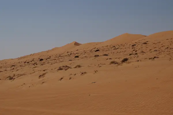
- Wahiba Sands: you can only drive into the dunes with a 4x4. Many camps will collect you from the desert edge, though, so a normal car can stay at Al Mintarib.
- Jebel Akhdar: travellers report a checkpoint on the way up that only lets 4x4s through. We couldn't verify an official rule, so this mountain is only an option here. It can replace Jebel Shams if you're hiring a 4x4 anyway.
The UK government says to travel off-road only in a well-equipped 4x4, in convoy if possible. A comparison of hire cars in Oman* shows both classes. Avoid driving outside Muscat after dark; the German Foreign Office names roaming camels as a reason.
Days 1–2: Muscat
Muscat is strung out along the coast, and you don't need the car until day 3. Dress modestly for the Sultan Qaboos Grand Mosque. In the old quarter, look at the forts and the harbour at Mutrah with its souk. If you'd rather not drive into the desert yourself, there are tours from Muscat*. Don't try to fit in more, as the buffer day brings you back here anyway.
Days 3–5: Nizwa, Bahla, Misfat, Jebel Shams
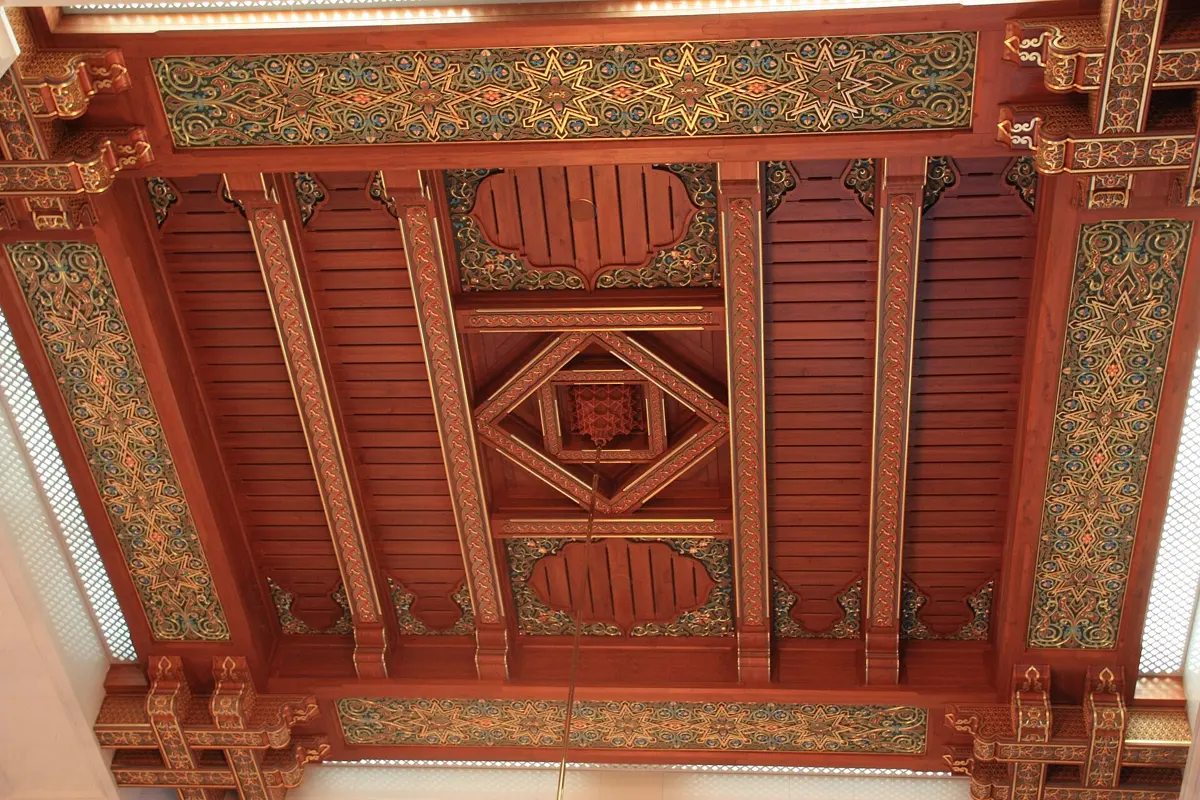
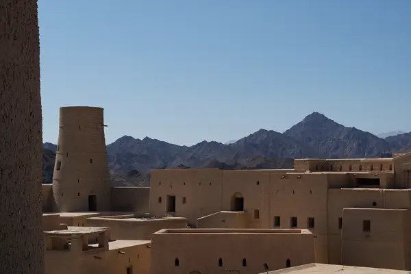
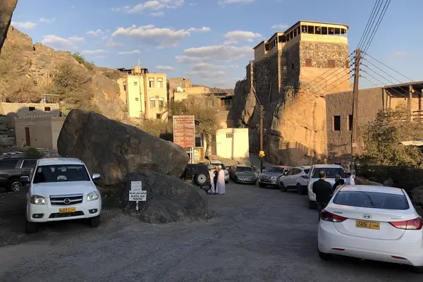
Nizwa is the best inland base: three nights, with the fort and souk close together. On day four, drive to Bahla, a walled oasis and UNESCO World Heritage Site that the Banu Nebhan tribe made their capital from the 12th to the end of the 15th century. Via Al Hamra you then reach Misfat al Abriyeen, a mud-and-stone village on a hillside with irrigation channels running through its gardens. These are aflaj: more than 3,000 still work in Oman, and one of the five on the World Heritage list, Falaj Daris, is in Nizwa.
Day five is for Jebel Shams. Nizwa to Al Hamra is 49 km (approx. 0:50 h), and from there about 43 km to the road end (approx. 1:20 h). That is roughly 90 km and just over 2 hours each way, so the 179 km and approx. 4:05 h in the table are for the round trip. Start early and bring a warm layer, because altitude changes everything: January averages are 9 °C by day and about 0 °C at night, while Nizwa below reaches 25 °C. If you plan to sleep up there, pack for it.
Days 6–7: Wahiba Sands
On the way east, Birkat al Mawz with the World Heritage channel Falaj Al-Khatmeen is a quick stop after just 25 km. Then it's 158 km (approx. 2:10 h) to Al Mintarib on the edge of the Wahiba Sands. One night at a camp is enough for sunset and sunrise. Without a 4x4, arrange the pick-up before you set off.
Days 7–9: Sur, Ras al Jinz, Wadi Shab
Sur was once famous for its dhow yards. Qalhat, north of town, is the better reason to stop: another World Heritage Site, and a major port on Arabia's east coast between the 11th and 15th centuries. In the evening you can join a guided tour at Ras al Jinz on the coast to see green turtles coming ashore to lay their eggs.
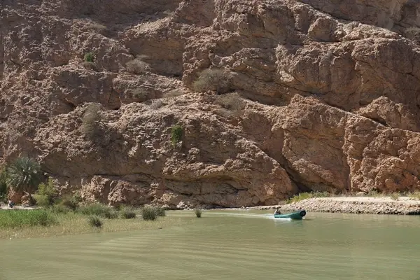
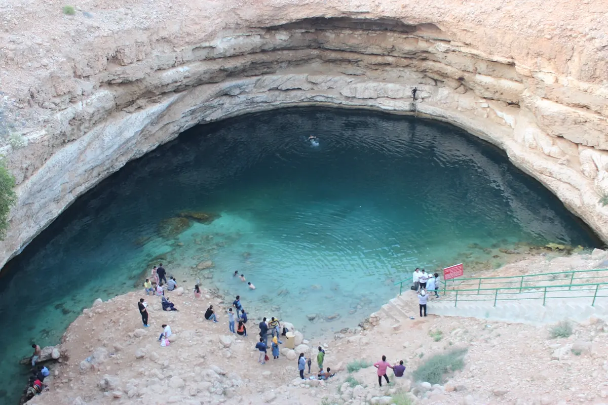
The last leg links two stops: Wadi Shab (52 km, approx. 0:55 h from Sur) and Bimmah Sinkhole (another 40 km, approx. 0:45 h). Give the wadi half a day. The German Foreign Office warns that paths at Wadi Shab and Wadi Bani Khalid are steep and unsecured. More important still, wadis flood quickly after rain, mainly from October to March, which is also the best travel season. Check the forecast and stay out when heavy rain is expected and for at least one day afterwards.
Weather on the road
The month-by-month picture is in the best time to visit Oman: November to March is the time for this loop. Here's only what's different in the high mountains compared with Muscat and Nizwa.
| Month | Jebel Shams day | Jebel Shams night | Nizwa day | Muscat day |
|---|---|---|---|---|
| Jan | 9.2 °C | -0.2 °C | 25.3 °C | 24.5 °C |
| Feb | 11.7 °C | 1.8 °C | 28.0 °C | 26.0 °C |
| Mar | 14.2 °C | 4.3 °C | 31.2 °C | 29.2 °C |
| Apr | 18.3 °C | 8.4 °C | 35.9 °C | 33.9 °C |
| May | 22.1 °C | 11.6 °C | 39.5 °C | 38.2 °C |
| Jun | 25.2 °C | 14.5 °C | 42.2 °C | 38.9 °C |
| Jul | 24.2 °C | 14.6 °C | 40.6 °C | 37.9 °C |
| Aug | 23.9 °C | 14.4 °C | 40.6 °C | 36.8 °C |
| Sep | 22.0 °C | 12.1 °C | 38.5 °C | 35.8 °C |
| Oct | 17.6 °C | 8.7 °C | 35.1 °C | 33.6 °C |
| Nov | 13.5 °C | 4.3 °C | 30.2 °C | 29.4 °C |
| Dec | 10.3 °C | 1.0 °C | 26.5 °C | 25.8 °C |
Temperatures: monthly averages 2015–2024 from the ERA5 reanalysis (Open-Meteo), rounded. A grid cell is about 25 km wide, so conditions on the rim can differ noticeably.
How YesTrip helps with this trip
Weather can change a day on this loop. In YesTrip you set up your stops and days and let the AI build a day plan, and the forecast for your travel days shows whether the wadi is realistic on the planned date. The packing list remembers the cold mountain night and the swim in the wadi. For stretches without signal, download the offline package with the maps first. Travelling together, you share the trip and settle camp and car costs. YesTrip books nothing itself; you book with the provider.

What to know before you go
- Entry: current rules are on gov.uk or with your own government.
- Roads: traffic laws are strictly enforced, using your phone while driving is illegal, and rain can flood roads that cross dry riverbeds without warning.
- Clothing: cover shoulders and knees, especially away from hotels.
- Mobile data: compare plans in our eSIM comparison for Oman. Our guide to travel eSIMs explains how to choose one.
To compare winter options, see where to go in January. If you'd rather have temples and tea hills, the Sri Lanka itinerary is a tour of similar pace.
* Ad – Partner link: if you book there, we earn a commission. Your price stays the same.
Free
Plan your trip in 30 seconds.
Tell YesTrip where and when – the app plans day by day with real places on the map, shows the weather, splits costs with your travel companions and guides you to the next stop on the go.
Frequently asked questions
Is Oman safe for tourists right now?
The German Foreign Office advises against travel to Musandam and the Yemen border area, but not the rest of the country. Both the UK and German governments describe the regional situation as very unstable, with possible short-notice airspace closures. Check the advice shortly before you fly.
Do you need a 4x4 in Oman?
Not for the coast, Nizwa or Sur. A 4x4 is strongly recommended on Jebel Shams, and to enter the Wahiba dunes you need one or a pick-up from your camp. Travellers report a 4x4-only checkpoint on Jebel Akhdar.
Are 10 days enough for Oman?
Ten days work well for the north with Muscat, Nizwa, Wahiba and Sur, covering about 690 km plus the mountain day trip. Salalah in the south doesn't fit, since it is about 1,000 km from Muscat.
When should you stay out of the wadis?
Stay out when heavy rain is expected and for at least one day afterwards, as the UK government advises. The risk is highest from October to March. If a storm warning is issued while you're inside, leave immediately.
How cold does Jebel Shams get?
January averages are 9 °C by day and about 0 °C at night, and December averages are 10 °C and 1 °C. In summer it reaches about 24 to 25 °C up there, while Nizwa passes 40 °C.
Sources
- Driving times: OSRM route calculation based on OpenStreetMap data – project-osrm.org
- Climate data: ERA5 reanalysis via Open-Meteo, monthly averages 2015–2024 – open-meteo.com
- Foreign travel advice for Oman: UK government – www.gov.uk
- Wadis, roads, desert travel: UK government – www.gov.uk
- Musandam, Yemen border, Salalah distance, wadi paths: German Foreign Office – www.auswaertiges-amt.de
- 4x4 on Jebel Shams, Jebel Akhdar, Wahiba (travel report, not official): Zigzag on Earth – www.zigzagonearth.com
- Bahla Fort: UNESCO World Heritage Centre – whc.unesco.org
- Aflaj irrigation: UNESCO World Heritage Centre – whc.unesco.org
- Qalhat: UNESCO World Heritage Centre – whc.unesco.org
Researched with AI support and checked by our editors. Prices, opening hours and weather can change – please check before you go. YesTrip is not a travel agency. Published: .
More articles
 Road trips & itineraries
Amalfi Coast itinerary: 5 days, no car needed
This 5-day route runs from Pompeii through Sorrento, Positano, Amalfi and Ravello to Salerno, with no car. Travelmar lists the boat from … · 9 min read Road trips & itineraries
Australia East Coast itinerary: 3 weeks by car
This Australia East Coast itinerary takes 21 days from Sydney via Byron Bay, Noosa, K'gari and the Whitsundays to Cairns and Port Douglas, … · 7 min read Road trips & itineraries
Bali itinerary: 2 weeks, 5 bases, no scooter
This 14-day loop covers about 410 km and almost 7 hours of pure driving through Ubud, Sidemen, Amed, Munduk and Uluwatu, by car with a … · 8 min read


