
Norway road trip: the fjords in 14 days
In short
The classic fjord road trip takes 14 days from Oslo via Flåm to Bergen, past the Sognefjord and Jostedalsbreen to Geiranger, over Trollstigen to Ålesund and along the Atlantic Road to Trondheim – about 1,500 km by hire car with several short ferries. The longest leg is Oslo to Flåm at just over 5 hours of pure driving. The best time to go is June to August.
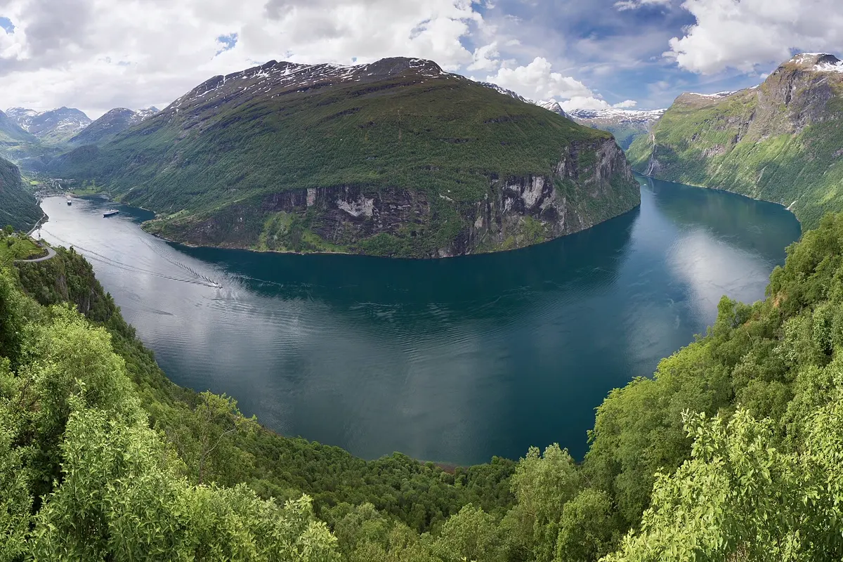
Norway's fjord country is best explored by car: the finest places – the Nærøyfjord, the Geirangerfjord, Trollstigen – lie on winding roads between steep mountains, linked by tunnels and short ferries. This route starts in Oslo, crosses the mountains to the west, follows the great fjords north and ends in Trondheim. With 14 days there is time for a second night in the most important places.
The route at a glance
| Day | Leg | Distance | Pure driving time |
|---|---|---|---|
| 1–2 | Oslo | – | – |
| 3 | Oslo → Flåm | 312 km | approx. 5:15 h |
| 4 | Flåm: Flåm Railway and Nærøyfjord | – | – |
| 5 | Flåm → Gudvangen → Voss → Bergen | 168 km | approx. 2:55 h |
| 6 | Bergen | – | – |
| 7 | Bergen → Lærdal → Sogndal (ferry) | 237 km | approx. 4:10 h |
| 8 | Sogndal → Fjærland → Loen | 128 km | approx. 2:10 h |
| 9 | Loen → Geiranger | 86 km | approx. 1:30 h |
| 10 | Geiranger → Trollstigen → Åndalsnes (ferry) | 87 km | approx. 1:40 h |
| 11 | Åndalsnes → Ålesund | 108 km | approx. 1:50 h |
| 12 | Ålesund → Molde → Atlantic Road → Kristiansund (ferries) | 182 km | approx. 3:45 h |
| 13 | Kristiansund → Trondheim (ferry) | 194 km | approx. 3:40 h |
| 14 | Trondheim | – | – |
Driving times: route calculation based on OpenStreetMap, without breaks. On legs with a ferry the crossing is included, the wait at the quay is not. On narrow fjord roads, behind camper vans and with photo stops, add about a third.
- Oslo
- Flåm
- Bergen
- Sogndal
- Fjærland
- Loen
- Geiranger
- Trollstigen
- Åndalsnes
- Ålesund
- Molde
- Atlantic Road
- Kristiansund
- Trondheim
Base map: Natural Earth
Days 1–2: Oslo
The capital is a relaxed start. You can walk right up the sloping roof of the Opera House, and the new Munch Museum stands next to it. Frogner Park is home to Gustav Vigeland's sculptures, and the Bygdøy peninsula has several museums on seafaring side by side. Pick up the hire car on day three – trams, buses and ferries get you everywhere in Oslo.

Days 3–4: over the mountains to Flåm
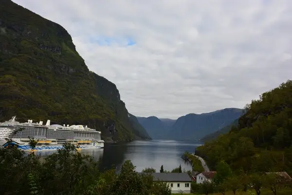
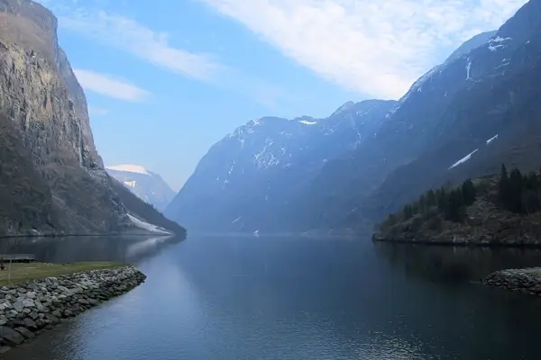
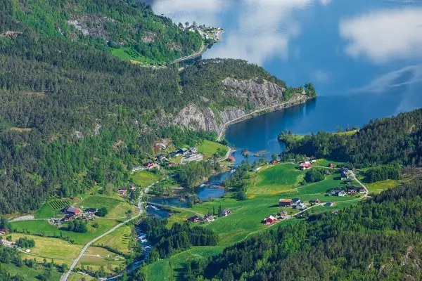
The drive west from Oslo is the longest of the trip at just over five hours. The landscape changes from forests and lakes to bare high mountains before the road drops down to the fjord. Plan two breaks. Flåm lies at the inner end of the Aurlandsfjord, an arm of the Sognefjord. On day four, ride the Flåm Railway up to Myrdal station and back – one of the steepest standard-gauge railways in the world – or take a boat through the narrow Nærøyfjord, a UNESCO World Heritage Site.
Days 5–6: Bergen
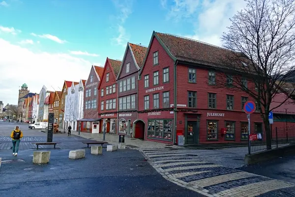
Via Gudvangen and Voss you reach Bergen, Norway's second city. The colourful wooden Hanseatic houses of Bryggen are a UNESCO World Heritage Site, the fish market sits by the harbour, and the Fløibanen funicular takes you up Mount Fløyen for a view over the city and fjord. Bergen is known for its rain – the climate table below shows why. Bring a good rain jacket for the city day.
Days 7–8: Sognefjord and Jostedalsbreen
From Bergen you head back east and through the Lærdal Tunnel, at about 24.5 km the longest road tunnel in the world. At Lærdal a ferry crosses the Sognefjord, Norway's longest fjord, to Sogndal. On day eight the road leads to Fjærland with its glacier museum; just beyond it you can see the Bøyabreen glacier tongue from the car. It belongs to Jostedalsbreen, the largest glacier on the European mainland. Spend the night in Loen on the Nordfjord, where the Loen Skylift cable car climbs Mount Hoven.
Days 9–10: Geiranger and Trollstigen
From Loen the road crosses the mountains to Geiranger. Just before the village, the detour to the Dalsnibba viewpoint at about 1,500 m is worth it – the toll road up is only open in summer. Like the Nærøyfjord, the Geirangerfjord is a UNESCO World Heritage Site; the best way to see it is on a sightseeing boat to the Seven Sisters waterfalls.
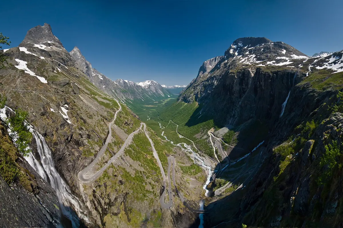
On day ten you drive up the hairpins of Ørnesvingen, take the ferry from Eidsdal to Linge and via Valldal reach Trollstigen: eleven hairpin bends winding down a steep rock face to Åndalsnes. Like the Dalsnibba road, Trollstigen is closed in winter – opening dates are published by the Norwegian Public Roads Administration, Statens vegvesen.
Days 11–12: Ålesund and the Atlantic Road
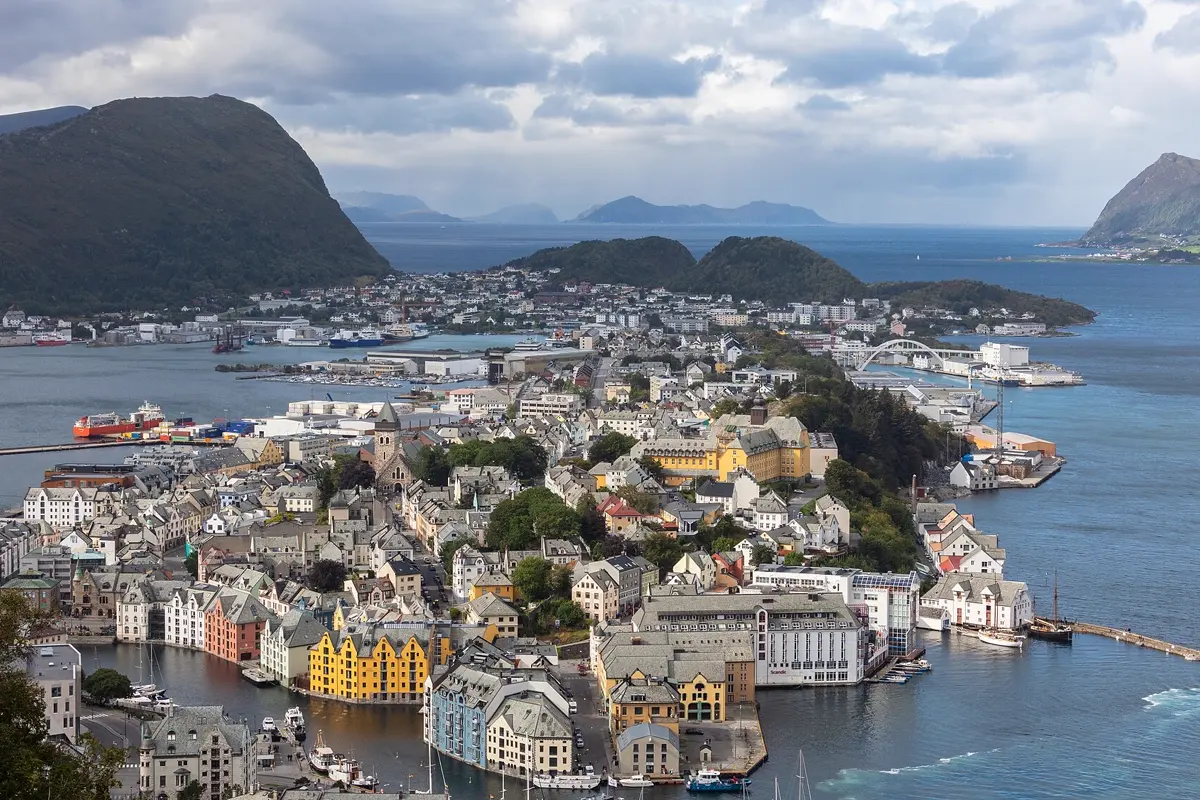
After a fire in 1904, Ålesund was rebuilt almost entirely in Art Nouveau style. From the Fjellstua viewpoint on Mount Aksla you look out over islands and channels. On day twelve two short ferries take you to Molde and on to the Atlantic Road – about eight kilometres of road that hops from skerry to skerry over several bridges. In a storm the waves break over the carriageway. Spend the night in Kristiansund.
Days 13–14: Trondheim
The last leg takes one more ferry to Trondheim. Nidaros Cathedral is the largest medieval church in Scandinavia, and old warehouses on stilts line the Nidelva river. From Trondheim you fly home or take the train to Oslo. Note that returning the hire car in a different city usually costs a one-way fee.
Back to Oslo instead of Trondheim: From Åndalsnes the road runs through Romsdalen and via Dombås to Oslo – 440 km, approx. 6:30 h of pure driving, best with a night in Lillehammer or Dombås.
Best time for the fjords
June to August is the best time: all mountain roads are open, the days are very long, and sightseeing boats and cable cars run frequently. Late May and September are quieter, but some mountain roads may still be, or already be, closed. Rain is part of the west coast – Bergen is one of the wettest cities in Europe. Inland around Geiranger and Lom it is much drier.
| Month | Day (avg high) | Night (avg low) | Rain |
|---|---|---|---|
| January | 2.8 °C | -1.5 °C | 264 mm |
| February | 3.6 °C | -1.3 °C | 233 mm |
| March | 5.8 °C | -0.3 °C | 182 mm |
| April | 9.2 °C | 1.4 °C | 108 mm |
| May | 13.5 °C | 5.7 °C | 116 mm |
| June | 16.6 °C | 9.2 °C | 133 mm |
| July | 17.2 °C | 10.6 °C | 193 mm |
| August | 17.2 °C | 10.8 °C | 257 mm |
| September | 15.0 °C | 9.0 °C | 265 mm |
| October | 10.4 °C | 5.0 °C | 295 mm |
| November | 6.1 °C | 1.8 °C | 244 mm |
| December | 4.0 °C | -0.2 °C | 291 mm |
Climate in Bergen: 2015–2024 averages from the ERA5 reanalysis (Open-Meteo), rounded. April and May are the driest months, autumn the wettest.
Good to know before you go
- Entry: Norway is not in the EU but is part of the Schengen Area, so the same entry rules apply as for the rest of Schengen. Customs allowances apply to goods, especially alcohol.
- Mobile data: Norway is in the European Economic Area, so EU and EEA plans roam there like at home. With a plan from elsewhere, check your roaming rates before you go.
- Money: The currency is the Norwegian krone. Cards are accepted almost everywhere; you will hardly need cash.
- Ferries: Short car ferries cross the fjords on this route. On the main crossings they shuttle back and forth regularly and usually need no booking. In summer there can be queues.
- Driving: The speed limit outside towns is usually 80 km/h, and many fjord roads are narrow. Dipped headlights are required in daytime too.
- Flight: A direct flight from London to Oslo takes approx. 2 hours.
How YesTrip helps with this trip
Create a trip in YesTrip with the stops of this route: the app shows every place on the map, uses AI to plan your days in Oslo, Bergen and Ålesund and shows the weather for your travel days – on the west coast that often decides which day you take the boat trip. The packing list suggests clothing to match the forecast, the offline map helps in valleys without reception, and if you travel with friends you can share the trip and the expenses in the app. To start, there is our ready-made plan for Oslo.
Free
Plan your trip in 30 seconds.
Tell YesTrip where and when – the app plans day by day with real places on the map, shows the weather, splits costs with your travel companions and guides you to the next stop on the go.
Frequently asked questions
How many days do you need for a Norway fjord road trip?
Fourteen days are ideal for Oslo – Bergen – Geiranger – Ålesund – Trondheim. Ten days work too, without the Atlantic Road and with only one night each in Bergen and Flåm. If you need to return to Oslo, drive from Åndalsnes via Dombås, about 440 km.
When is the best time to visit the Norwegian fjords?
June to August. All mountain roads such as Trollstigen and the Dalsnibba road are open, the days are long, and Bergen is warmest at about 17 °C during the day. In winter several mountain roads on this route are closed.
Do you need to book ferries in Norway in advance?
For the short car ferries across the fjords on this route, usually not – they shuttle regularly and you simply drive to the quay. In high season there can be waits, which are not included in the driving times in this article.
How much does it rain in Bergen?
A lot: averaged over 2015 to 2024, Bergen gets between 108 mm in April and 295 mm in October per month. Even July and August see about 190 to 260 mm. Inland around Geiranger it is much drier.
Do I need an eSIM for Norway?
Not with an EU or EEA plan – Norway is in the European Economic Area, so roaming works like at home. With a plan from elsewhere, compare your roaming rates with a local or travel SIM.
Sources
- Driving times and ferry links: OSRM route calculation based on OpenStreetMap data – project-osrm.org
- Climate: Open-Meteo Historical Weather API (ERA5), averages 2015–2024 – open-meteo.com
- Road closures and mountain roads: Statens vegvesen – www.vegvesen.no
- West Norwegian Fjords (Geirangerfjord and Nærøyfjord): UNESCO World Heritage – whc.unesco.org
- Bryggen in Bergen: UNESCO World Heritage – whc.unesco.org
Researched with AI support and checked by our editors. Prices, opening hours and weather can change – please check before you go. YesTrip is not a travel agency. Published: .
More articles
 Road trips & itineraries
Iceland road trip itinerary: Ring Road in 12 days
The classic Iceland road trip follows the Ring Road for 12 days from Reykjavík: Golden Circle, the south coast with Skógafoss and Vík, the … · 8 min read Road trips & itineraries
Ireland road trip: a 10-day itinerary
The classic 10-day Ireland road trip runs from Dublin via Glendalough and Kilkenny to Cork and Kinsale, around the Ring of Kerry, to the … · 7 min read Road trips & itineraries
Japan itinerary: 2 weeks by train
The classic two-week Japan itinerary runs by train from Tokyo via Hakone near Mount Fuji to Kyoto, Nara, Osaka and Hiroshima with the island … · 7 min read


